
Can’t see? Download the full resolution image here. Need some help? Hint 1 will give you some tips to help you start identifying features in satellite imagery, hint 2 will give you another nudge in the right direction and answer will spell out what you need to do to get today’s answer.
Click here to go to the previous question, or the next question.
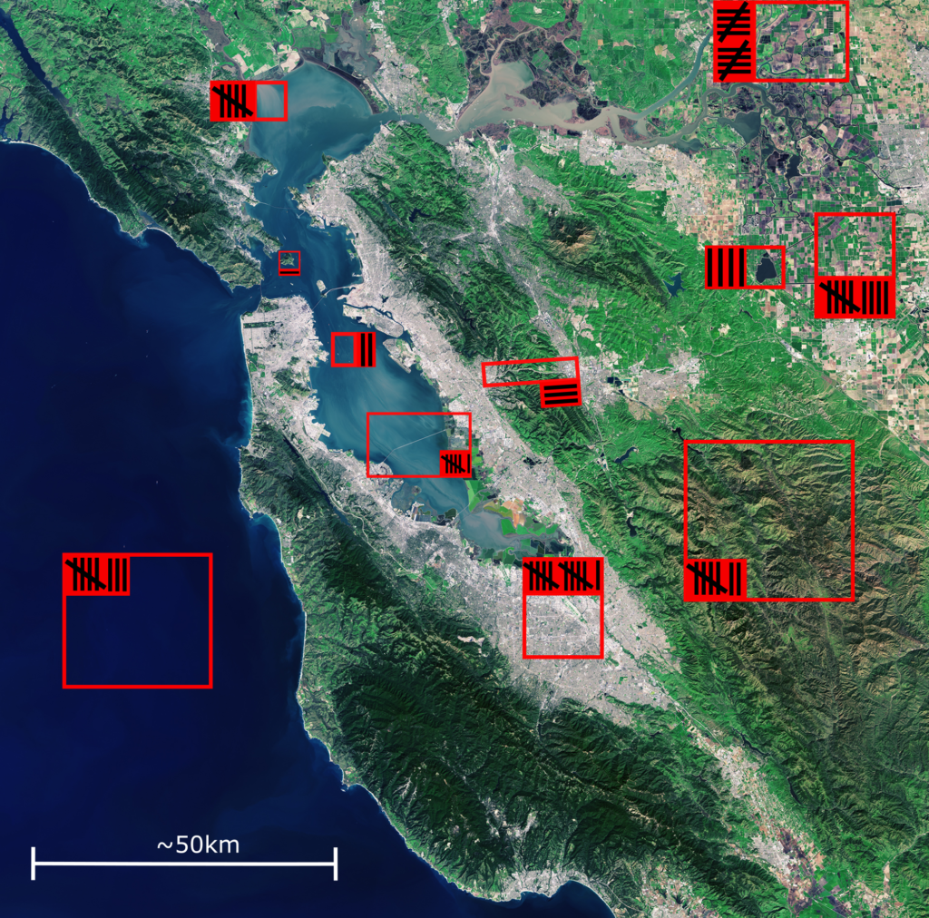
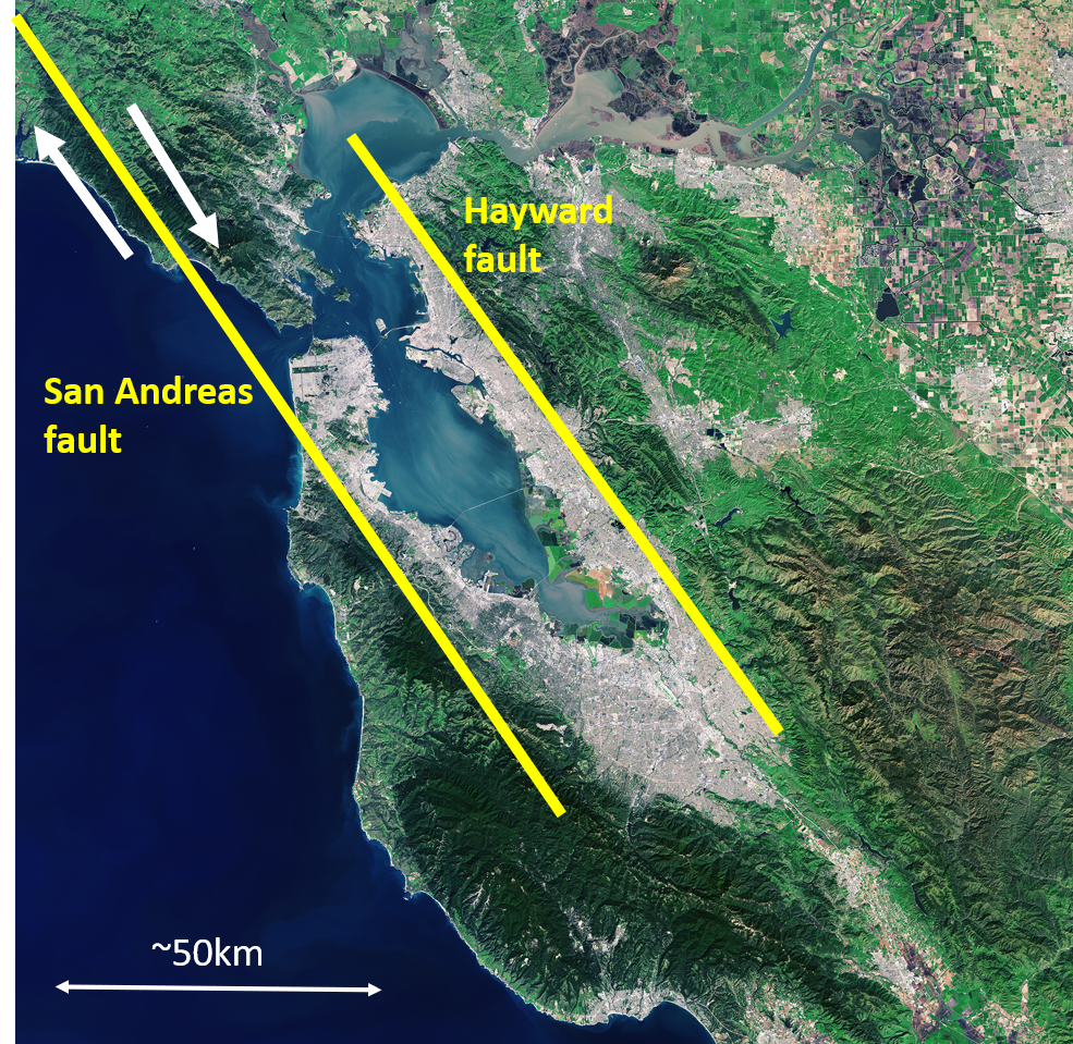
Fun fact: this satellite image is of San Fransisco, in California, America (© USGS/ESA). This is where part of one of the most famous faults in the world is – the San Andreas fault. Earthquakes happen on faults and this fault is ~1,500km long! In the picture below the faults are drawn on in yellow. Because of the way the tectonic plates are moving, during an earthquake the ground moves in the direction of the arrows:
Extension 1
Draw your own image of somewhere from space. Will it be a real place, or imaginary? Will it have buildings? Will it be an island? Will it have a volcano? If it has a river will it be straight or wiggly?
Extension 2
Check out this link for some fun things to do from the European Space Agency (ESA). There are games, challenges and fun facts. Maybe you could build your own spacecraft?