University of Edinburgh logo British Antarctic Survey logo National Oceanographic Centre logo University of Leeds logo

New publication by SENSE manager

Ruth Amey, SENSE’s Leeds-based centre manager, has just published a new paper using satellite imagery to create high-resolution maps of ground surface elevation. This is then used to better inform estimates of hazard and risk due to earthquakes.

The paper focusses on Almaty in Kazakhstan. Almaty, like many cities around the world, it is located close to a number of active faults on which earthquakes can occur. There may also potentially be faults underneath the city that have been buried as Almaty has expanded and increased in population to approximately 2 million.

Almaty city, taken looking South. The mountains are formed by active faults.

In the paper, the authors use Pleiades and SPOT stereo satellite imagery. This is optical satellite imagery of the same area taken from at least two different angles.

Google Earth image of Almaty, Kazakhstan, with an indication of the locations of the two Pleiades satellites

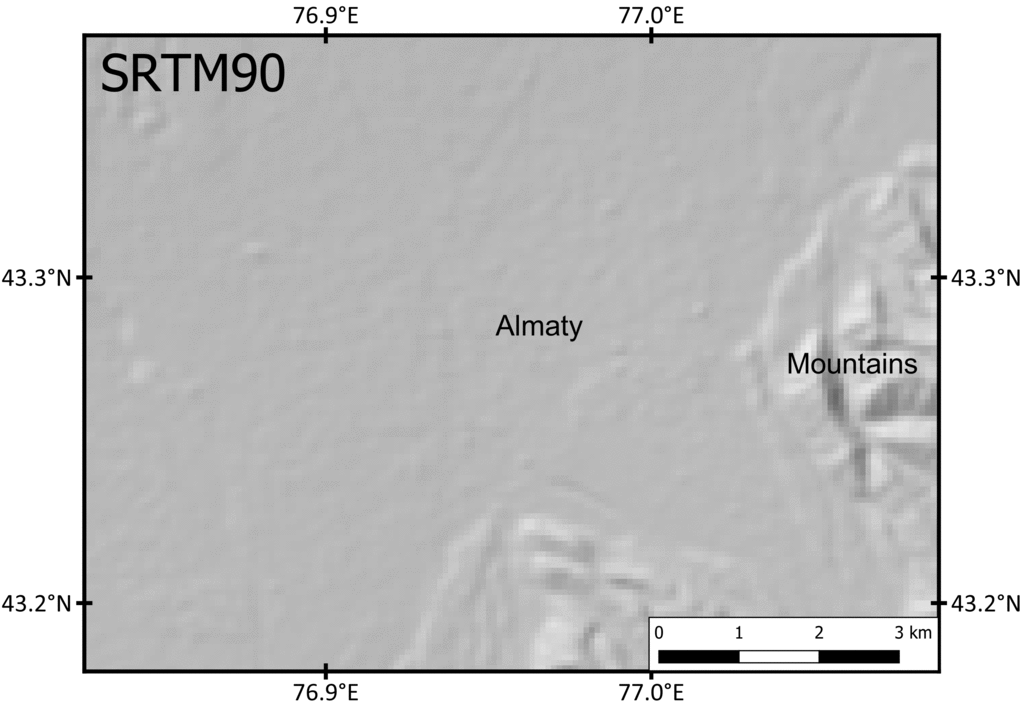
Then by using photogrammetric methods, the authors create high-resolution digital elevation models (DEMs). As the gif below shows, DEMs at very low resolution can pick out the outline of mountain ranges, but not much more than this. With Pleiades imagery, we can create DEMs of approximately 2m resolution, meaning we can pick out details in the city such as buildings and trees. This is the resolution needed to identify subtle changes in elevation in cities that may indicate there are active faults.

DEMs of different resolution over Almaty city. Adapted from figure in Amey et al., 2021

With these high-resolution DEMs, fieldwork and other literature, the authors identify and examine a potential active fault underneath Almaty city. The authors then use the Global Earthquake Model‘s Openquake Engine to calculate the hazard (ground shaking) and risk (damage and losses) to Almaty city.

You can read the full paper (open-access) here.

New publication from SENSE student Max Lowe

Huge congratulations to SENSE student Max Lowe for publishing his first paper, from his Msc thesis, in EGU journal Solid Earth.

Max says –

This study estimates the gravitational contribution of former tectonic plates subducted into Earth’s interior (slabs) to the Alpine gravity field. Different seismological studies identified various slab segments beneath the Alpine mountain belt within Earth’s upper mantle. However, the position, geometry and extend of those slabs vary strongly in those studies. In addition, some recent gravity models do not account for such heterogeneities in the Earth’s mantle.

Here, the sensitivity of gravity measurements to variation in slab position, geometries and volume is tested. Therefore, two competing slab configurations are defined based on seismological findings. In addition, the gravity contribution caused by slab segments within the Earth’s mantle is estimated by forward calculating density distributions based on three different modelling approaches. a) direct conversion of seismic velocities to density distributions, b) density variation based on predefined slab configurations and c) calculating density distributions based on geophysical and petrological modelling taking rock composition, temperature and pressure into consideration.

We find that the gravity signal caused by the slab segments is sharp and can be separated for the different slab segments for the gravity field measured at near surface height. At satellite altitude the contribution of different slab segments cannot be separated anymore. We showed that slab segments can contribute up to 40 mGal to the Alpine gravity field. This is significant and demonstrates that future studies should account for densities variation within the mantle caused by slabs to provide a meaningful representation of the geodynamic complex Alpine area.

You can read the paper here.