
Hannah Barnett did a Research Experience Placement funded by NERC through SENSE in the summer of 2021, working with Duncan Quincy and Liam Taylor at the University of Leeds. As part of this, Hannah went to Iceland to collect data. Here is her blog of her trip:
My Iceland Experience
As part of my SENSE Research Experience Placement (REP), I was lucky enough to be asked if I would like to accompany my placement supervisors (Liam Taylor and Professor Duncan Quincey from the School of Geography at the University of Leeds) to Iceland, to help collect some data for Liam’s PhD.
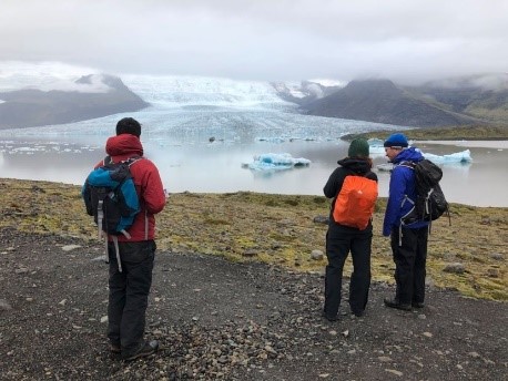
My first job was surveying a range of potential secondary study sites, to identify which would be more appropriate for testing the range of a sensor. This involved travelling to 6 glaciers with a range of different sizes, gradients and terminus types (e.g. proglacial lake terminating). At each of these sites, we estimated the distance to the terminus of the glacier and the height of the face, took photos from a range of angles and locations, and recorded a description of the area. This information was then presented to Liam at the campsite, allowing him to make an informed decision about where to test the sensor. I was also able to help Liam more directly, by taking GPS measurements and recording the photo IDs associated with each location he chose. Back at the campsite I wrote this up, along with the data from other days, into a central space.
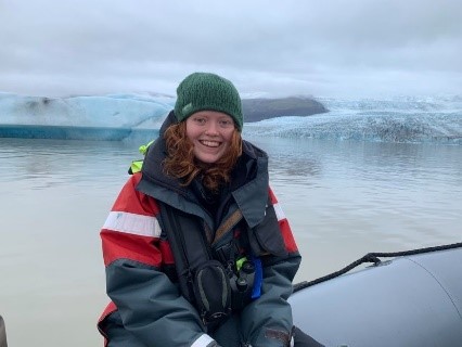
Whilst Liam was collecting his data, I was able to collect some of my own. I trialled structure from motion (SfM) – I learned the theory of this technique in my degree but never had the chance to put it into practice. SfM uses photogrammetry, matching overlapping points from a series of photos to create a model. I used my camera to take approximately 250 photos of the calving face of Fjallsjökull from a range of angles. When I returned to Exeter, I uploaded these into a SfM software, and created a series of point clouds and mesh to produce a textured 3D model of the glacier terminus. The first result of this is shown in the figure below. I really enjoyed trialling SfM, it is an accessible technique with a range of applications and I am sure I will use it throughout the rest of my degree.
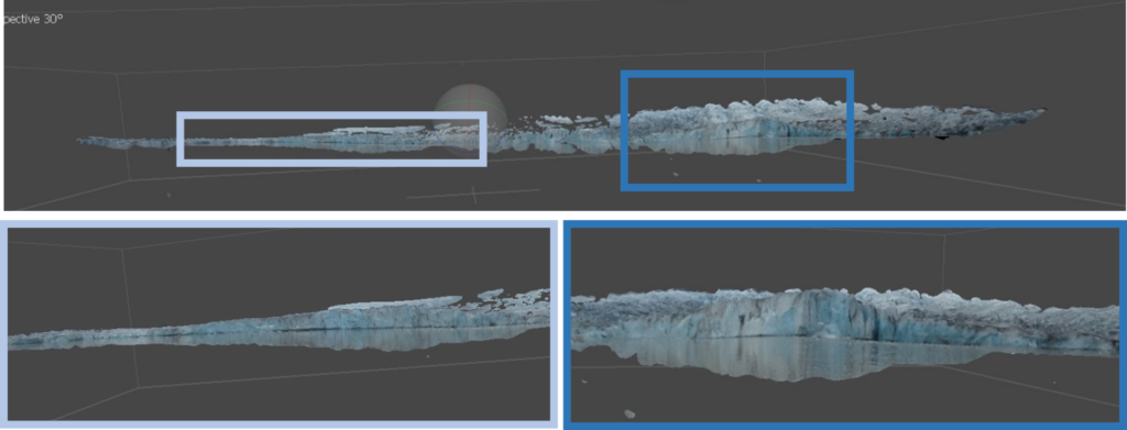
Figure 1 | The 3D model of Fjallsjökull produced from my Structure from Motion survey, with two particularly clear sections of the face highlighted and showcased below
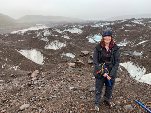
I had never seen a glacier before, but thanks to this trip I even got to walk on one! I learnt how to put crampons on correctly and how to hold an ice axe. We climbed across moraines (large sediment ridges) to reach the glacier and from there navigated our way along the crevasses. The section of the glacier we were on was debris-covered, although you can see sections of clean ice in crevasses in the photo (to the left). Whilst glacier walking, we also discussed the basic processes and mechanisms of glaciers, as well as remote and in-field techniques used to measure mass balance and flow velocity. This allowed me to revisit my cryosphere knowledge from first year and build upon it, seeing many features resulting from these processes in person!
I really enjoyed my time in Iceland, it was incredible to see in-person the landscapes I have been studying all summer in my REP. I can’t thank SENSE, my supervisors and the School of Geography at the University of Leeds enough for giving me this opportunity, and I hope it might inspire future REP interns to apply!