
The first cohort of NERC SENSE CDT students have finished 8 weeks of intensive training in Earth Observation and advanced data techniques, split into an Edinburgh block and a Leeds block. This training aims to give this next generation of Earth Observation experts an overview and the skills they need to succeed in their PhD, as well as create a bonded cohort of students.
The multi-disciplinary training included weeks on software carpentry, vegetation, machine learning and cryosphere and solid earth. In the future, students will have sessions on oceanography and fieldwork (postponed due to covid).
“The breadth of topics covered on the training allowed me to think outside of the world of glaciology for a while and consider some other approaches I could take forward in my project, such as machine learning. And despite everything running virtually, we were able to get to know each other better as a SENSE cohort. I think we will all be a valuable support network for each other over the next few years and hopefully could lead to some exciting scientific collaborations!”
– Bryony Freer, British Antarctic Survey and University of Leeds
Many hands make satellite work
A key part of this training is the group work aspect, allowing the students to network, share expertise and work together on ideas. The final piece of group work was to design a new Earth Observation mission, and present this to a panel. Here are the exciting new satellite missions that they have created!
INSPECT: the Insect, Pathogen and Environmental Change Tracking Satellite.
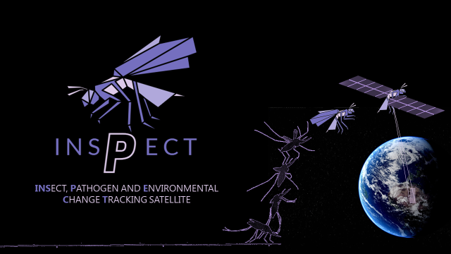
The main purpose of the mission is to monitor distribution and potential expansion of certain (sub-)tropical environments that are the preferred habitat of mosquitos – a known vector of many deadly diseases including malaria. The hyperspectral sensor (with thermal bands) onboard INSPECT will be able to map temperature, humidity, vegetation conditions and location of stagnant bodies of water. These observations will allow the distribution of the species to be modelled as a function of environmental conditions.
Comprehensive Atmospheric Radiation Records After Ten PM (CARRAT)
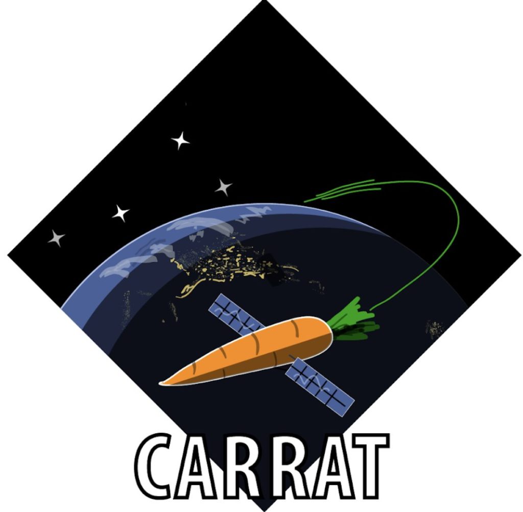
The proposed Earth Explorer mission Comprehensive Atmospheric Radiation Records After Ten PM (CARRAT) came about by asking ‘who knows what happens when the sun goes down?’. The aim of this satellite is to monitor the Earth’s atmospheric composition and pollution of cities at night by observing the atmospheric scattering of city lights. It will provide an insight into night time pollution and chemical species that contribute to global warming, as some chemical species go through photochemical and dark chemical cycles. In addition to monitoring the atmosphere, CARRAT has the potential to monitor urban development and observe lightning, bioluminescence, airglow and zodiacal light.
Have they (or)bit off more than they could chew?
WEL: Water Exploration Lidar
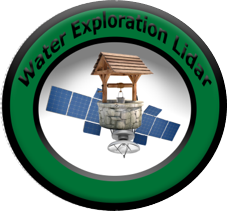
A mission to study land water sources as climate change and population growth continues to put stress on the worlds water cycle and increase water scarcity
Collaboration and wider impact
The training included a JASMIN workshop from the CEDA (Centre for Environmental Data Analysis) team. JASMIN is a globally unique supercomputer for environmental science, which many of the students will use to process their satellite data and investigate topics such as global warming and environmental change. The CEDA team regularly runs hands-on interactive training workshops for users of JASMIN, and the workshop for SENSE students was the first to be held virtually. This had 25 attendees and included a mixture of live lectures, recorded talks, exercises and tutorials. The CEDA team is funded by NCEO (National Centre for Earth Observation) and NCAS (National Centre for Atmospheric Science).
The machine learning week also featured an Alan Turing Institute – SENSE hackathon event. The goal of this challenge was to automatically identify sea, ice and land in satellite images of Danmarkshavn on the east coast of Greenland. Seven Alan Turing Institute PhD students joined the session, and using Sentinel-1 images the students worked in small teams to build and train a model to classify sea, ice and land in a dataset spanning a year, using data prepared for the ExtremeEarth project.
SENSE’s training programme is extremely important to the centre. Of the students who filled in the feedback from, 100% of students agreed or strongly agreed that SENSE’s training programme affected their decision to apply to or accept a PhD position at SENSE. The training was an opportunity to the students to learn a variety of new skills and to bond as group.
The training not only benefitted SENSE students, as we opened it to first-year students at Edinburgh, Leeds, NOC (National Oceanogrpahy Centre) and BAS (British Antarctic Survey). Nineteen PhD students joined the SENSE cohort for at least one week training from across these institutes.
The SENSE training has introduced me to a broad range of Earth observation tools and methods which have given me a good basis for the start of PhD and beyond. It was also a great opportunity to work with other PhDs during the group projects and allowed me to get to know the SENSE cohort which would have been difficult otherwise with the current restrictions.”
– Emily Dowd, University of Leeds
Where there’s a skill there’s a way
As well as learning technical details of Earth Observation and advanced data techniques, the training featured ‘soft skills’ sessions, to teach the students to be all-round academics and researchers. Tom Richardson from Nature Geoscience gave a presentation on ‘Publishing with Nature Geoscience’ with eighty-six attendees. Tom Lyons from STEM Centre and Andy Clarke presented on outreach and how the students can engage, which led to a number of students signing up to be STEM ambassadors. The students learnt valuable tips and tricks for working with the media in a session by Ian Rosser from the University of Leeds press office. Finally, Jurgen Neuberg gave the students some dos and don’ts for face to face and online presentations – which will be useful for the students in their first-year presentations and future conference contributions.
A SENSE of direction – looking to the future
In their second year, the SENSE students will do a 3-day Science Communication and Outreach course, run by Professor Mark Brandon and colleagues at the Open University. They will then do a 1-week Space Industry week, hosted by the Satellite Applications Catapult and European Space Agency (ESA) in Harwell. In their third year, the students will do a residential course in ESA’s ESRIN facility near Rome, Italy, as well as doing their 3-month industry placement. And finally in their final year the students will have career and CV coaching sessions, along with courses on Entrepreneurship and Intellectual Property.
As the students embark on their exciting new PhD projects, SENSE are thrilled to give the students this expert training, which will equip the students with skills, knowledge and confidence to thrive in their PhDs and future careers.