University of Edinburgh logo British Antarctic Survey logo National Oceanographic Centre logo University of Leeds logo

First ‘in person’ Edinburgh training a big success

In November 2021 the second cohort of students took part in the first in person block of Earth Observation training at the University of Edinburgh. Due to the pandemic the previous training had take place online so we were really excited to be able to deliver the training in person.

The training took place over four weeks with each week having a different focus and being lead by a different members of staff from the University of Edinburgh.

Week 1: Software Carpentry and Google Earth Engine

Week 2: Statistical Machine Learning, Time series analysis, and Bayesian Filtering

Week 3: Optical Earth Observation

Week 4: Lidar and SAR

Each week is structured around lectures and practical exercises and in the later part of the week the student apply what they have learned to complete a group project which they present to the lecturers the the rest of the group. We also had some keynote talks where those active in Earth Observation discussed their research.

Practical Session on ecognition

The training went down very well with the students who found it intense but rewarding and learned lots of new skills which they can apply to their research.

‘It was all very interesting, and even when I did not understand things it was very valuable to be exposed to new topics and terminology. I most enjoyed meeting my colleagues, who are supportive and made the learning environment enjoyable, and they really gave time to help and explain concepts and issues as we learn.

Google Earth Engine will be really useful for my project and was taught very clearly with examples

The lectures this week were ace, I was very impressed with the teaching! A great use of multiple examples to ensure we understood everything.

The keynote talk from Gary was very interesting – loved how it brings science into the bigger picture and makes it more applicable to pressing issues in society.

‘I think the machine learning practical’s were very interesting and useful as I can probably apply some of that to my project.’

I learned a lot about how radar and lidar measurements work and also learned a lot in the keynote lecture about the GEDI mission

Iain has a great way of teaching about radar data which really helps to understand the concepts, e.g. all the small experiments he does

‘amazing, loved it, woke up every day thinking I’m so happy to be here, living the dream’

‘Training made my PhD work make so much more sense. More well equipped to do the work now than I was before training’

As the students who are not normally based in Edinburgh were living here for a month it also gave them a chance to get to know the city and get to know some of the cohort 1 SENSE students. There were lots of opportunities to socialise and work together and everyone is looking forward to being together again in spring 2022 for the next block of training in Leeds.

Portobello beach – fire and pizza
Cohort 1 & 2 students on top of Arthurs Seat

We are incredibly grateful to the staff who contributed to the training: Dr Encarni Medina-Lopez, Dr Victor Elvria, Dr Steven Hancock, Professor Iain Woodhouse, Professor Ed Mitchard, Dr Caroline Nicol, Dr Andrew Gray, Dr Daniel Clewley (from NEODASS), Dr Gary Watmough and Professor Ralph Dubayah (University of Maryland/NASA)

We would also like to thank the terrific demonstrators who also did a fantastic job of supporting the students: Sol White, Peter Hargreaves, Johannes Hansen, Elise Gallois & Joseph Everest

Categories Uncategorised

Cohort 1 all together for media training

Cohort 1 of SENSE students

17th November 2021 was a momentous and happy day for team SENSE when after 13 months of working remotely the first cohort of students (and gorgeous mini scientist Lily) were finally able to meet up in person for the first time. The group were at the University of Edinburgh to take part in a media training session with Boffin media to enable them with the skills to share their science with the wider public.

Working on their ideas

Over the course of the day the students learned about presenting their work in print and in podcasts and on film and were give the chance to try out some of the techniques they had learned.

Recording a podcast

“I enjoyed the video part of the training, as it was furthest from what I’ve done before. Being recorded on camera is intimidating and I feel this aspect of the training was particularly helpful for putting me at greater ease should this be necessary in future.

I think the most useful thing is just being aware of how to pitch your project/research to a public audience, its hard to gauge what people outside science understand in terms of language, so that’ll be useful just in general talking to people, regardless of whether its to the media or not

Once the training was over the group along with some of the SENSE director team and Cohort 2 student headed to the historic Sheep Heid for a meal and some games of skittles. It was such a lovely day as everyone in the group has worked really hard over this year to get to know each other and work together despite never meeting all together in person. We are so proud of their resilience and efforts to bond as a group and having the whole group together was an incredibly happy event.

As the students were in Edinburgh for a few days along with many of the cohort 2 students they made the most of their time with both work and social events. These included the launch of the SatSchool outreach project and walk up Arthur’s seat and for a few brave people a sea swim and Portobello.

Cohort 1 & 2 students at the top of Arthurs seat

Everyone really enjoyed this week and we look forward to more like this in the future. As we like to say in Edinburgh – Haste Ye Back

Categories Uncategorised

SENSE student leads the way with her work on whales and oceans

SENSE student Penny Clarke (who is based at British Antarctic Survey) and an international team of collaborators from the British Antarctic Survey, CEAZA (Center for Advanced Research in Arid Zones), Oceanswell and the University of Massey, published a paper on using new technology to study mass stranding of whales from space and how the technology could be used to help protect populations.

The study published in Frontiers in Marine Science found that studying high–resolution satellite imagery could help build long–term cetacean (i.e. whales, dolphins and porpoises) stranding monitoring programmes in remote regions and stranding networks globally.

Whale strandings are becoming a critical ocean health issue and an increase in capacity to monitor and understand strandings is urgently required. The World Health Organisation recently announced their ‘One Health’ approach, which recognises oceanic conditions that impact whales often affect the marine ecosystem, with potential ramifications for human health too. 

For remote regions, satellites could form an ‘early response’ tool, alerting managers to a problem and allowing for appropriate response, which could increase the likelihood of attaining useful diagnostic samples to understand exactly what is causing these events.

Stranded whale from satellite image

Penny Clarke, Lead Author of the study and a SENSE PhD Researcher, said:

“This study reveals that we need to increase the monitoring of mass strandings across the globe to greater understand cetacean populations, the threats they face and to evaluate the impact of future change. This is particularly important in remote regions, absent of stranding monitoring networks, where satellites offer an opportunity to gather baseline data in these regions.”

Dr Jennifer Jackson, Whale Biologist at British Antarctic Survey said:

“As whale populations recover from whaling and suffer growing impacts from humans and from climate change, we need new tools to monitor these impacts, particularly in remote areas. Satellites hold a lot of promise for helping monitor those strandings over huge areas, as well as to look at local sea conditions, to help identify the causes faster, and make the right recommendations for ocean protection and management.”

Dr Asha de Vos, Founder and Executive Director of Oceanswell in Sri Lanka said:

“Strandings happen across all our coastlines, but not all of us are equipped to monitor or document these events. Satellites provide us with a unique opportunity to monitor even the most far flung places but the key thing is increasing access. If we want to truly understand and protect our planet, we need to ensure equitable access to tools that can help us solve our greatest challenges together.”

The international team hope to challenge the current disparity in stranding monitoring efforts through use of satellites. They also call for collaborative partnerships between satellite providers and stranding networks governments and NGOs, for equal access to satellite imagery, a recommendation endorsed by the International Whaling Commission Scientific Committee.

The research highlights the importance of collaborating across remote sensing specialisms to determine if satellites may help understand the environmental and human induced conditions before, during and after a mass stranding event. Other remotely sensed data could help to highlight changes in the ocean environment and to provide an early warning system to mitigate mass stranding events and develop more informed, knowledgeable and rapid response stranding networks.

Moving forward, the team plan to test the robustness of this technology by partnering with existing and efficient stranding networks in hotspot areas, such as New Zealand, to develop working protocols and automated detection procedures. Following this they will concentrate on remote priority locations such as: the Chilean Patagonia region; much of the West and Eastern coastlines of Africa; the Polar Regions; and coasts in politically turbulent regions such as the North West Indian Ocean.

Cetacean strandings from space: Challenges and opportunities of very high resolution satellites for the remote monitoring of cetacean mass strandings by Penny J. Clarke,  Hannah C. Cubaynes,  Karen A. Stockin,  Carlos Olavarria, Asha de Vos,  Peter T. Fretwell and  Jennifer A. Jackson is published in the journal Frontiers in Marine Science. Read the paper on their website.

Podcast

A new polar podcast – If Oceans Could Speak – was launched in October featuring SENSE PhD student Penny Clarke as Lead Producer, and a suite of European collaborators. This première season focuses exclusively on the Arctic – listening to stories from those who have shared their life with the mighty Arctic Ocean. Each week presenters Jen Freer and Stefan Kirchner discuss a new perspective, from the adventures of Thomas Wunderlich, Captain of RV Polarstern; to the musical journey of composer Lera Auerbach which led to her award-winning symphony, ‘Arctica’. Guests reflect on climate change, sustainability, and equality, and share their hopes and concerns for the Arctic’s future. The podcast is an output from the EU4Ocean Coalition for Ocean Literacy. Supported by the European Commission, this bottom-up initiative aims to unite the voices of Europeans to make the ocean a concern for everyone. Find out more at www.eu-oceanliteracy.eu and listen to the podcast by searching for ‘If Oceans Could Speak’ on your usual listening platform e.g. Spotify or Apple podcasts, or alternatively, go to their webpage.

30MapChallenge

SENSE student Penny Clarke, won 100km2 of high-resolution satellite imagery as part of Sentinel Hub’s Twitter November #30DayMapChallenge.

Penny called upon the Twitter community to like and share her tweet, to support access to costly highly detailed satellite images to study whale strandings from space.

Whale strandings are on the rise globally, reflecting increasing pressures on our oceans. We need to scale up monitoring to remote coastlines around the world and winning this satellite imagery is hugely valuable to making this happen.

The winning tweet featured a Sentinel-2 satellite image from 2019, at the of the site of the largest known mass stranding of baleen whales in the world and recurring events, alongside an image of the known 2019 strandings in that area. The tweet aimed to highlight how important access to highly detailed satellite imagery is for identifying strandings and to understand the timings of these events; in turn supporting local stranding networks to invest in resources on the ground at the right time to understand what is causing these events.

Sentinel Hub recognised the importance of this work and in their endeavours to support science, have since increased the image quota won to 600km2. Penny and her internationally collaborative team are extremely grateful to the support of Sentinel Hub and Airbus and are excited to delve into the image archives to see what stranding events they can uncover.

Watch this space to see what they will find!

Categories Uncategorised

Research Experience Placement: Caitlin Frampton

Caitlin is a Zoology student who worked with our centre director Professor Ed Mitchard‘s research group and was supervised by Dr Charlotte Wheeler. Her project involved mapping forest height in Ghana using earth observation.

What are you studying?

I am studying Zoology at Newcastle University.

Tell us a bit about the project you have been working on this summer?

I worked on mapping the forest height in the South-West of Ghana using satellite imagery. With the aim to help support carbon-based conservation and aid the Forestry Commission of Ghana in their reporting. The aim was to create a model using random forest regression to map the heights of the different types of forest and repeat this to visualise where the forest was most affected by degradation over time.

I used Google Earth Engine to visualise the datasets from Sentinel-1, Sentinel-2, ALOS/PALSAR and GEDI. This was used as the input for the random forest model and the data was under sampled to allow for the balancing of heights across the forest. The model could be further improved by masking out areas of least importance and using a wider range of data to train the model.

One of the forest maps produced

What new skills have you learned while doing this internship?

I have learned how to use Java as a coding language to manipulate datasets, I have also learned how to use multiple analytical tools to achieve the outcome I was aiming for. My communication skills have vastly improved as I needed to convey my plans for the project and accurately explain any errors I was encountering. I also got a taste of problem-solving from a research perspective when things did not always go to plan.

How have you found working with your research team?

My research team were amazing and such a great help when it came to learning new skills. Dr Charlotte Wheeler in particular was always there to offer advice and guidance and I was made to feel very welcome in the Mitchard group as a whole.

What has been the highlight of the internship for you?

The highlight of the internship for me was getting to work as part of the research team and see the dynamic and collaborative environment each team member contributed to.

How has doing this internship changed your plans or thoughts about your future career?

This internship has given me a taste of what a PhD consists of and has led me to realise that this is definitely something I want to pursue in my future career. I thoroughly enjoyed the independent working aspect of the internship as well as conducting my own research and learning the variety of new skills required for achieving the outcome I desired.

Categories Uncategorised

Research Experience Placement: Hollie Black

Hollie Black

Hollie is a student from the University of Strathclyde who worked with Dr Gary Watmough and his Geospatial Livelihoods group on a project entitled Supporting the development of a Children’s vulnerability to climate change index in Uganda

What are you studying?

A Masters in Mathematics and Statistics at the University of Strathclyde

Tell us a bit about the project you have been working on this summer?

I have been working on creating a subnational Children’s Vulnerability to Climate Change Index for both Uganda and Tanzania. Currently the Children’s climate risk index (CCRI) is being created on a national level and we are investigating if there should be further funding to create the index on a subnational level as countries will have different scores across the districts within the country. However, the current CCRI only gives one singular vulnerability score for each country. This is also not as useful as a subnational index for policy makers as the subnational index will allow governments to look within their own country and determine which areas need help and for which sector e.g. education.

What new skills have you learned while doing this internship?

I have learned how to use arcMap which is a GIS software, have learned about using STAN in R as a multilevel modelling code type, learned how to do principle component analysis in SPSS and mostly learned about climate change and the social economic vulnerability it causes especially to children.

How have you found working with your research team here at the University of Edinburgh?

Working with my research team has been great everyone is very supportive and helpful. I think it is very important that you feel comfortable asking questions to your supervisor and I definitely did which made the experience more enjoyable.

What has been the highlight of the internship for you?

The highlight for myself has been being able to present my index to the creators of the Children’s Climate Risk Index which is an team containing academics from the University of Southampton, the University of Leeds, the University of Edinburgh and UNICEF.

How has doing this internship changed your plans or thoughts about your future career.

This internship has pushed me towards applying for a PhD within geoscience as I found the project very interesting and enjoyed the research I carried out.

Research Experience Placement: Gareth Haagman

Gareth is a student from the University of Exeter who worked with Dr Gary Watmough and his Geospatial Livelihoods research group on a project entitled: Poverty Estimates in Zimbabwe Using High Resolution Satellite Data

What are you studying?

Mathematics BSc at the University of Exeter, currently going into my third year.

Tell us a bit about the project you have been working on this summer?

My project aims to facilitate the mapping and monitoring of socioeconomic conditions in Bulawayo, Zimbabwe. Using a combination of high-resolution satellite data and novel machine learning techniques I have been able to identify certain features of residential buildings which can often be correlated with wealth and poverty.

You can find a more detailed explanation of the work Gareth did here on his research group blog

What new skills have you learned while doing this internship?

While undertaking the internship I have gained a massive insight into the research process as well as applying new software and programming libraries I had not previously used. For example, using Google Earth Engine to extract mapping data and using Python libraries such as geopandas to interpret geospatial information. I also got the opportunity to apply Vision Transformer, a new type of computer vision algorithm to perform building segmentation.

Building segments on a satellite image

How have you found working with your research team here at the University of Edinburgh?

I have immensely enjoyed working with the Geospatial Livelihoods Group, especially my supervisor Gary who has been very helpful in introducing me to the topic of Earth Observation and to Sohan Seth a researcher in informatics who gave me some insight and advice on how to apply machine learning to this new data.

What has been the highlight of the internship for you?

The highlight of the internship for me was the opportunity to present my research to some of the senior members at SENSE CDT as well getting to see the other research that was being conducted by the other REP interns.

How has doing this internship changed your plans or thoughts about your future career?

Doing this placement has confirmed for me that I would like to continue to study at postgraduate level and incorporate some more cross-disciplinary work in the future.

Categories Uncategorised

Research Experience Placement: Ilaria Stolberg

During summer 2021 SENSE have been involved in the NERC Research Experience Placement Scheme and hosted 14 interns with our supervisory teams. The purpose of the REP scheme is to allow undergraduate students from their final or penultimate year of study to gain experience of working on a research project by completing a short paid internship with some of the SENSE supervisors and their research groups. This will hopefully allow the students to learn about what being a research student would be like and encourage them to apply for a PhD in the future.

Because due to Covid the placements were able to be offered remotely we attracted a large number of excellent applicants from across the UK and the competition for places was tough. We had some excellent interns who have blown us away with the amazing work they have done in a really short space of time. In addition to the placements we have also been providing the interns with opportunities to network and make connections with other interns and current PhD student through the Space Hub Yorkshire Intern Network.

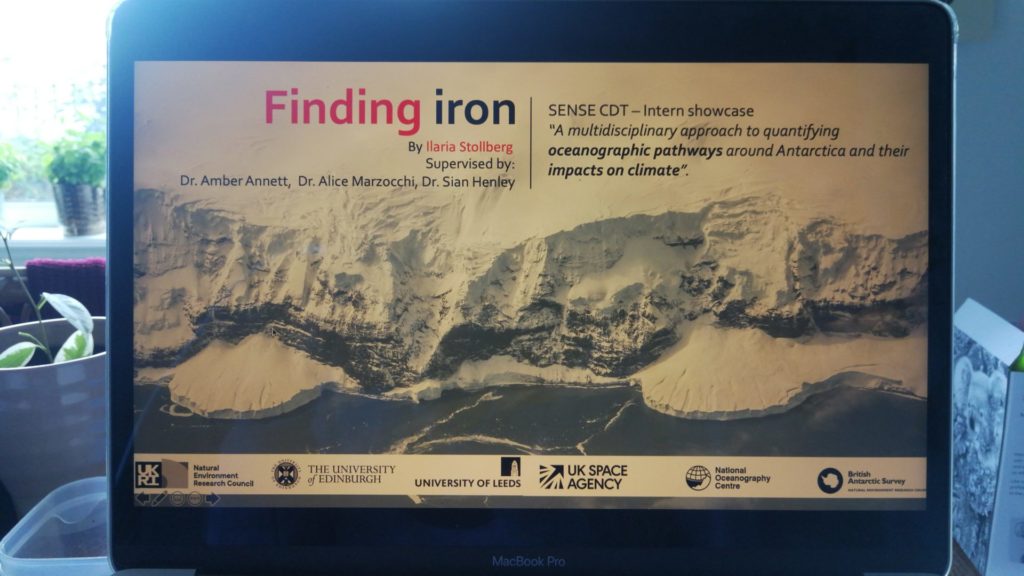
First off we have Ilaria Stolberg who is a student from Scottish Association for Marine Science. Ilaria worked with Dr Amber Annett (University of Southampton), Dr Alice Marzzochi (National Oceanography Centre) & Dr Sian Henley (School of Geosciences, University of Edinburgh) on a project called A multidisciplinary approach to quantifying oceanographic pathways around Antarctica and their impacts on climate

What are you studying?

I am currently in my 4th and last undergraduate year studying Marine Science at the Scottish Association for Marine Science – with a focus on oceanography and the endless uses of robotic platforms in marine research.

Tell us a bit about the project you have been working on this summer?

My project, which I lovingly nicknamed “Finding iron”, was “A multidisciplinary approach to quantifying oceanographic pathways around Antarctica and their impacts on climate. In the Southern Ocean, iron controls the very foundations of the food web, and it is extremely scarce. Using data from an expedition in 2018, I built a 2D section of the Drake Passage showing the concentration of various radioisotopes, which are naturally occurring “chronometers”. Radioisotopes help us understand how long ago a water mass has been in contact with sediment, a major source of iron in the Southern Ocean. By looking at other environmental properties, such as temperature, oxygen, and salinity, I also tried to find out where these water masses were coming from – were they the cold, dense waters that spill into the depths of the Southern Ocean as ice forms, or warmer waters travelling from the Equator, or eddies breaking off from the churning currents of the Drake Passage?
What new skills have you learned while doing this internship?

Asking simple questions to smart people! And programming, and networking, and finding my own answers when no one else could help. Handling “raw” data also showed me that a single sentence in a textbook is likely the tidy, clean result of years of someone’s efforts. I truly got to experience what the scientific method is all about – less of a linear road, and more like a windy, unpaved (and exciting) trail.

How have you found working with your research team here at the University of Edinburgh?

My research team (Dr. Sian Henley, Dr. Amber Annett, and Dr. Alice Marzocchi) proved to me that academia can be a welcoming space. Being trusted to produce sound results and to advance my own hypothesis were such important milestones for me, as an aspiring scientist; I was listened to and treated as an integral part of the team. My supervisors also made plenty of time to discuss my future, point me to useful resources, and encourage me to pursue an academic career – I had many eye-opening moments.

What has been the highlight of the internship for you?

Getting to know the paths that brought my research team to where they are, definitely! Learning the behind-the-scenes of the scientific community opened the gates to a world that always seemed “a bit too far”.

How has doing this internship changed your plans or thoughts about your future career.

I have taken a leaf from my team’s book – I am much more intrigued and knowledgeable about polar biogeochemistry than when I first started my internship. I now dream of (and work towards) getting my own laboratory to study the processes that govern the polar seas, and how climate change might affect them (and us). Environmental policy is also a field that I became interested in during this internship – as a result, I am researching opportunities that bring biogeochemistry and the “human factor” together.