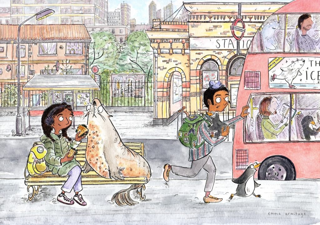
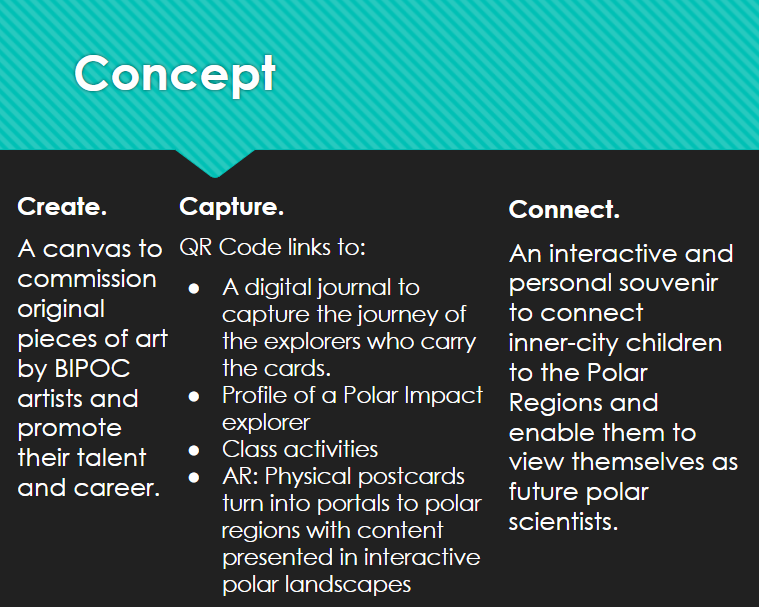
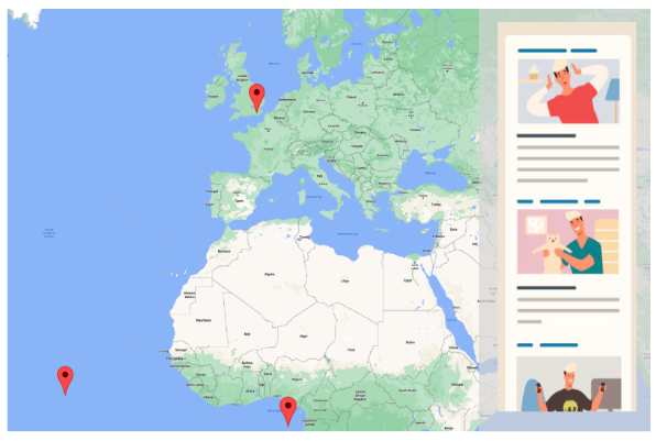
Polar Impact is an inclusive network of racial and ethnic minorities and allies in the polar research community. In autumn 2022, we will send Polar Portals (Augmented Reality (AR) enabled postcards) via the Antarctic to schools in the UK to inspire and engage children to consider a career in polar research, especially among the target audience of 8 – 12-year-olds from racial and ethnic minorities. We will be commissioning original works from BIPOC artists living in polar regions which will be printed into several postcard designs. The postcards will present visual artworks connected to the theme of polar regions, exploration and science. On the reverse of the postcards, pupils will be able to access a QR code to learn about the postcard’s journey and bring it to life through AR.
Concept postcard designed by Emma Armitage.
With Royal Museums Greenwich an under-18s Postcard Design Competition will be held with local schools in East London. The winning postcard will be stocked in the UK Antarctic Heritage Trust Penguin Post Office and available for purchase. A temporary exhibition for all entries to the competition will be hosted at the National Maritime Museum in December 2022.
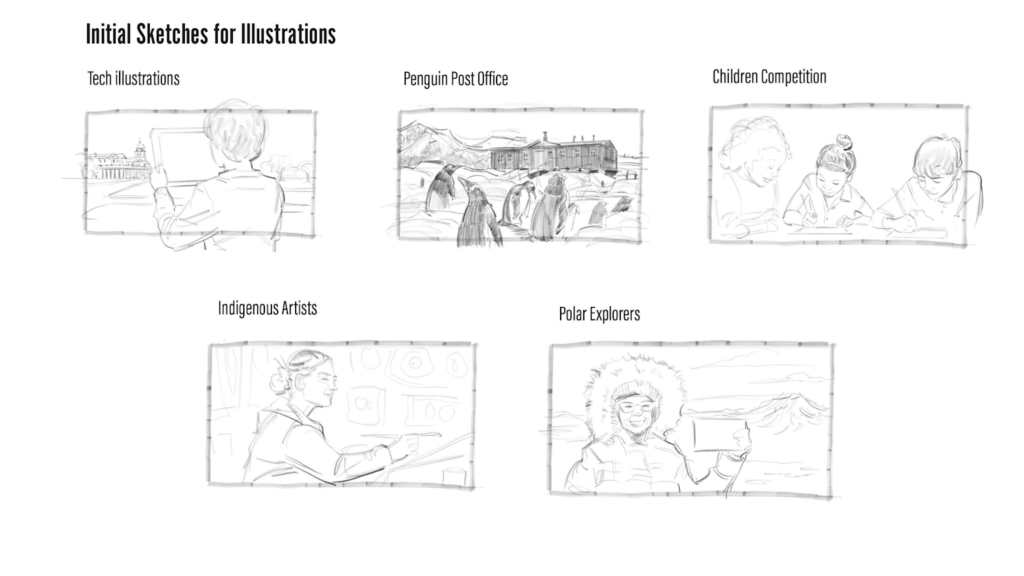
Working illustration by Farid Hussein (2022).
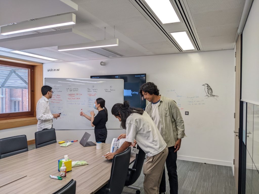
Polar Portals Workshop 1 – supported by SENSE and the Alun Turing Institute
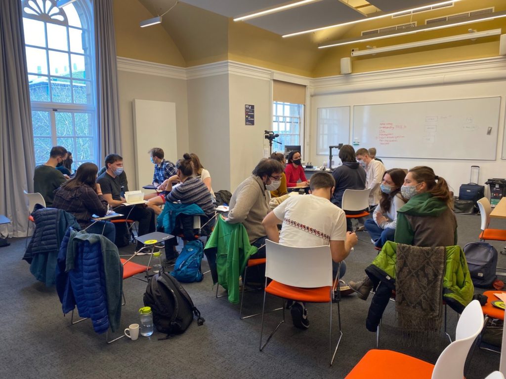
On Friday the 29th of July the SENSE EDI Champion Heather Selley led a workshop at the Alun Turing Institute to kick off the project. The volunteers included Prem Gill (Polar Impact Founder), Heather Selley (Project Lead Organiser), Kirsty Flockhart (Art and production officer), Keiron Bally (Augmented Reality Officer), Priscilla Wong (Digital Content Officer) and Farid Hussein (Illustrator). The workshop allowed the volunteer team to come together and meet for the first time after working virtually on the project for the last few months. The team includes polar scientists, art curators, illustrators, web developers and PhD students with a wide variety of skills and backgrounds. It also gave the team the opportunity to discuss the more technical aspects with the Alun Turing Community, who are data science specialists. A key aim of this project is to make it scalable and be able to be as automated as possible to ensure longevity. This workshop focused on automating the process of getting the polar explorer’s geotagged digital diary which can be shown on a map, tools for QR code tracking, and expanding the project’s augmented reality concept. They also got to try out the mythical Alun Turing Institute coffee machine.
Today SENSE held a showcase event for our REP (Research Experience Placement) students. The REP scheme is funded by NERC and allows undergraduate students to complete a short paid research placement with one of our supervisory teams during their summer vacation. The purpose of this is to allow the student to get taster for what completing a PhD would be like and also gain experience working as part of an active research team. SENSE took part in the programme in 2021 and many of our REP alumni were successful in obtaining either PhD studentships or places on masters programmes.
The REP showcase was a hybrid event taking place in person in Leeds and Edinburgh and also online and allowed each of the students to give a short presentation about their project to some of the current students and staff working with SENSE. It was also a networking opportunity to allow them to meet each other and those currently part of the centre.
We currently have six students working with SENSE
At the University of Leeds
Sara Bennie
Using big data to identify glaciers that surge
Supervisors: Professor Duncan Quincey & Liam Taylor
Isabelle Wicks
Using remote sensing to analyse Himalayan glacial lake thermal regimes
Supervisors: Professor Duncan Quincey & Alex Scoffield
At the University of Edinburgh
Nathaniel Edward-Inatimi
Using machine learning to predict the timing, magnitude and impact of solar flares from satellite imagery
Supervisors: Professor Kathy Whaler & Dr. Ciaran Beggan
Qiusi Zou
Using machine learning to identify buildings and land cover from very high-resolution satellite images
Supervisor: Dr Sohan Seth
Arnav Sinha
Multi Satellite Weather Files for Net Zero Developments
Supervisors: Dr Daniel Fosas De Pano & Dr Dru Crawley
Thomas Gilliespie
Designing future lidar satellites for monitoring Net Zero
Supervisor: Dr Steven Hancock
Everyone was very impressed with the quality of the students presentations and there were lots of interesting questions. The variety of the projects and subject areas covered demonstrates the many and incredibly varied application of satellite data. The REP students are all at different stages of their projects but once they are complete we will be sharing more information about their results and how they found the experience. Thank you very much to NERC for allowing us to extend this opportunity to them.
In May 2022 SENSE student Lucy Wells travelled to Brazil for field work looking at the dry tropical areas. Lucy is a student at the University of Edinburgh and is supervised by Dr Casey Ryan. Here Lucy reports on her visit to Brazil
Dry tropical ecosystems are broadly made up of two main biomes – dry forests and savannas. These are the largest tropical land cover type, globally covering more area than rainforests, yet receiving far less research attention. In addition, they have unique and ancient biodiversity and are home to more than 1 billion people. Consequently, they are incredibly important ecosystems.
My PhD project is focused around using earth observation data to investigate the vegetation structure in these biomes, to try and understand their distribution. This is a challenging question because dry forests and savannas occupy the same climatic space, and so their distribution is controlled by different things, including soil type and fire.
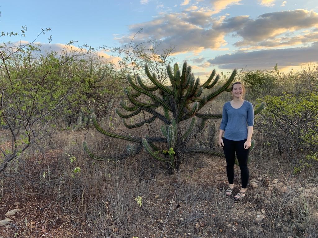
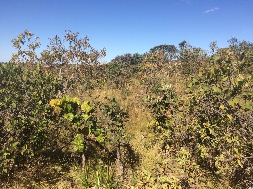
The first half of my PhD looks at the Brazilian dry tropics, particularly the Caatinga, which is an area of dry forest located in the North-East of Brazil. During May-June 2022 I was able to visit the Caatinga, to help with some fieldwork that was taking place, and to visit different areas of the Caatinga to understand its vegetation.
The Caatinga is generally characterised by the presence of relatively hort trees, which have leaves in the wet season (December-June), but are lost in the dry months of the year (July-November). The trees commonly have spines, and there are often cacti present. However, as I learnt, there are lots of variations on this theme!
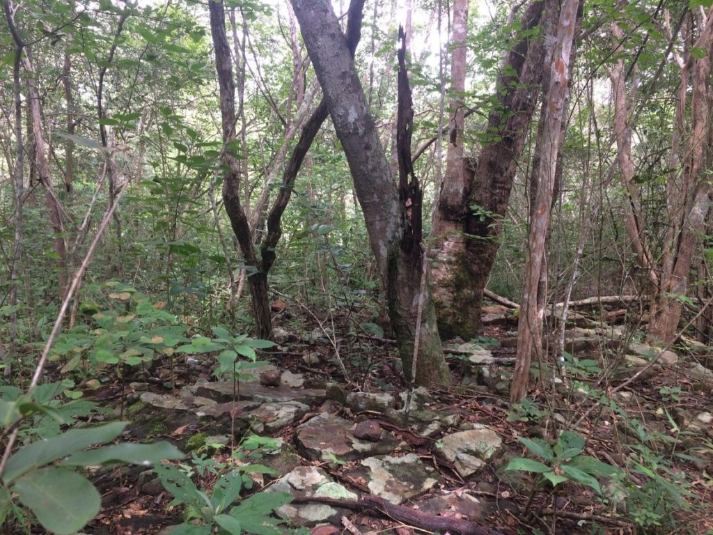
I visited three sites with a team of Brazilian scientists, who were resampling trees in plots that had previously been established. Tree plots are an area of forest (in this case, a rectangle 100 metres * 50 metres), where every tree is recorded. At each plot, the diameter of every tree is measured, its species recorded, and other measurements taken such as the tree height, health of the canopy and overall status of the tree, for example, whether it has multiple stems, is alive or dead. Ideally, the plot is recensused a few years later, to understand how these measurements change over time. This recensus is what my team were doing, five years after the plots were set up in 2017.
This information has a wide range of uses, for example understanding which tree species are present where, tree mortality and recruitment, and competition between species. I work within the SECO project, which is a research project aiming to generate estimates of the carbon fluxes of the dry tropics. Carbon fluxes in dry tropical ecosystems are important to understand, as they currently both mitigate and exacerbate climate change, but the processes are poorly understood. The plot data provides information how much carbon is stored as biomass by the trees on these sites, and is used in conjunction with radar remote sensing to understand the carbon dynamics of dry tropical ecosystems.
Plot 1 – Serra das Almas. This plot is in a nature reserve at quite high elevation, which means there is more rain than typical dry forest. The trees are therefore relatively tall here.Plot 2 – Lagoa Grande. This plot was more what I was expecting, small trees and lots of spiky plants! Although it rained the days that we visited, it was the end of the wet season and you can see that the trees (not the bushy undergrowth) are losing their leaves.Plot 3 – Serra Talhada. This plot was interesting to visit because it is in an area of farmland, and so experiences some disturbance from livestock.
These plots are part of a large network of plots which are spread across the worlds tropical forests, collated by ForestPlots.net. FP.net hosts data from over 6000 plots across the tropical biomes, where the trees are measured using standardised techniques, allowing them to be compared. The network also aims to promote equitable science via collaborative networks throughout the tropics. I’ve included some links to resources about ethical and equitable tropical forest science at the bottom of the article.
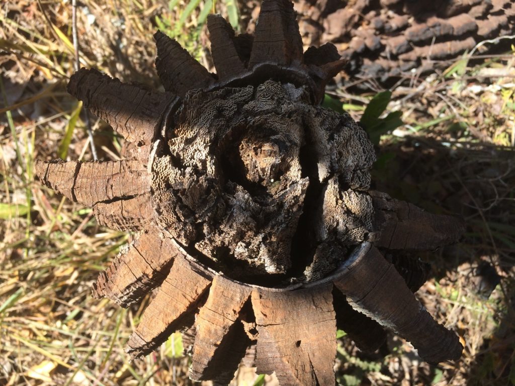
I was also able to visit another collaborator, Desiree Ramos, in Brasilia, which is located in an area of cerrado. The cerrado is the Brazilian area of savanna, the difference from dry forest being the grassy understory underneath the trees. This grassy layer provides fuel for the fires which characterise the savanna ecosystem. Desiree and I visited several areas of cerrado around Brasilia, and she demonstrated her exciting work with phenocams, which take daily photographs of the vegetation, providing information on the timing of things like flowering, and when the leaves become green.
Cerrado, Brasilia – much more grass underneath the trees!Cross-section of a tree stump in the cerrado. The star-shape around the tree is the bark, which is really thick to protect the tree from the natural fires that occur in this ecosystem.
Overall, the trip was a great experience, and has greatly improved understanding of these ecosystems which I can now apply to my research – I’ve got lots of new ideas! As I’d never worked on dry tropical ecology prior to my PhD it was great to learn from knowledgeable Brazilian people on the ground, and establish links with scientists there.
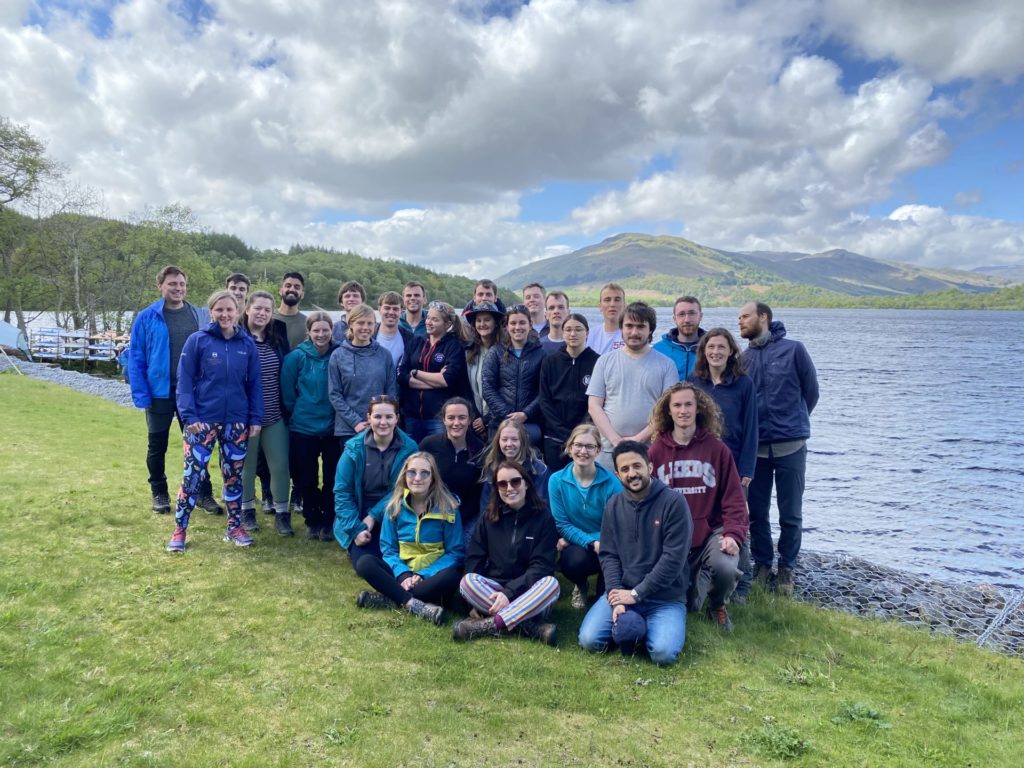
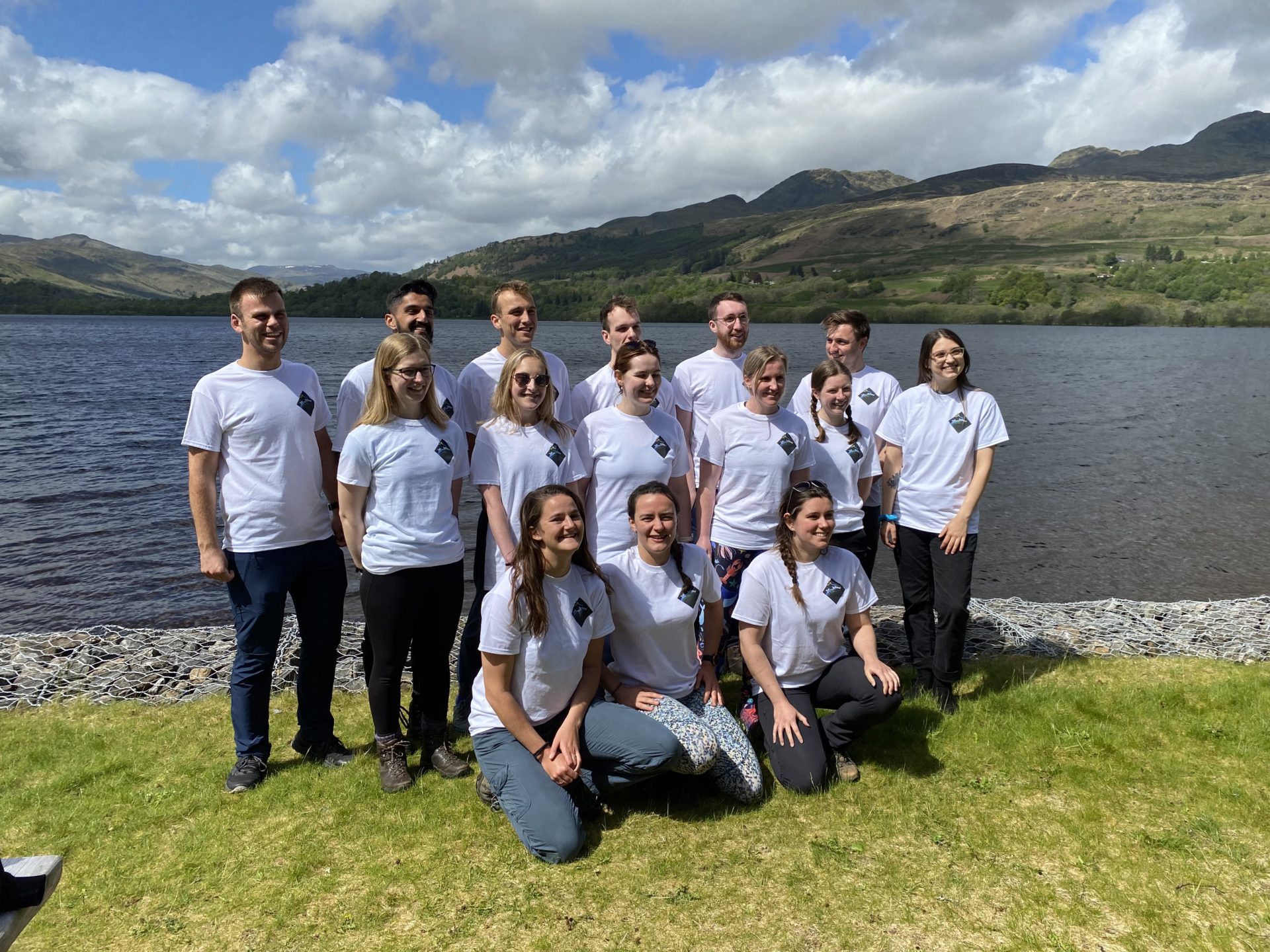
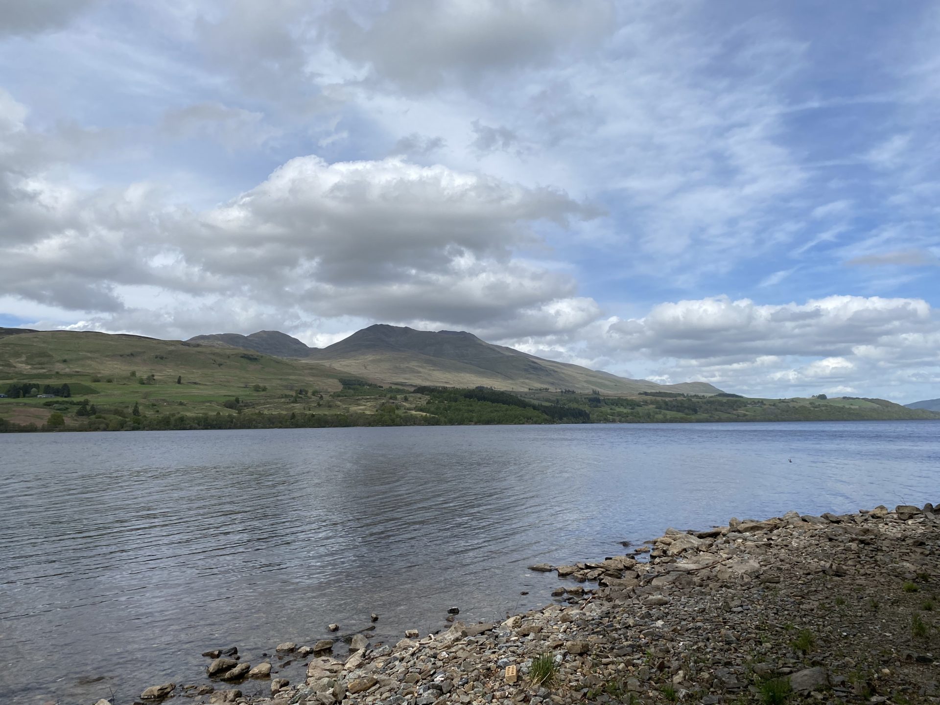
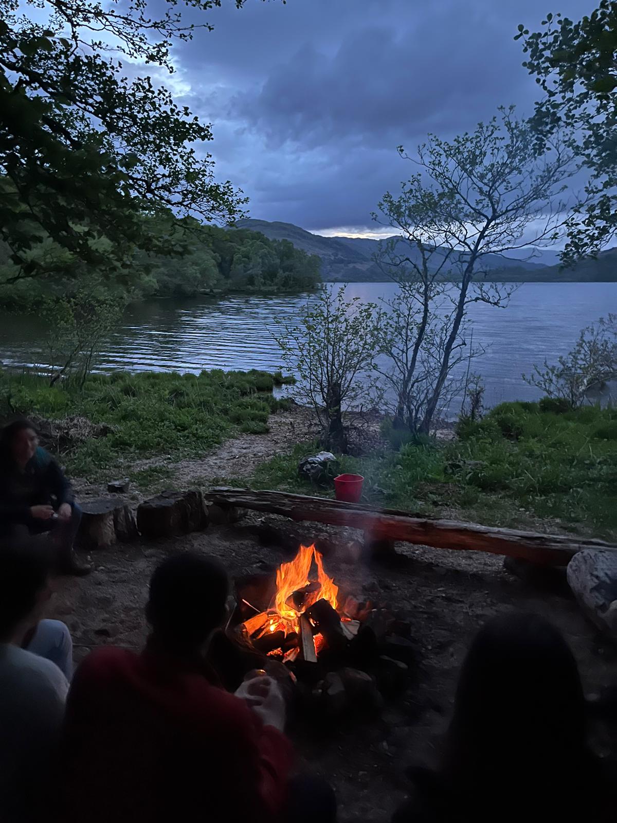
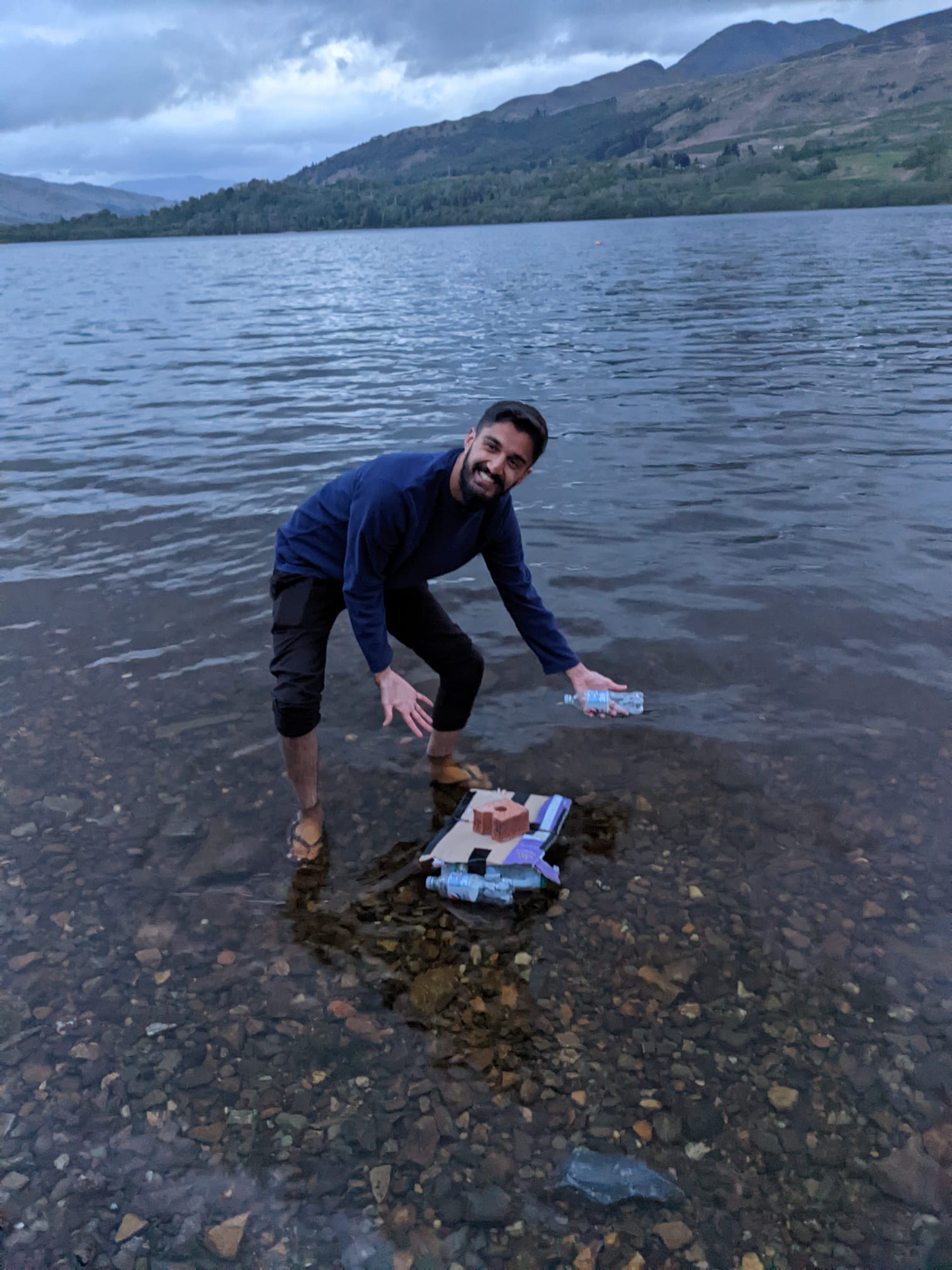
In May 2022 SENSE cohort 1 and 2 students made their way to Firbush the University of Edinburgh outdoor centre near Killin in Stirlingshire for a week of field skills training. This is part of the core training for the CDT students which due to Covid had been delayed on several occasions.
Although most of our students use satellite data for their research collecting ‘ground truth data’ in the field is an important part of research as it can be used to validate satellite data in gaining a better understanding of the area being analysed.
As team SENSE headed north spirits were high as this was going to be the first time all together as a full group and everyone was looking forward to spending time together and getting to know each other properly.
After settling into the centre and trying out some watersports on Loch Tay the group were ready to start out activities which were led by staff from the school of Geosciences at the University of Edinburgh.
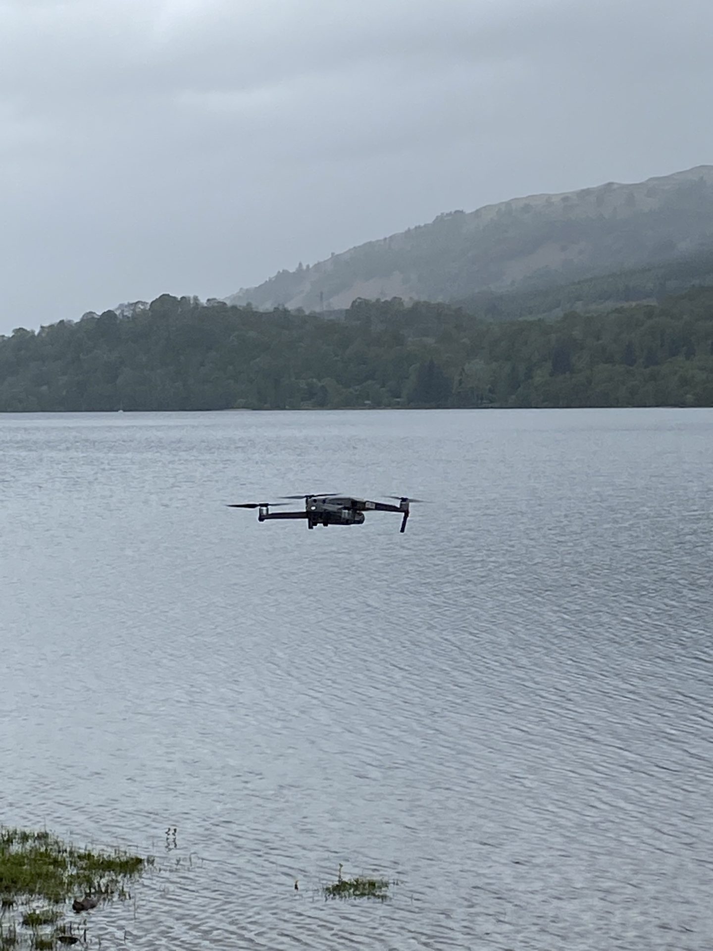
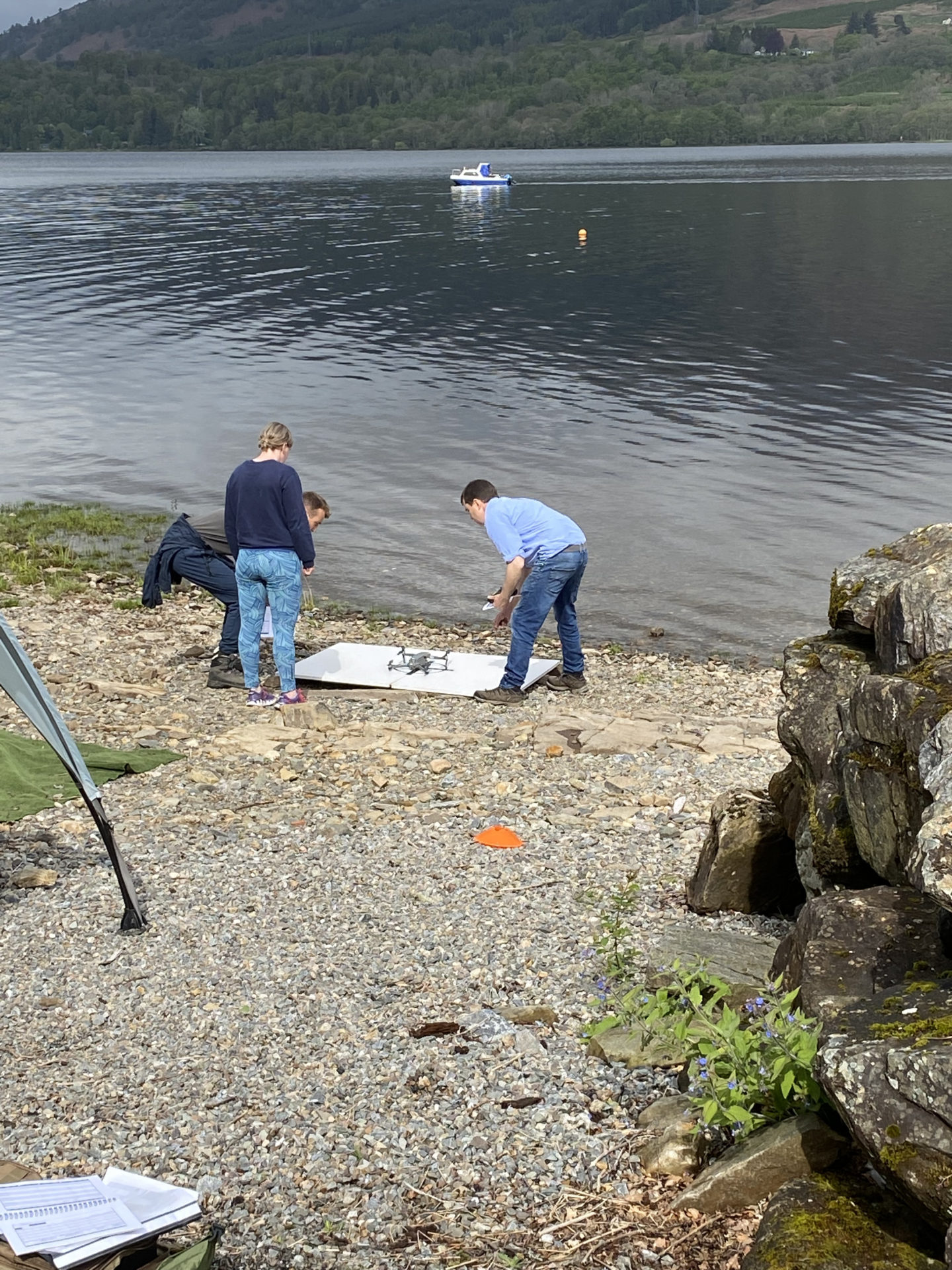
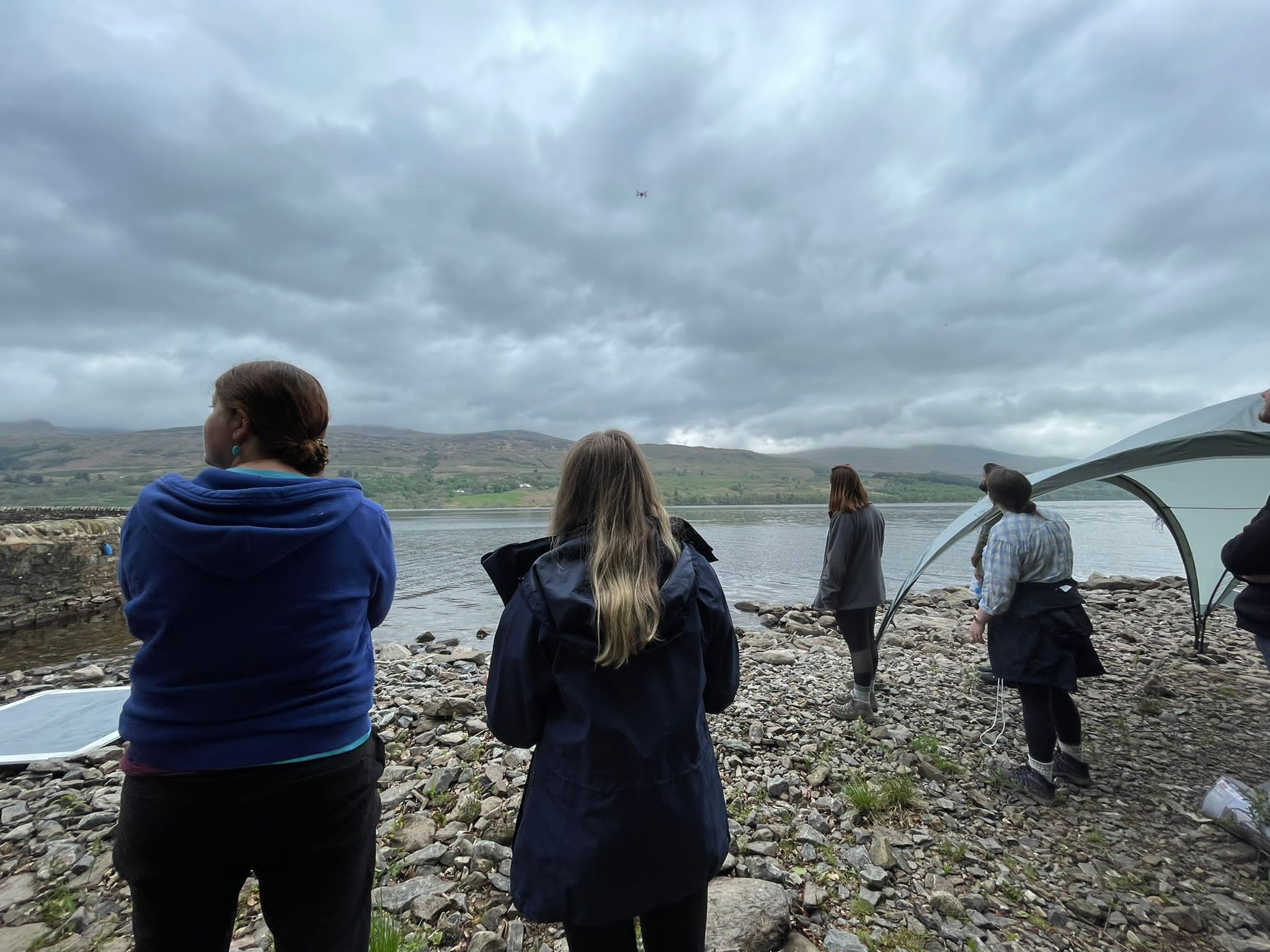
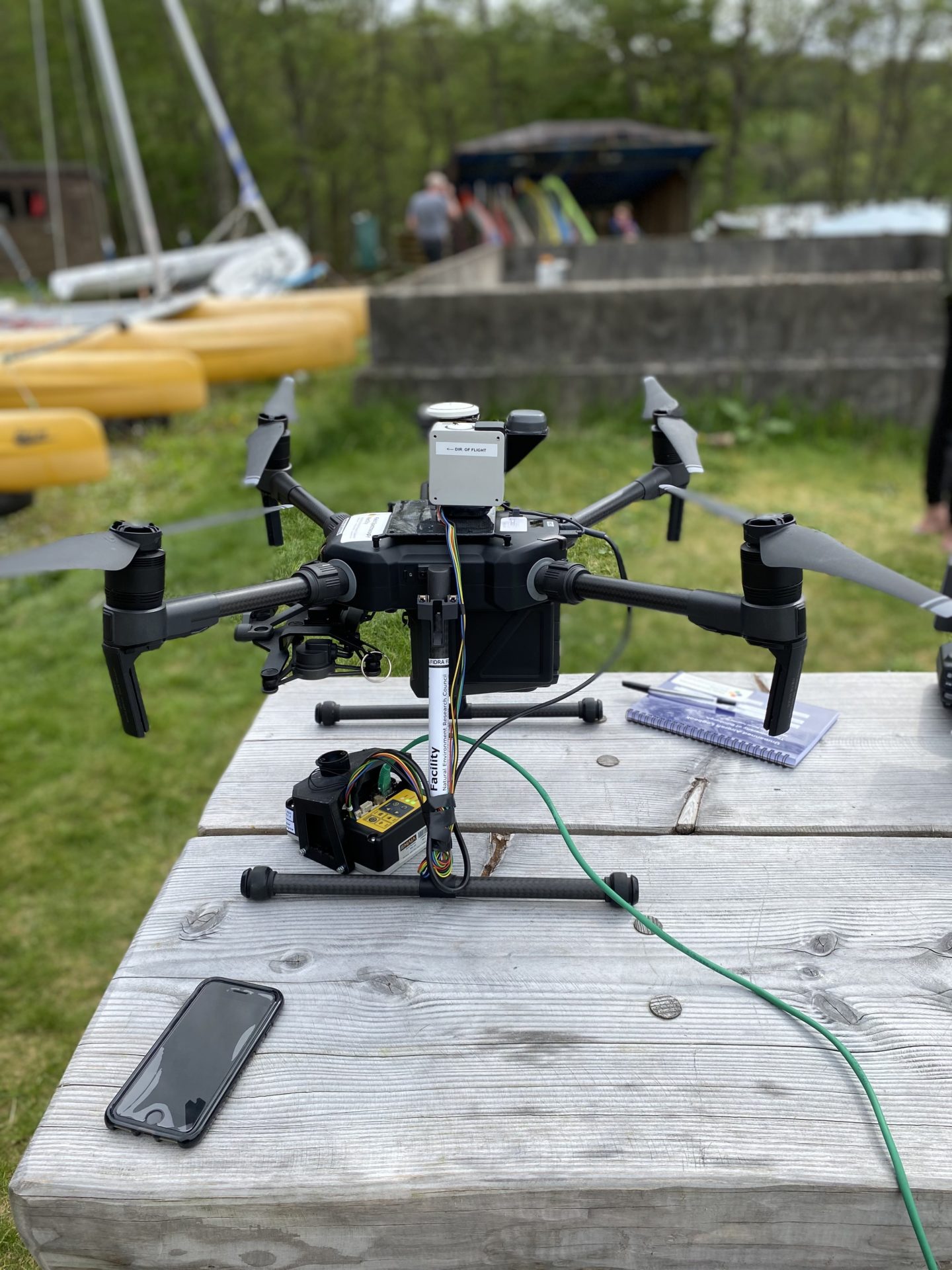
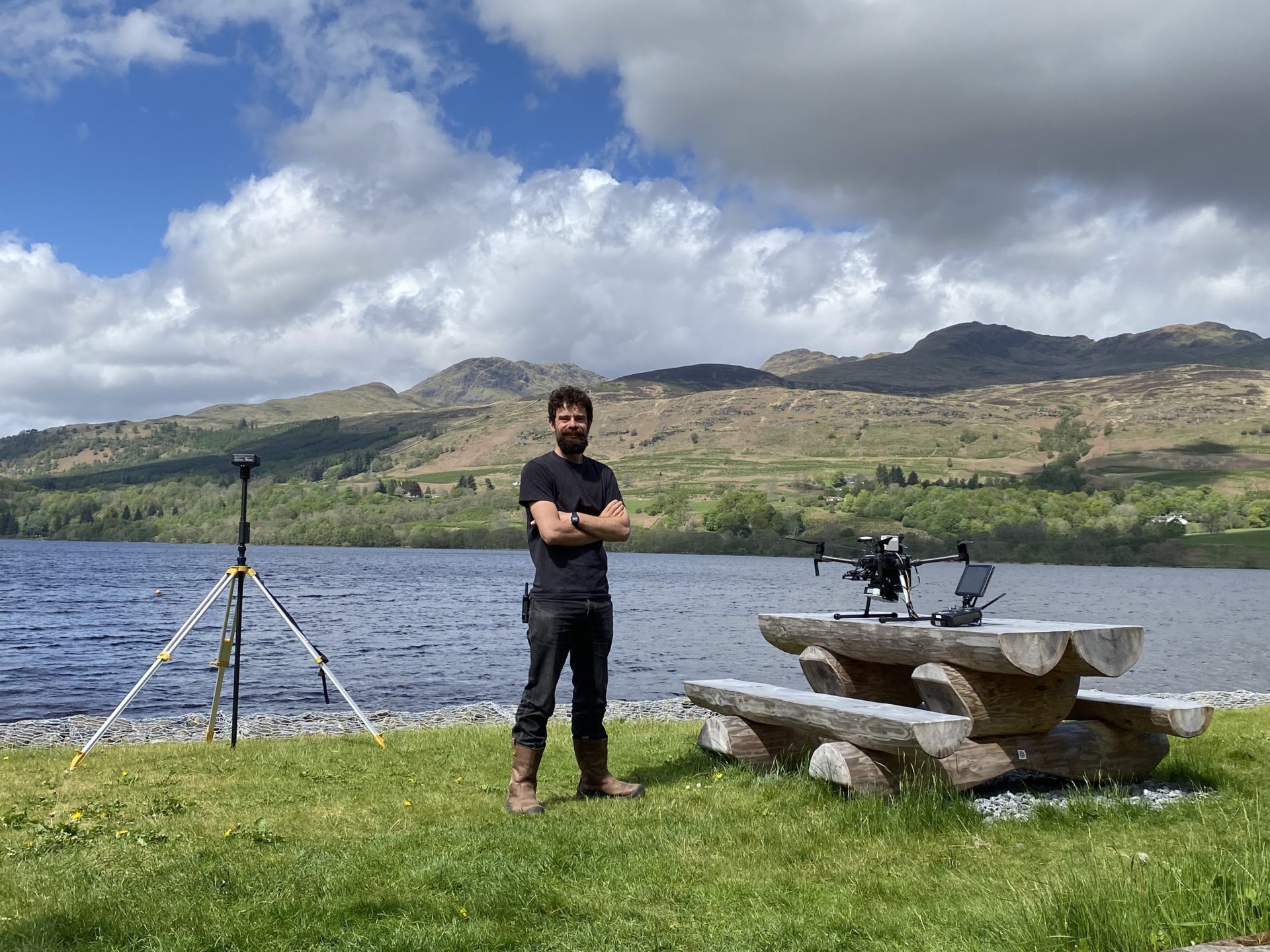
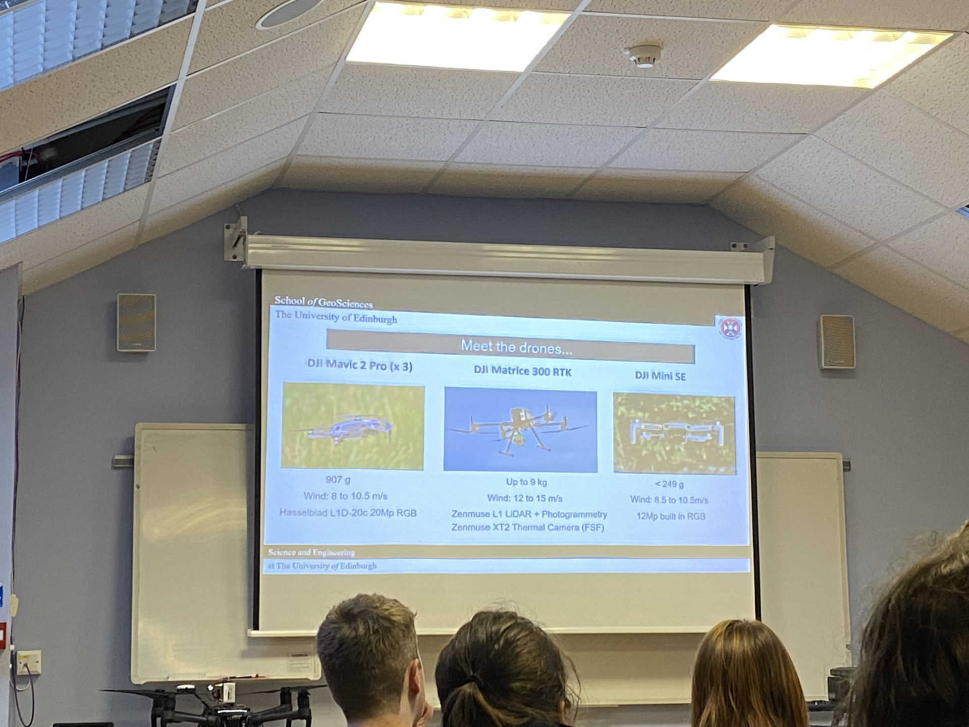
Drone operation was led by Tom Wade (Airborne Geoscience) and Liz Poulsom (E4 DTP) who explained the risk assessment required for flying drones, discussed planning missions and gave practical demonstrations. There is a lot to consider when flying drones and everyone was surprised how much you have to consider including informing the military who may be using the area for operations. Once the safety aspect sorted then it was time to fly and the students all managed to have a shot of the smaller drones and some even got experience of the larger more complex ones (while avoiding the pesky fishermen).
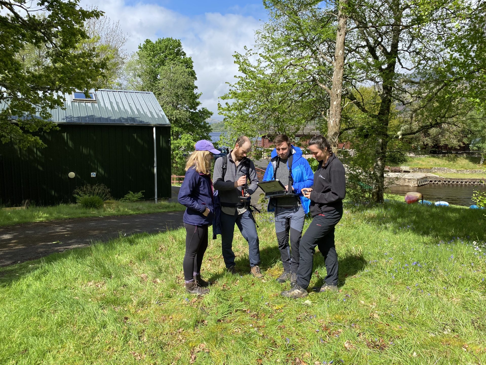
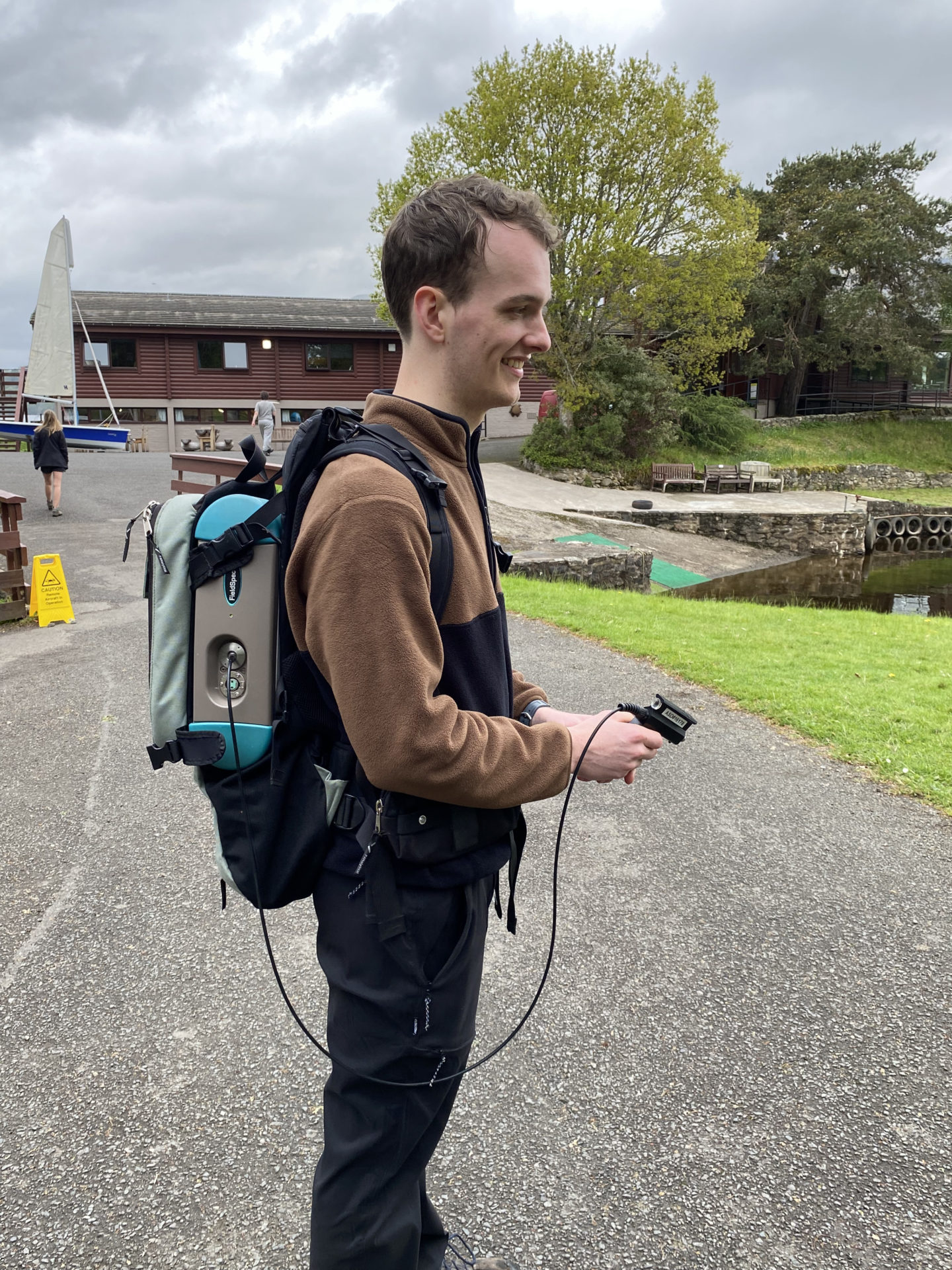
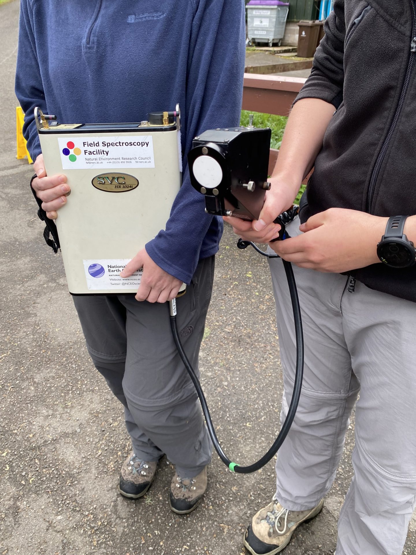
The group were joined by Jack Gillespie from the NERC Field Spectroscopy Facility. Field spectroscopy relates to the measurement of the optical characteristics of a surface and provides quantitative measurements of radiance, irradiance, reflectance or transmission. Analysis of specific areas of the spectral data can infer properties of the sample material, and various indices exist to quantify various parameters. Jack had brought some of the portable equipment used by the unit and the students had a great time looking at different spectral properties of things they could find around the site. The FSF facility lends out spectroscopy equipment to the research community and some of which is carried on drones and Jack had brought along some of the equipment to show us including the headwall camera.
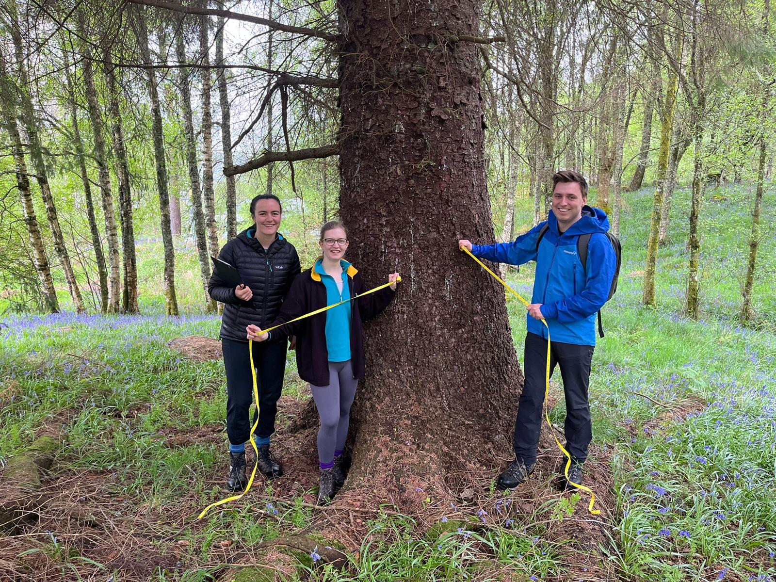
The third activity was forest inventory and tree measuring with Dr Ian Davenport and Wequan Dong from the Mitchard research group. Forest survey is used in calculating the biomass of a forest and is important in validating satellite data although often in exotic locations than a Scottish forest. Ian also shared some work he had carried out using Lidar on a fixed wing UV looking at peat in the Congo forests.
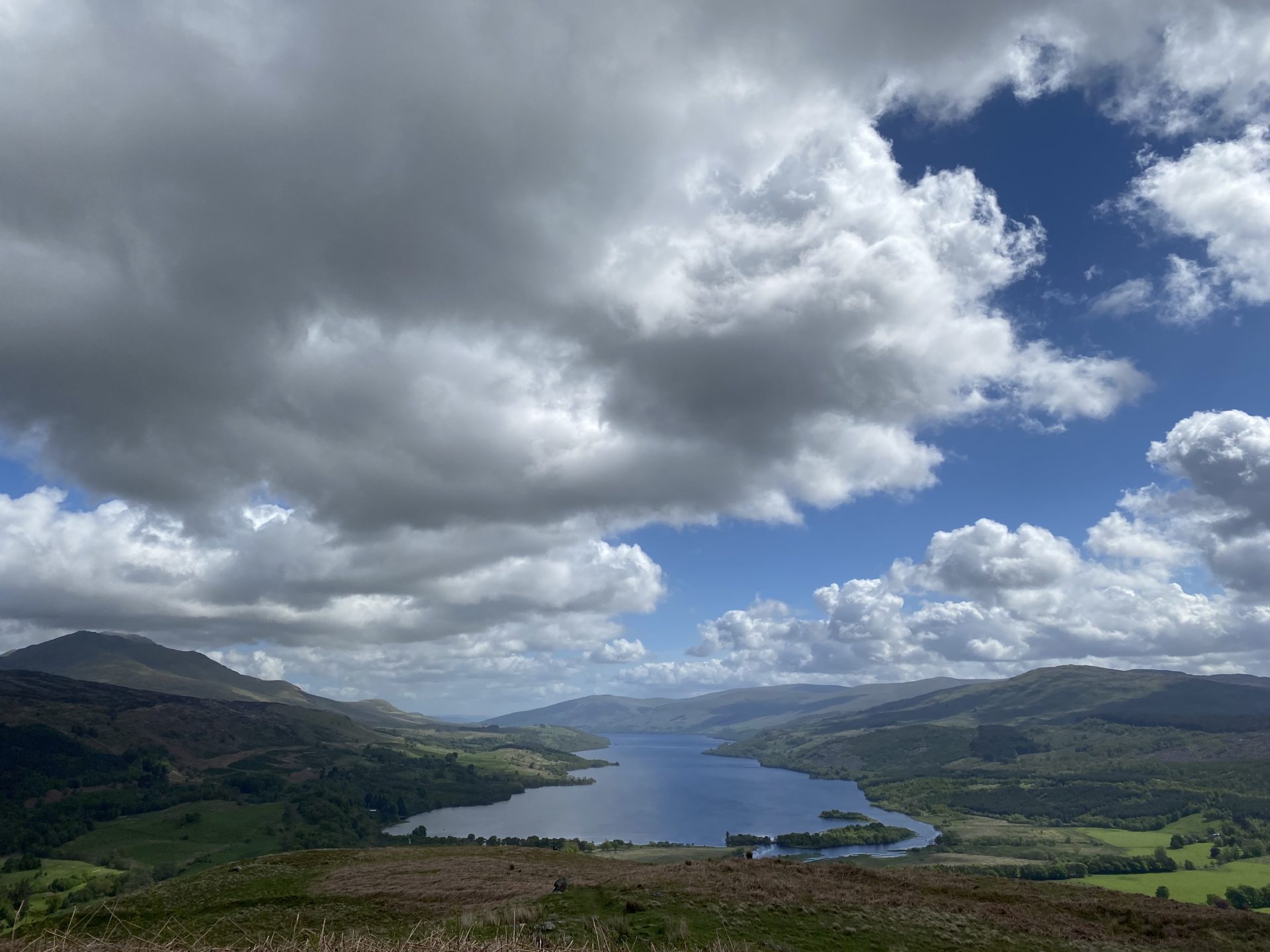
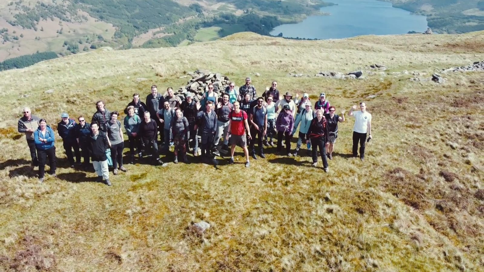
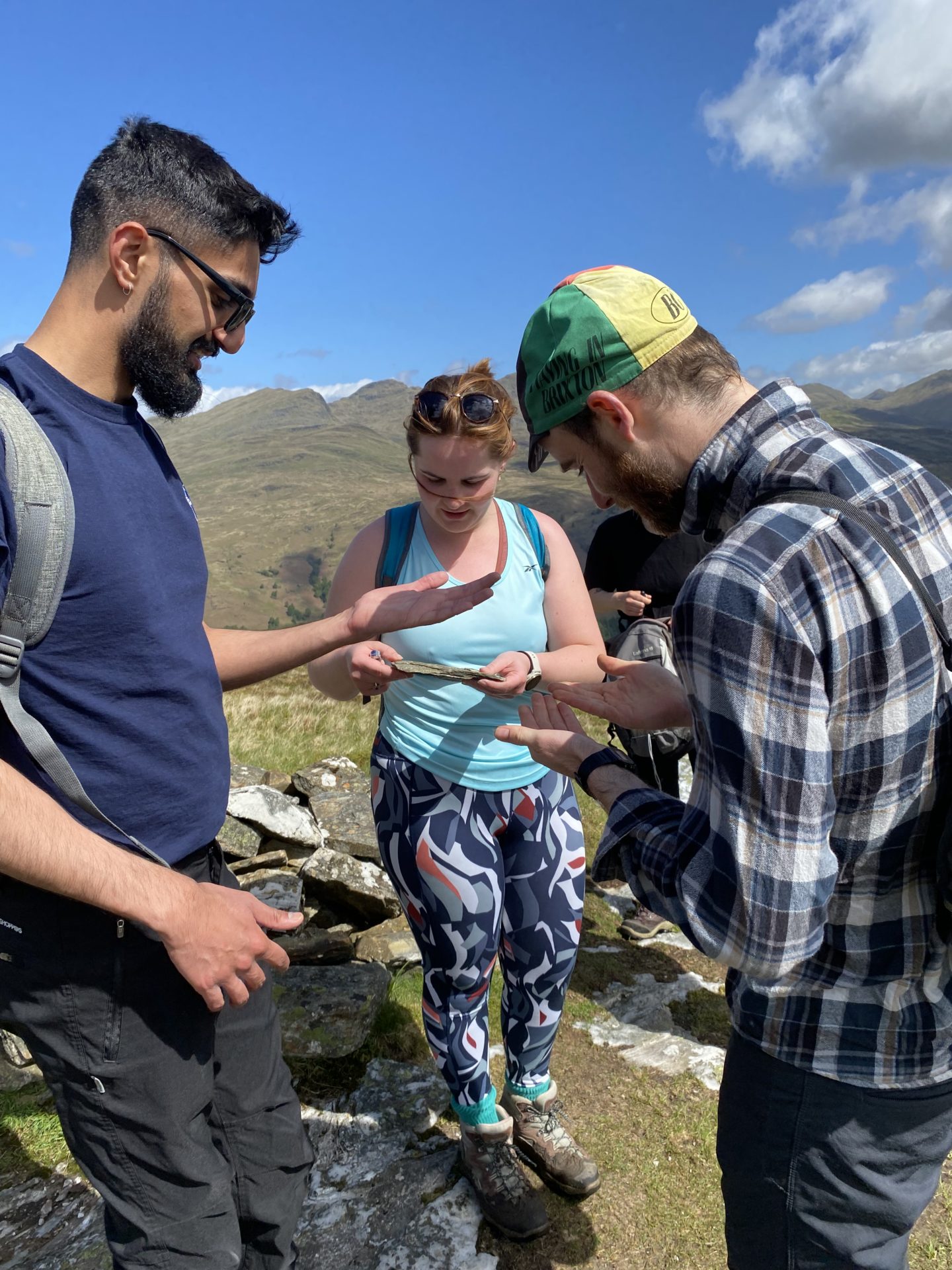
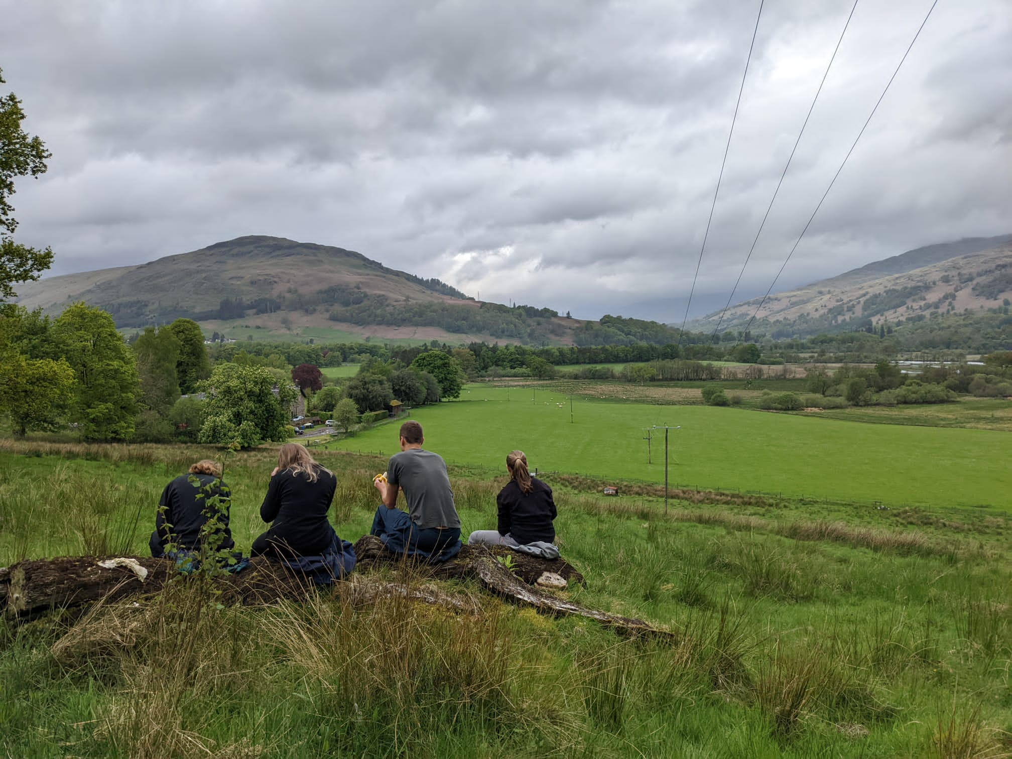
The final activity was a walk up Creag Buidhe a nearby hill overlooking Loch Tay where we were able to discuss the forestry around the area and find out more about the history of the area from the Firbush staff including hydro schemes and crannogs. It was quite a steep walk but more than worth it for the amazing views and also the chance to take a drone selfie thanks to SENSE student Sam Bancroft.
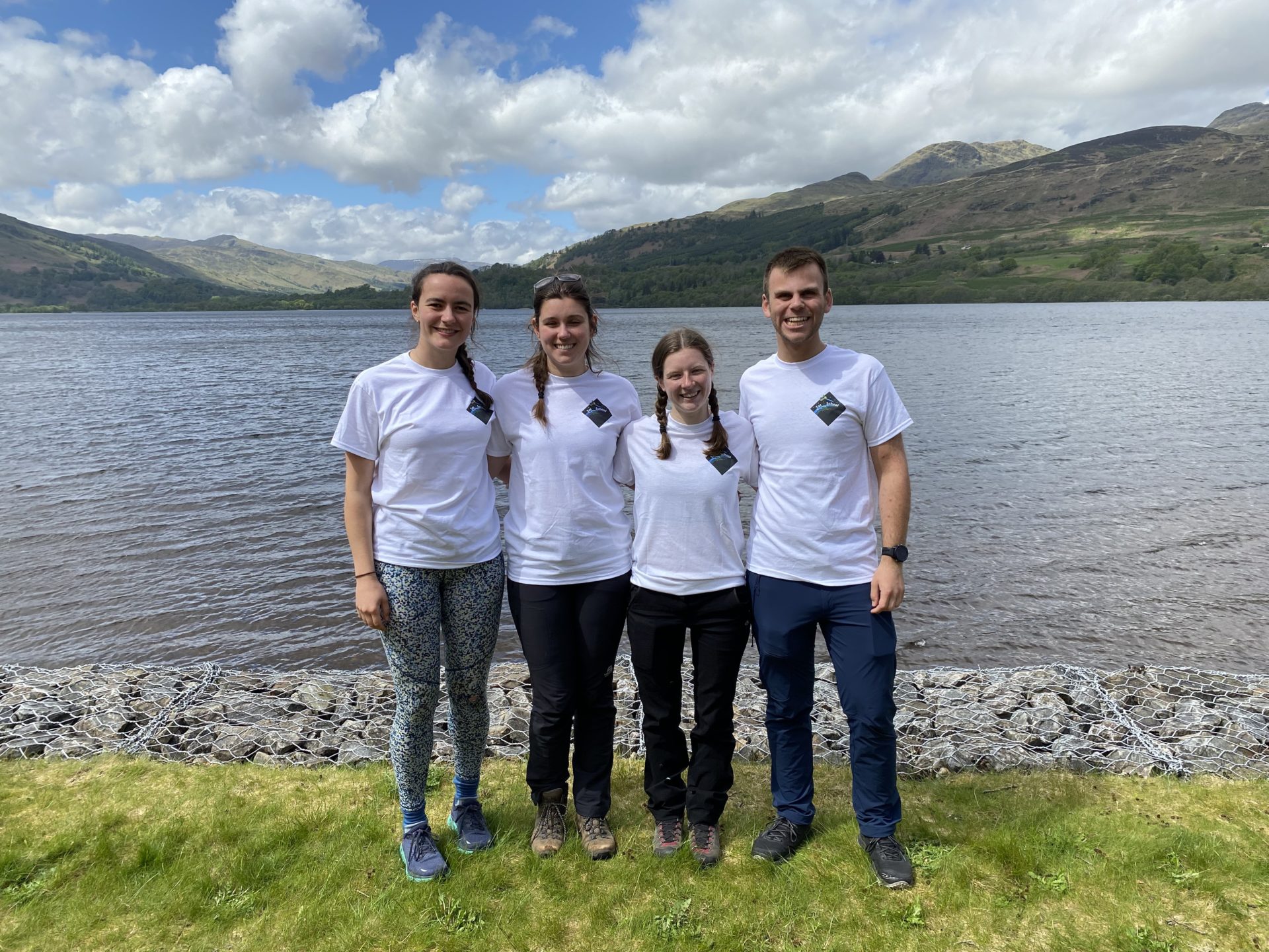
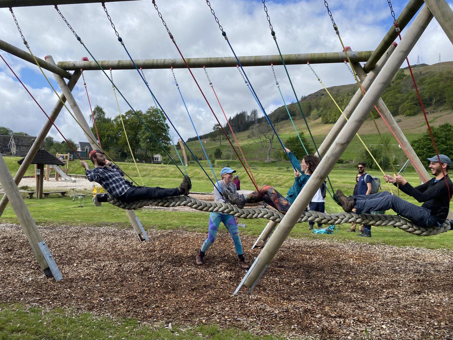
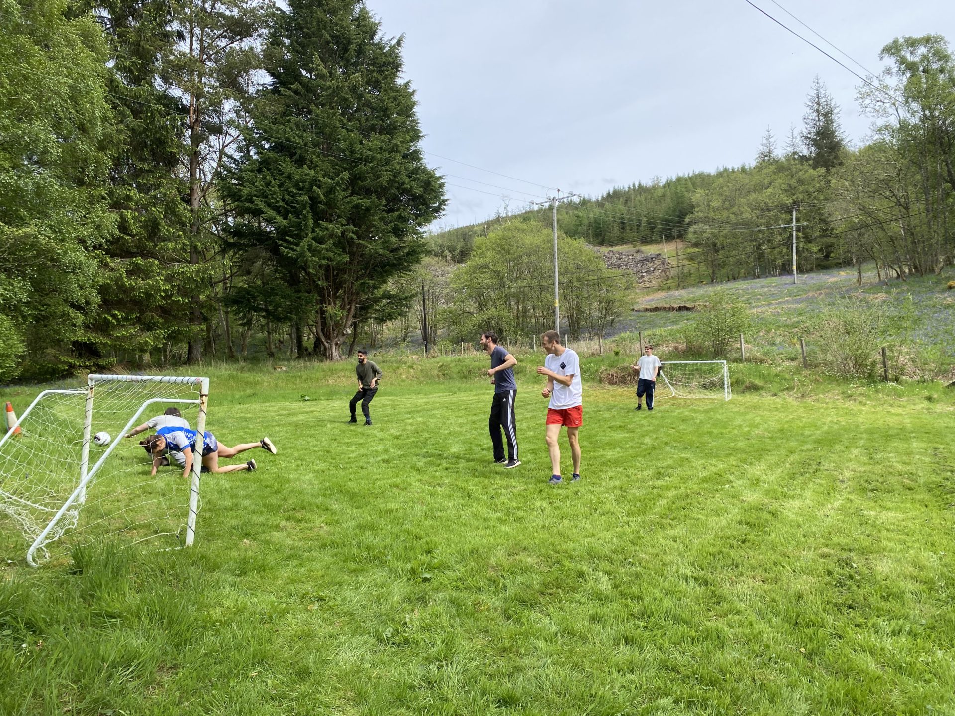
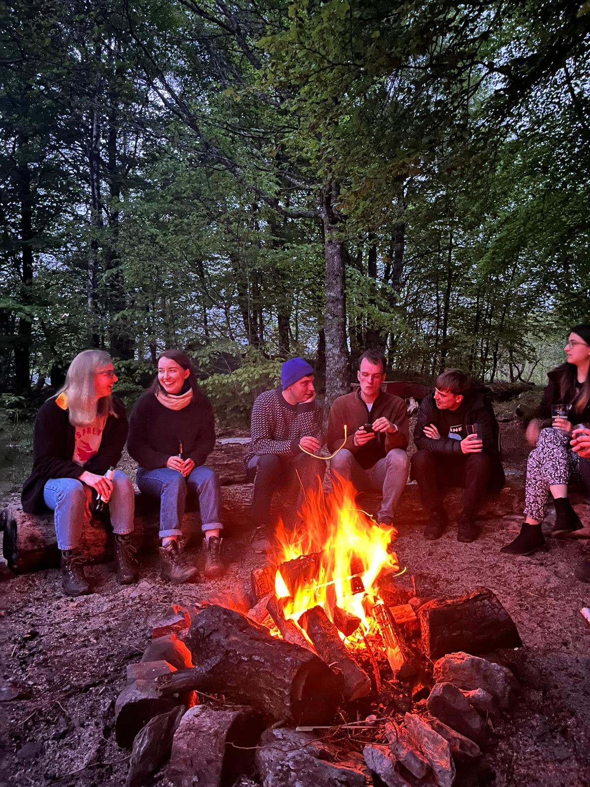
As well as the training activities the students were able to take advantage of the excellent facilities at Firbush and enjoy cycling, walking, football, windsurfing, sailing, kayaking and swimming in the loch. Evenings involved games, a quiz and a taskmaster event as well as time to chat and get to know each other. With conferences coming up there was also time to work on talks and posters and it the first chance for the full team for Sat School our amazing outreach programme to celebrate their hard work (and model the very cool Satschool t shirts).
Cohort building is very important within SENSE as forming professional and personal bonds during their PhD will be essential to our students as they continue their journeys in science and the group took full advantage of this week to do that.
Thank you so much to the Tom, Jack, Liz, Ian, Dong, Eleanor and the Firbush staff for making this such a memorable trip. It was an amazing week with lots of fun and memories made and the group look forward to getting together again soon.
In November 2021 the second cohort of students took part in the first in person block of Earth Observation training at the University of Edinburgh. Due to the pandemic the previous training had take place online so we were really excited to be able to deliver the training in person.
The training took place over four weeks with each week having a different focus and being lead by a different members of staff from the University of Edinburgh.
Week 1: Software Carpentry and Google Earth Engine
Week 2: Statistical Machine Learning, Time series analysis, and Bayesian Filtering
Week 3: Optical Earth Observation
Week 4: Lidar and SAR
Each week is structured around lectures and practical exercises and in the later part of the week the student apply what they have learned to complete a group project which they present to the lecturers the the rest of the group. We also had some keynote talks where those active in Earth Observation discussed their research.
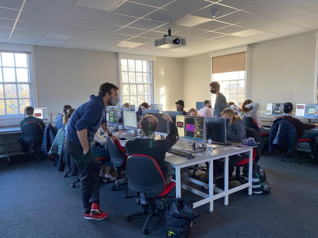
Practical Session on ecognition
The training went down very well with the students who found it intense but rewarding and learned lots of new skills which they can apply to their research.
‘It was all very interesting, and even when I did not understand things it was very valuable to be exposed to new topics and terminology. I most enjoyed meeting my colleagues, who are supportive and made the learning environment enjoyable, and they really gave time to help and explain concepts and issues as we learn.‘
‘Google Earth Engine will be really useful for my project and was taught very clearly with examples‘
‘The lectures this week were ace, I was very impressed with the teaching! A great use of multiple examples to ensure we understood everything.‘
‘The keynote talk from Gary was very interesting – loved how it brings science into the bigger picture and makes it more applicable to pressing issues in society.‘
‘I think the machine learning practical’s were very interesting and useful as I can probably apply some of that to my project.’
‘I learned a lot about how radar and lidar measurements work and also learned a lot in the keynote lecture about the GEDI mission‘
Iain has a greatway of teaching about radar data which really helps to understand the concepts, e.g. all the small experiments he does
‘amazing, loved it, woke up every day thinking I’m so happy to be here, living the dream’
‘Training made my PhD work make so much more sense. More well equipped to do the work now than I was before training’
As the students who are not normally based in Edinburgh were living here for a month it also gave them a chance to get to know the city and get to know some of the cohort 1 SENSE students. There were lots of opportunities to socialise and work together and everyone is looking forward to being together again in spring 2022 for the next block of training in Leeds.
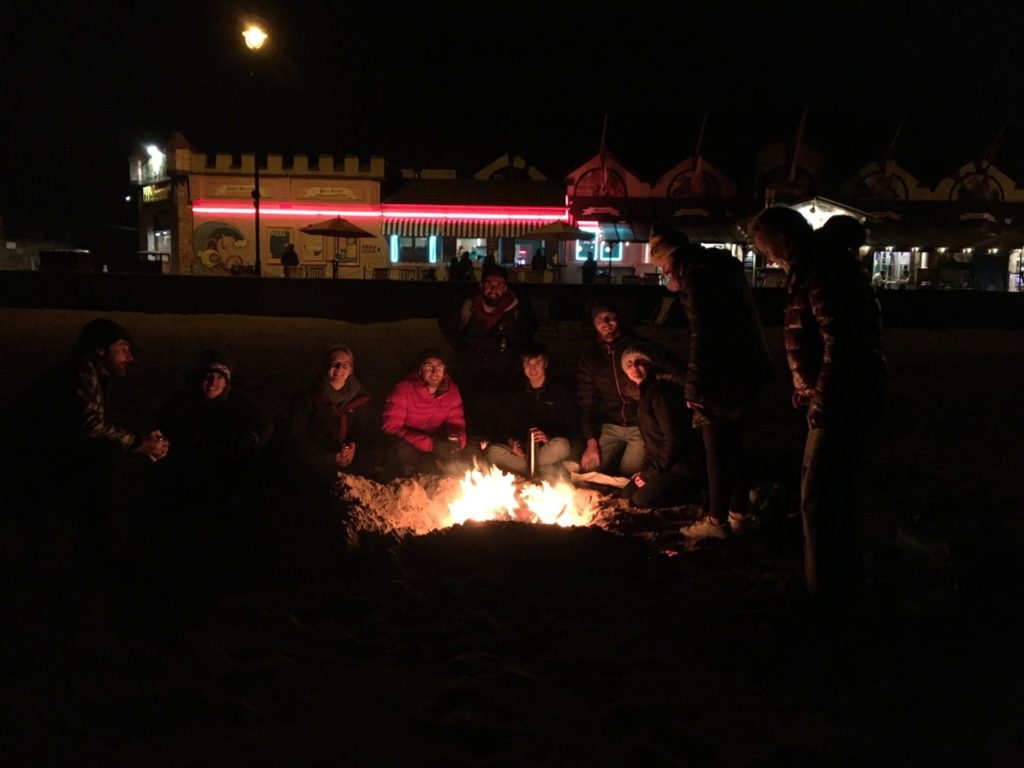
Portobello beach – fire and pizza
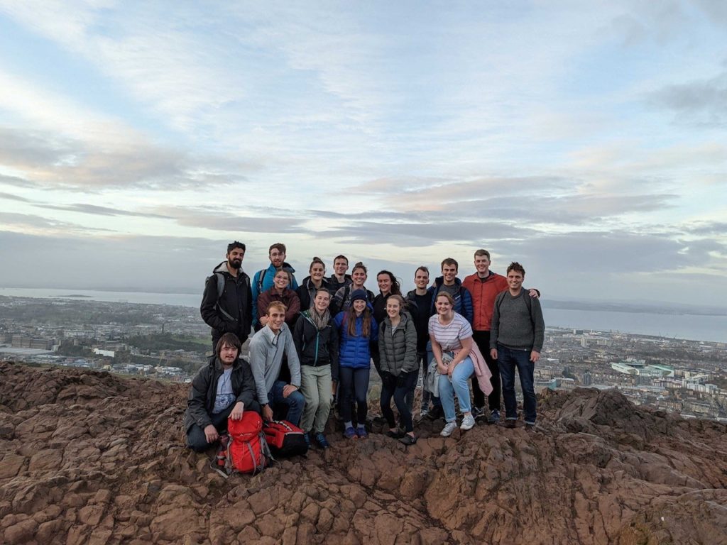
Cohort 1 & 2 students on top of Arthurs Seat
We are incredibly grateful to the staff who contributed to the training: Dr Encarni Medina-Lopez, Dr Victor Elvria, Dr Steven Hancock, Professor Iain Woodhouse, Professor Ed Mitchard, Dr Caroline Nicol, Dr Andrew Gray, Dr Daniel Clewley (from NEODASS), Dr Gary Watmough and Professor Ralph Dubayah (University of Maryland/NASA)
We would also like to thank the terrific demonstrators who also did a fantastic job of supporting the students: Sol White, Peter Hargreaves, Johannes Hansen, Elise Gallois & Joseph Everest
17th November 2021 was a momentous and happy day for team SENSE when after 13 months of working remotely the first cohort of students (and gorgeous mini scientist Lily) were finally able to meet up in person for the first time. The group were at the University of Edinburgh to take part in a media training session with Boffin media to enable them with the skills to share their science with the wider public.
Working on their ideas
Over the course of the day the students learned about presenting their work in print and in podcasts and on film and were give the chance to try out some of the techniques they had learned.
Recording a podcast
“I enjoyed the video part of the training, as it was furthest from what I’ve done before. Being recorded on camera is intimidating and I feel this aspect of the training was particularly helpful for putting me at greater ease should this be necessary in future.“
“I think the most useful thing is just being aware of how to pitch your project/research to a public audience, its hard to gauge what people outside science understand in terms of language, so that’ll be useful just in general talking to people, regardless of whether its to the media or not“
Once the training was over the group along with some of the SENSE director team and Cohort 2 student headed to the historic Sheep Heid for a meal and some games of skittles. It was such a lovely day as everyone in the group has worked really hard over this year to get to know each other and work together despite never meeting all together in person. We are so proud of their resilience and efforts to bond as a group and having the whole group together was an incredibly happy event.
As the students were in Edinburgh for a few days along with many of the cohort 2 students they made the most of their time with both work and social events. These included the launch of the SatSchool outreach project and walk up Arthur’s seat and for a few brave people a sea swim and Portobello.
Cohort 1 & 2 students at the top of Arthurs seat
Everyone really enjoyed this week and we look forward to more like this in the future. As we like to say in Edinburgh – Haste Ye Back
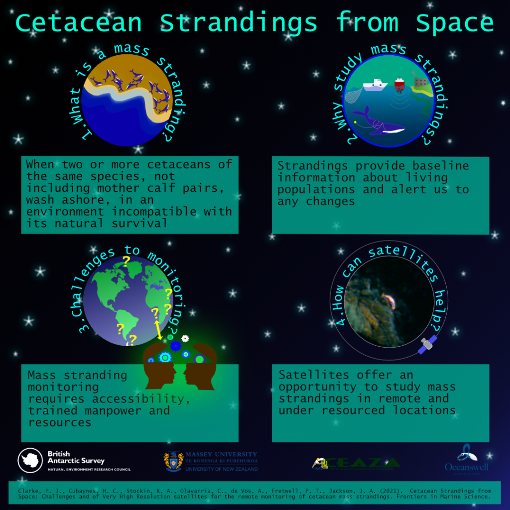
SENSE student Penny Clarke (who is based at British Antarctic Survey) and an international team of collaborators from the British Antarctic Survey, CEAZA (Center for Advanced Research in Arid Zones), Oceanswell and the University of Massey, published a paper on using new technology to study mass stranding of whales from space and how the technology could be used to help protect populations.
The study published in Frontiers in Marine Science found that studying high–resolution satellite imagery could help build long–term cetacean (i.e. whales, dolphins and porpoises) stranding monitoring programmes in remote regions and stranding networks globally.
Whale strandings are becoming a critical ocean health issue and an increase in capacity to monitor and understand strandings is urgently required. The World Health Organisation recently announced their ‘One Health’ approach, which recognises oceanic conditions that impact whales often affect the marine ecosystem, with potential ramifications for human health too.
For remote regions, satellites could form an ‘early response’ tool, alerting managers to a problem and allowing for appropriate response, which could increase the likelihood of attaining useful diagnostic samples to understand exactly what is causing these events.
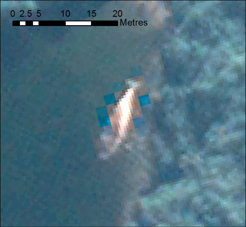
Stranded whale from satellite image
Penny Clarke, Lead Author of the study and a SENSE PhD Researcher, said:
“This study reveals that we need to increase the monitoring of mass strandings across the globe to greater understand cetacean populations, the threats they face and to evaluate the impact of future change. This is particularly important in remote regions, absent of stranding monitoring networks, where satellites offer an opportunity to gather baseline data in these regions.”
Dr Jennifer Jackson, Whale Biologist at British Antarctic Survey said:
“As whale populations recover from whaling and suffer growing impacts from humans and from climate change, we need new tools to monitor these impacts, particularly in remote areas. Satellites hold a lot of promise for helping monitor those strandings over huge areas, as well as to look at local sea conditions, to help identify the causes faster, and make the right recommendations for ocean protection and management.”
Dr Asha de Vos, Founder and Executive Director of Oceanswell in Sri Lanka said:
“Strandings happen across all our coastlines, but not all of us are equipped to monitor or document these events. Satellites provide us with a unique opportunity to monitor even the most far flung places but the key thing is increasing access. If we want to truly understand and protect our planet, we need to ensure equitable access to tools that can help us solve our greatest challenges together.”
The international team hope to challenge the current disparity in stranding monitoring efforts through use of satellites. They also call for collaborative partnerships between satellite providers and stranding networks governments and NGOs, for equal access to satellite imagery, a recommendation endorsed by the International Whaling Commission Scientific Committee.
The research highlights the importance of collaborating across remote sensing specialisms to determine if satellites may help understand the environmental and human induced conditions before, during and after a mass stranding event. Other remotely sensed data could help to highlight changes in the ocean environment and to provide an early warning system to mitigate mass stranding events and develop more informed, knowledgeable and rapid response stranding networks.
Moving forward, the team plan to test the robustness of this technology by partnering with existing and efficient stranding networks in hotspot areas, such as New Zealand, to develop working protocols and automated detection procedures. Following this they will concentrate on remote priority locations such as: the Chilean Patagonia region; much of the West and Eastern coastlines of Africa; the Polar Regions; and coasts in politically turbulent regions such as the North West Indian Ocean.
Cetacean strandings from space: Challenges and opportunities of very high resolution satellites for the remote monitoring of cetacean mass strandings by Penny J. Clarke, Hannah C. Cubaynes, Karen A. Stockin, Carlos Olavarria, Asha de Vos, Peter T. Fretwell and Jennifer A. Jackson is published in the journal Frontiers in Marine Science. Read the paper on their website.
Podcast
A new polar podcast – If Oceans Could Speak – was launched in October featuring SENSE PhD student Penny Clarke as Lead Producer, and a suite of European collaborators. This première season focuses exclusively on the Arctic – listening to stories from those who have shared their life with the mighty Arctic Ocean. Each week presenters Jen Freer and Stefan Kirchner discuss a new perspective, from the adventures of Thomas Wunderlich, Captain of RV Polarstern; to the musical journey of composer Lera Auerbach which led to her award-winning symphony, ‘Arctica’. Guests reflect on climate change, sustainability, and equality, and share their hopes and concerns for the Arctic’s future. The podcast is an output from the EU4Ocean Coalition for Ocean Literacy. Supported by the European Commission, this bottom-up initiative aims to unite the voices of Europeans to make the ocean a concern for everyone. Find out more at www.eu-oceanliteracy.eu and listen to the podcast by searching for ‘If Oceans Could Speak’ on your usual listening platform e.g. Spotify or Apple podcasts, or alternatively, go to their webpage.
30MapChallenge
SENSE student Penny Clarke, won 100km2 of high-resolution satellite imagery as part of Sentinel Hub’s Twitter November #30DayMapChallenge.
Penny called upon the Twitter community to like and share her tweet, to support access to costly highly detailed satellite images to study whale strandings from space.
Whale strandings are on the rise globally, reflecting increasing pressures on our oceans. We need to scale up monitoring to remote coastlines around the world and winning this satellite imagery is hugely valuable to making this happen.
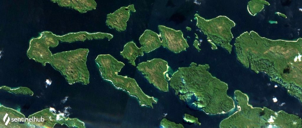
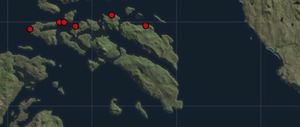
The winning tweet featured a Sentinel-2 satellite image from 2019, at the of the site of the largest known mass stranding of baleen whales in the world and recurring events, alongside an image of the known 2019 strandings in that area. The tweet aimed to highlight how important access to highly detailed satellite imagery is for identifying strandings and to understand the timings of these events; in turn supporting local stranding networks to invest in resources on the ground at the right time to understand what is causing these events.
Sentinel Hub recognised the importance of this work and in their endeavours to support science, have since increased the image quota won to 600km2. Penny and her internationally collaborative team are extremely grateful to the support of Sentinel Hub and Airbus and are excited to delve into the image archives to see what stranding events they can uncover.
Caitlin is a Zoology student who worked with our centre director Professor Ed Mitchard‘s research group and was supervised by Dr Charlotte Wheeler. Her project involved mapping forest height in Ghana using earth observation.
What are you studying?
I am studying Zoology at Newcastle University.
Tell us a bit about the project you have been working on this summer?
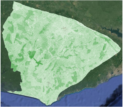
I worked on mapping the forest height in the South-West of Ghana using satellite imagery. With the aim to help support carbon-based conservation and aid the Forestry Commission of Ghana in their reporting. The aim was to create a model using random forest regression to map the heights of the different types of forest and repeat this to visualise where the forest was most affected by degradation over time.
I used Google Earth Engine to visualise the datasets from Sentinel-1, Sentinel-2, ALOS/PALSAR and GEDI. This was used as the input for the random forest model and the data was under sampled to allow for the balancing of heights across the forest. The model could be further improved by masking out areas of least importance and using a wider range of data to train the model.
One of the forest maps produced
What new skills have you learned while doing this internship?
I have learned how to use Java as a coding language to manipulate datasets, I have also learned how to use multiple analytical tools to achieve the outcome I was aiming for. My communication skills have vastly improved as I needed to convey my plans for the project and accurately explain any errors I was encountering. I also got a taste of problem-solving from a research perspective when things did not always go to plan.
How have you found working with your research team?
My research team were amazing and such a great help when it came to learning new skills. Dr Charlotte Wheeler in particular was always there to offer advice and guidance and I was made to feel very welcome in the Mitchard group as a whole.
What has been the highlight of the internship for you?
The highlight of the internship for me was getting to work as part of the research team and see the dynamic and collaborative environment each team member contributed to.
How has doing this internship changed your plans or thoughts about your future career?
This internship has given me a taste of what a PhD consists of and has led me to realise that this is definitely something I want to pursue in my future career. I thoroughly enjoyed the independent working aspect of the internship as well as conducting my own research and learning the variety of new skills required for achieving the outcome I desired.
Hollie is a student from the University of Strathclyde who worked with Dr Gary Watmough and his Geospatial Livelihoods group on a project entitled Supporting the development of a Children’s vulnerability to climate change index in Uganda
What are you studying?
A Masters in Mathematics and Statistics at the University of Strathclyde
Tell us a bit about the project you have been working on this summer?
I have been working on creating a subnational Children’s Vulnerability to Climate Change Index for both Uganda and Tanzania. Currently the Children’s climate risk index (CCRI) is being created on a national level and we are investigating if there should be further funding to create the index on a subnational level as countries will have different scores across the districts within the country. However, the current CCRI only gives one singular vulnerability score for each country. This is also not as useful as a subnational index for policy makers as the subnational index will allow governments to look within their own country and determine which areas need help and for which sector e.g. education.
What new skills have you learned while doing this internship?
I have learned how to use arcMap which is a GIS software, have learned about using STAN in R as a multilevel modelling code type, learned how to do principle component analysis in SPSS and mostly learned about climate change and the social economic vulnerability it causes especially to children.
How have you found working with your research team here at the University of Edinburgh?
Working with my research team has been great everyone is very supportive and helpful. I think it is very important that you feel comfortable asking questions to your supervisor and I definitely did which made the experience more enjoyable.
What has been the highlight of the internship for you?
The highlight for myself has been being able to present my index to the creators of the Children’s Climate Risk Index which is an team containing academics from the University of Southampton, the University of Leeds, the University of Edinburgh and UNICEF.
How has doing this internship changed your plans or thoughts about your future career.
This internship has pushed me towards applying for a PhD within geoscience as I found the project very interesting and enjoyed the research I carried out.
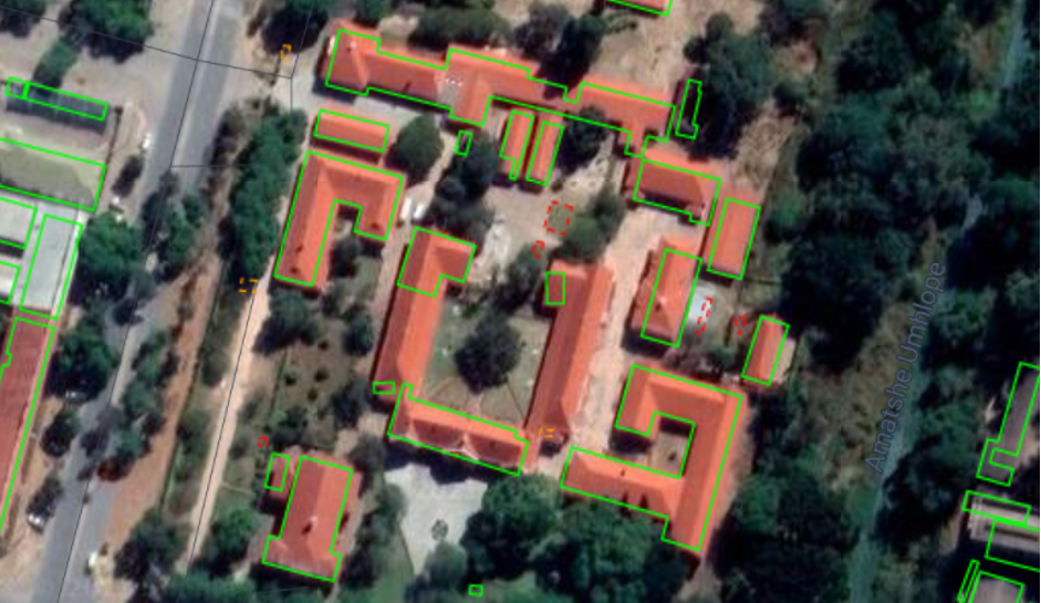
Gareth is a student from the University of Exeter who worked with Dr Gary Watmough and his Geospatial Livelihoods research group on a project entitled: Poverty Estimates in Zimbabwe Using High Resolution Satellite Data
What are you studying?
Mathematics BSc at the University of Exeter, currently going into my third year.
Tell us a bit about the project you have been working on this summer?
My project aims to facilitate the mapping and monitoring of socioeconomic conditions in Bulawayo, Zimbabwe. Using a combination of high-resolution satellite data and novel machine learning techniques I have been able to identify certain features of residential buildings which can often be correlated with wealth and poverty.
You can find a more detailed explanation of the work Gareth did here on his research group blog
What new skills have you learned while doing this internship?
While undertaking the internship I have gained a massive insight into the research process as well as applying new software and programming libraries I had not previously used. For example, using Google Earth Engine to extract mapping data and using Python libraries such as geopandas to interpret geospatial information. I also got the opportunity to apply Vision Transformer, a new type of computer vision algorithm to perform building segmentation.
Building segments on a satellite image
How have you found working with your research team here at the University of Edinburgh?
I have immensely enjoyed working with the Geospatial Livelihoods Group, especially my supervisor Gary who has been very helpful in introducing me to the topic of Earth Observation and to Sohan Seth a researcher in informatics who gave me some insight and advice on how to apply machine learning to this new data.
What has been the highlight of the internship for you?
The highlight of the internship for me was the opportunity to present my research to some of the senior members at SENSE CDT as well getting to see the other research that was being conducted by the other REP interns.
How has doing this internship changed your plans or thoughts about your future career?
Doing this placement has confirmed for me that I would like to continue to study at postgraduate level and incorporate some more cross-disciplinary work in the future.