
Name: Jess Payne
Institution: University of Leeds
PhD Project title: Falling Basins: revealing hidden faults from patterns of land subsidence from water extraction using Earth Observation data
What is your background?
I am a second year SENSE CDT PhD student at the University of Leeds. Prior to my PhD, I studied an undergraduate degree in Natural Sciences. This was a great way to keep learning about all corners of science and not commit to a subject which might be very different at university compared to A Levels! I particularly enjoyed Plant Sciences and Earth Sciences, the latter of which I focused on in my third year. I then stayed at the same institute for my MSci in Earth Sciences. Here I chose to learn about Natural Hazards including earthquakes and volcanoes.
After finishing my MSci, I worked for a year researching the global tin market for the international tin board. This was a great opportunity to explore how resources are used and governed, but I missed researching Earth Sciences. I particularly missed learning about all the techniques and approaches used to remotely monitor volcanoes, earthquakes, and other phenomena on our planet. I was introduced to many of these as part of my MSci project on earthquakes in China but really wanted to learn about Interferometric Synthetic Aperture Radar (InSAR). This is a really cool satellite technique that measures how the surface of the Earth is deforming! With the support of SENSE, I ended up studying a PhD that uses InSAR to measure land subsidence in Iran.
Tell us about your project and the area of environmental science are you most excited about?
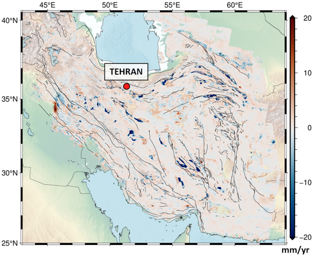
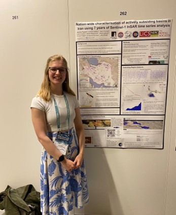
My project focuses on using satellite data to measure the rates and extents of land surface subsidence in Iran. Subsidence is where the land surface moves down over time. Iran experiences some of the fastest subsidence rates in the world at up to 150 mm/yr. But how does this subsidence happen? Iran is an arid country with little rainfall and as a result has few lakes and reservoirs. This means freshwater is often instead extracted from aquifers underground. When this water is removed, gaps or empty pore spaces remain where the water once was. As there is a lot of sand, sediment and even buildings weighing down on these pore spaces, this weight forces the gaps to close or collapse. Sometimes grains around these spaces even deform. These processes result in land surface subsidence. We can use InSAR to measure where this subsidence is happening.
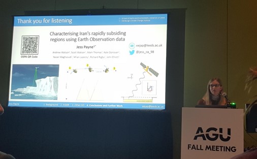
Sentinel-1 is a satellite constellation launched by the European Space Agency in 2014. The data Sentinel-1 collects is used to calculate velocity fields of the land surface. These velocity fields tell you at what rate the land is moving up or down. If we construct such a field over Iran, the regions of subsidence clearly stand out. In fact, we documented 99 of these regions across Iran and constructed the open-access COMET Subsidence Portal, a helpful tool for those interested or affected by land subsidence in the country.
Land subsidence might not appear the most exciting solid earth hazard out there, but it is often directly linked to human development, activity, and economic growth as well as climate change. Indeed, working out where subsidence is happening can tell us how groundwater resources are being managed and how changes in precipitation rates are impacted our land. Moreover, subsidence presents a threat to buildings, bridges, and people. For example, subsidence has been linked to metro line collapse in Mexico City, while communities are being forced to move out of villages in Iran to avoid buildings collapsing due to subsidence. Managing groundwater resources and resulting subsidence rates is therefore essential in our changing world.
Was using satellite data at the core of your PhD project important to you?
Absolutely! Having done a lot of geology during my undergraduate degree and not knowing the potential of satellite data, I was blown away when I first heard that InSAR could be used to automatically monitor volcanoes thousands of kilometers away. I was used to travelling to a geologically interesting place at one or a handful of times, recording a few pieces of data by hand in spot locations and using these data to come to conclusions about how the area has or is currently deforming. The enormously increased data coverage and frequency of satellite measurements has and still is revolutionizing how Earth Sciences is studied; satellite data is an incredibly useful tool to complement geological studies.
Also, studying regions which are difficult to access for political or social reasons is made a lot easier with satellite data!
Why did you decide to enter the space sector?
Entering the space sector sort of happened by accident- my interest in Earth Sciences and Geology drew me to satellite based tools. However, I love using satellite data and would consider a related career in future.
What are your hopes for future PhD students?
I hope that people from any background will feel that they are able to apply and have success in applying for a PhD programme. SENSE is a really exciting programme to be part of because of the diverse backgrounds and cultures that SENSE students come from- my time so far wouldn’t be the same without the diversity among my cohort. In future, I hope more PhD programmes and institutes make prospective students at any stage of live and from any culture feel welcome.
Any tips for those interested in applying for PhDs?
Ask lots of questions and show lots of interest! Applying for a PhD can seem like a mysterious, black-box process so asking anyone you can think of how to apply is a great start. Maybe some of your peers have applied for a PhD, sometimes sending an email to a potential supervisor asking for some advice might be useful. Most people want to help and are excited about their research, so would love to chat.
Read more about Jess here.
Follow Jess on Twitter @Jess_ca_98