
SENSE student Penny Clarke (who is based at British Antarctic Survey) and an international team of collaborators from the British Antarctic Survey, CEAZA (Center for Advanced Research in Arid Zones), Oceanswell and the University of Massey, published a paper on using new technology to study mass stranding of whales from space and how the technology could be used to help protect populations.
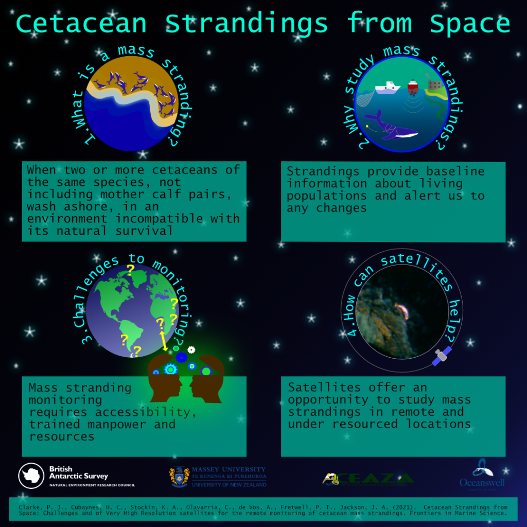
The study published in Frontiers in Marine Science found that studying high–resolution satellite imagery could help build long–term cetacean (i.e. whales, dolphins and porpoises) stranding monitoring programmes in remote regions and stranding networks globally.
Whale strandings are becoming a critical ocean health issue and an increase in capacity to monitor and understand strandings is urgently required. The World Health Organisation recently announced their ‘One Health’ approach, which recognises oceanic conditions that impact whales often affect the marine ecosystem, with potential ramifications for human health too.
For remote regions, satellites could form an ‘early response’ tool, alerting managers to a problem and allowing for appropriate response, which could increase the likelihood of attaining useful diagnostic samples to understand exactly what is causing these events.
Penny Clarke, Lead Author of the study and a SENSE PhD Researcher, said:
“This study reveals that we need to increase the monitoring of mass strandings across the globe to greater understand cetacean populations, the threats they face and to evaluate the impact of future change. This is particularly important in remote regions, absent of stranding monitoring networks, where satellites offer an opportunity to gather baseline data in these regions.”
Dr Jennifer Jackson, Whale Biologist at British Antarctic Survey said:
“As whale populations recover from whaling and suffer growing impacts from humans and from climate change, we need new tools to monitor these impacts, particularly in remote areas. Satellites hold a lot of promise for helping monitor those strandings over huge areas, as well as to look at local sea conditions, to help identify the causes faster, and make the right recommendations for ocean protection and management.”
Dr Asha de Vos, Founder and Executive Director of Oceanswell in Sri Lanka said:
“Strandings happen across all our coastlines, but not all of us are equipped to monitor or document these events. Satellites provide us with a unique opportunity to monitor even the most far flung places but the key thing is increasing access. If we want to truly understand and protect our planet, we need to ensure equitable access to tools that can help us solve our greatest challenges together.”
The international team hope to challenge the current disparity in stranding monitoring efforts through use of satellites. They also call for collaborative partnerships between satellite providers and stranding networks governments and NGOs, for equal access to satellite imagery, a recommendation endorsed by the International Whaling Commission Scientific Committee.
The research highlights the importance of collaborating across remote sensing specialisms to determine if satellites may help understand the environmental and human induced conditions before, during and after a mass stranding event. Other remotely sensed data could help to highlight changes in the ocean environment and to provide an early warning system to mitigate mass stranding events and develop more informed, knowledgeable and rapid response stranding networks.
Moving forward, the team plan to test the robustness of this technology by partnering with existing and efficient stranding networks in hotspot areas, such as New Zealand, to develop working protocols and automated detection procedures. Following this they will concentrate on remote priority locations such as: the Chilean Patagonia region; much of the West and Eastern coastlines of Africa; the Polar Regions; and coasts in politically turbulent regions such as the North West Indian Ocean.
Cetacean strandings from space: Challenges and opportunities of very high resolution satellites for the remote monitoring of cetacean mass strandings by Penny J. Clarke, Hannah C. Cubaynes, Karen A. Stockin, Carlos Olavarria, Asha de Vos, Peter T. Fretwell and Jennifer A. Jackson is published in the journal Frontiers in Marine Science. Read the paper on their website.
Podcast
A new polar podcast – If Oceans Could Speak – was launched in October featuring SENSE PhD student Penny Clarke as Lead Producer, and a suite of European collaborators. This première season focuses exclusively on the Arctic – listening to stories from those who have shared their life with the mighty Arctic Ocean. Each week presenters Jen Freer and Stefan Kirchner discuss a new perspective, from the adventures of Thomas Wunderlich, Captain of RV Polarstern; to the musical journey of composer Lera Auerbach which led to her award-winning symphony, ‘Arctica’. Guests reflect on climate change, sustainability, and equality, and share their hopes and concerns for the Arctic’s future. The podcast is an output from the EU4Ocean Coalition for Ocean Literacy. Supported by the European Commission, this bottom-up initiative aims to unite the voices of Europeans to make the ocean a concern for everyone. Find out more at www.eu-oceanliteracy.eu and listen to the podcast by searching for ‘If Oceans Could Speak’ on your usual listening platform e.g. Spotify or Apple podcasts, or alternatively, go to their webpage.
30MapChallenge
SENSE student Penny Clarke, won 100km2 of high-resolution satellite imagery as part of Sentinel Hub’s Twitter November #30DayMapChallenge.
Penny called upon the Twitter community to like and share her tweet, to support access to costly highly detailed satellite images to study whale strandings from space.
Whale strandings are on the rise globally, reflecting increasing pressures on our oceans. We need to scale up monitoring to remote coastlines around the world and winning this satellite imagery is hugely valuable to making this happen.
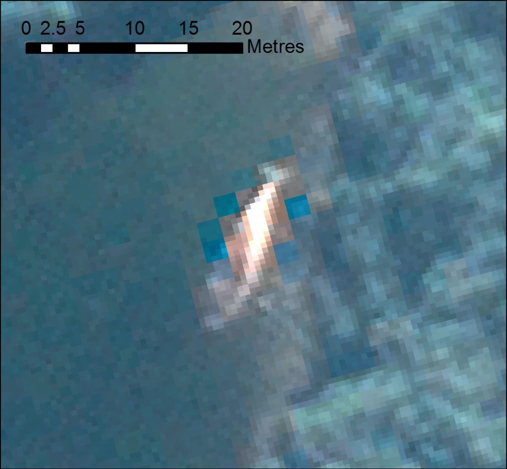
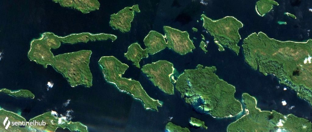
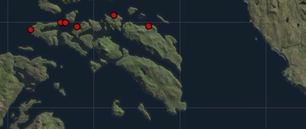
The winning tweet featured a Sentinel-2 satellite image from 2019, at the of the site of the largest known mass stranding of baleen whales in the world and recurring events, alongside an image of the known 2019 strandings in that area. The tweet aimed to highlight how important access to highly detailed satellite imagery is for identifying strandings and to understand the timings of these events; in turn supporting local stranding networks to invest in resources on the ground at the right time to understand what is causing these events.
Sentinel Hub recognised the importance of this work and in their endeavours to support science, have since increased the image quota won to 600km2. Penny and her internationally collaborative team are extremely grateful to the support of Sentinel Hub and Airbus and are excited to delve into the image archives to see what stranding events they can uncover.
Watch this space to see what they will find!