University of Edinburgh logo British Antarctic Survey logo National Oceanographic Centre logo University of Leeds logo

Ducks, Drones & Dancing – Firbush Field Skills May 2023

Even the ducks were keen to join the training

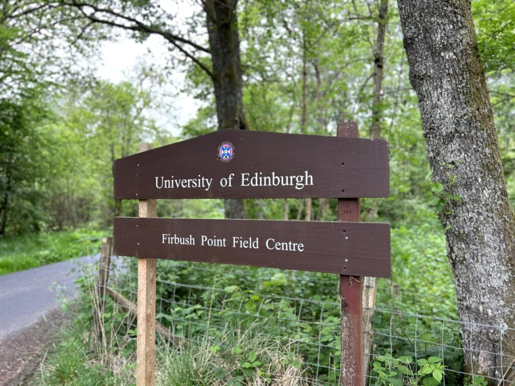
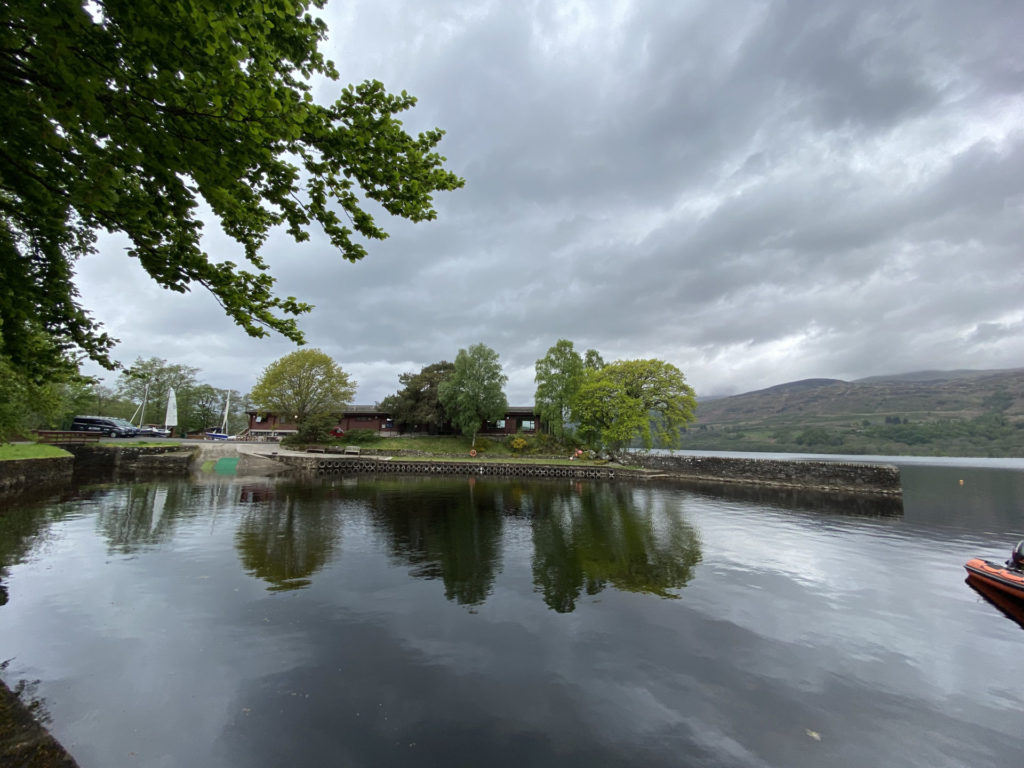
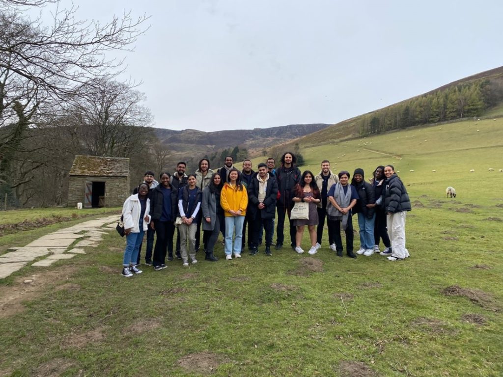
So after last year’s very successful Firbush field skills trip we thought we really couldn’t top it but how wrong we were. In June 2023 24 SENSE students and some special invited guest students (more about them later) headed north to the beautiful University of Edinburgh field skills centre at Firbush point on Loch Tay for a week of field skills training, outdoor pursuits and cohort building with staff from the School of Geoscience.

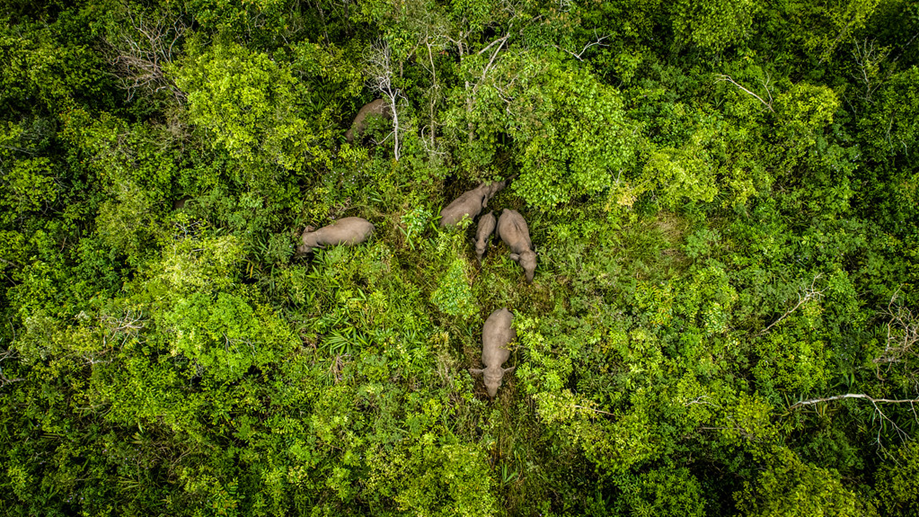
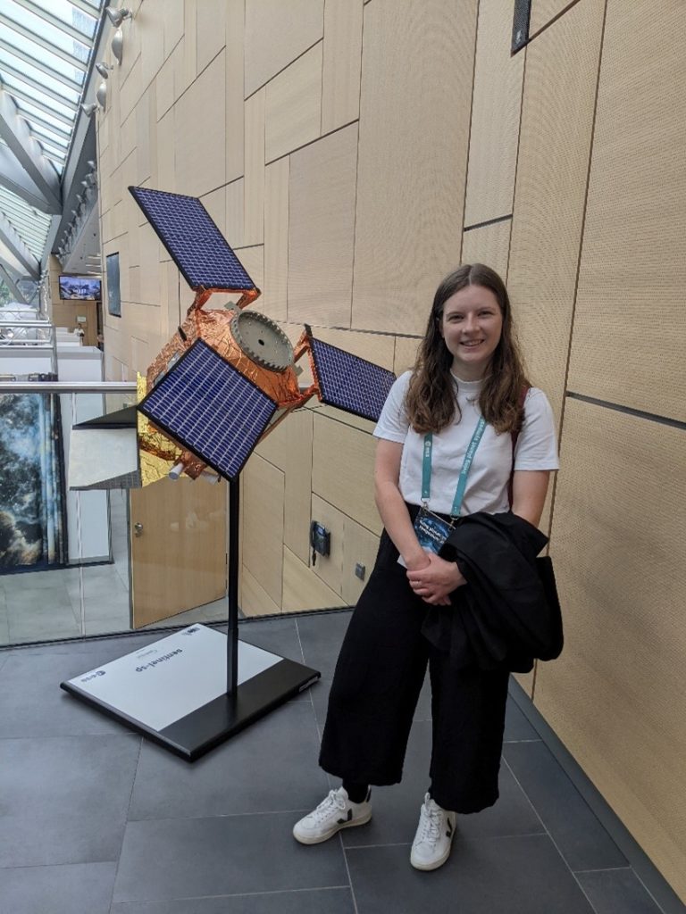
Collecting data in the field is very important when working with satellite data as it is often used to validate what we can see from the air and track down the locations where the data has been collected. Very important when dealing with data from vast areas.

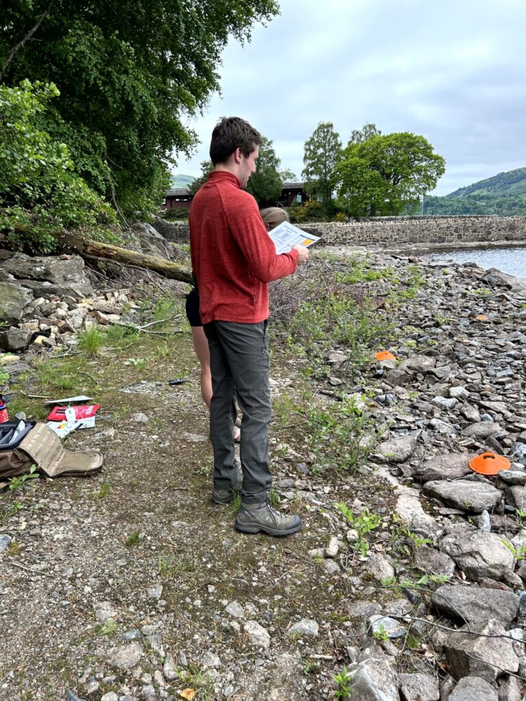
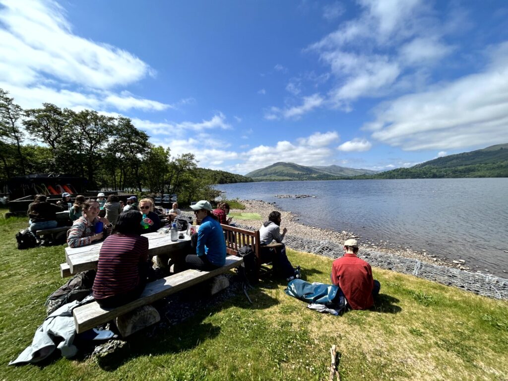
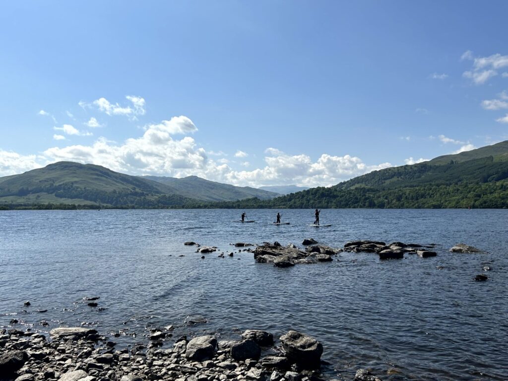
The forecast for the week was looking good so the group were in high spirits when they arrived. First on the agenda was some outdoor activities including paddleboarding, sailing, windsurfing and orienteering before dinner and an introduction to the first two days training activities.

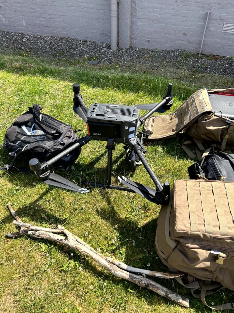
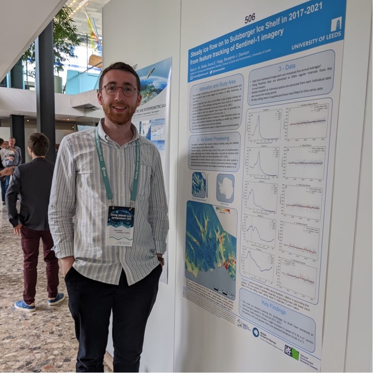
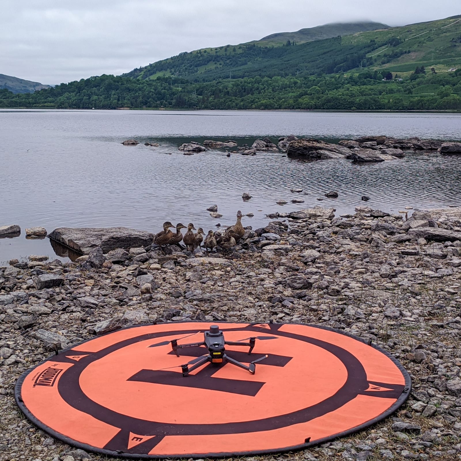
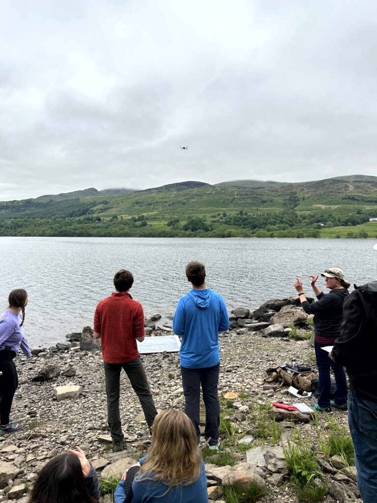
Drone operation led by Tom Wade (Airborne Research and Innovation) assisted by out fantastic demonstrators Liz Poulsom (E4 DTP) and SENSE students Charlotte Walshaw and Calum Hoad. Calum, Charlotte and Liz all use drones as part of their PhD research and have experience of using them in the field. Before we started Tom explained the process of risk assessment for flying drones and then everyone was able to get some experience of flying some of the smaller Mavic 2 & 3 drones. After everyone had a chance to try out the drones it was time for the team challenge – come up with a short drone flying sequence with a commentary and an entertaining accompaniment. The teams really rose to the challenge with some excellent flying and some inventive dance routine accompaniments although team ‘Mavic Mike’ was the overall winner.

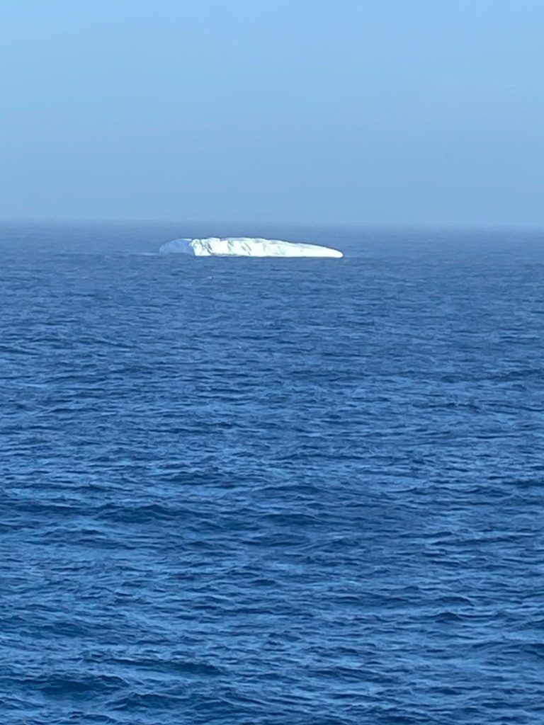
Day two of the drone training was focused on more complex drone operations such as demonstrations of collecting Lidar data from the surrounding forests and how to use a ranging station to record the points you are flying over. Calum and Charlotte also gave a talk in the evening about how they had used drone work in their field research – Charlotte in Antarctica and Calum in the Canadian arctic – hint watch out for bears.

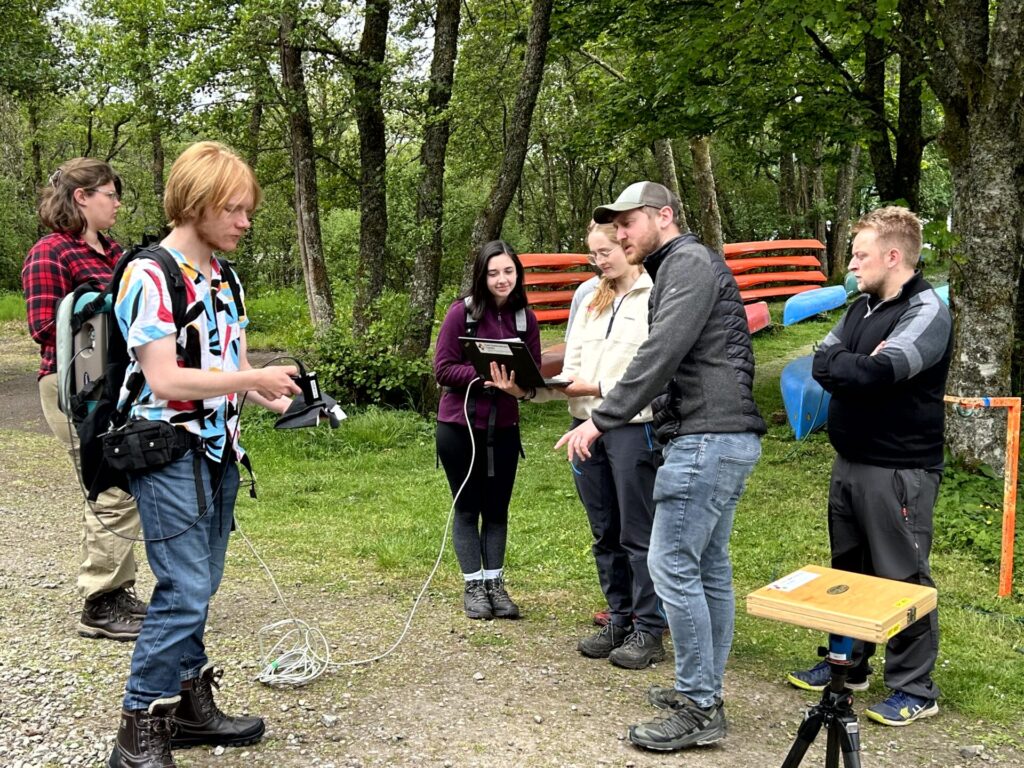
We were also joined by Alex Merrington and Craig Atkins from the NERC field spectroscopy facility which is based at the University of Edinburgh. Field spectroscopy relates to the measurement of the optical characteristics of a surface and provides quantitative measurements of radiance, irradiance, reflectance or transmission. Analysis of specific areas of the spectral data can infer properties of the sample material, and various indices exist to quantify various parameters. The students had a chance to collect some data and then analyse it. FSF were also able to introduce their service which allows NERC funded researchers and PhD students to borrow equipment at no or very low cost to use in the field.

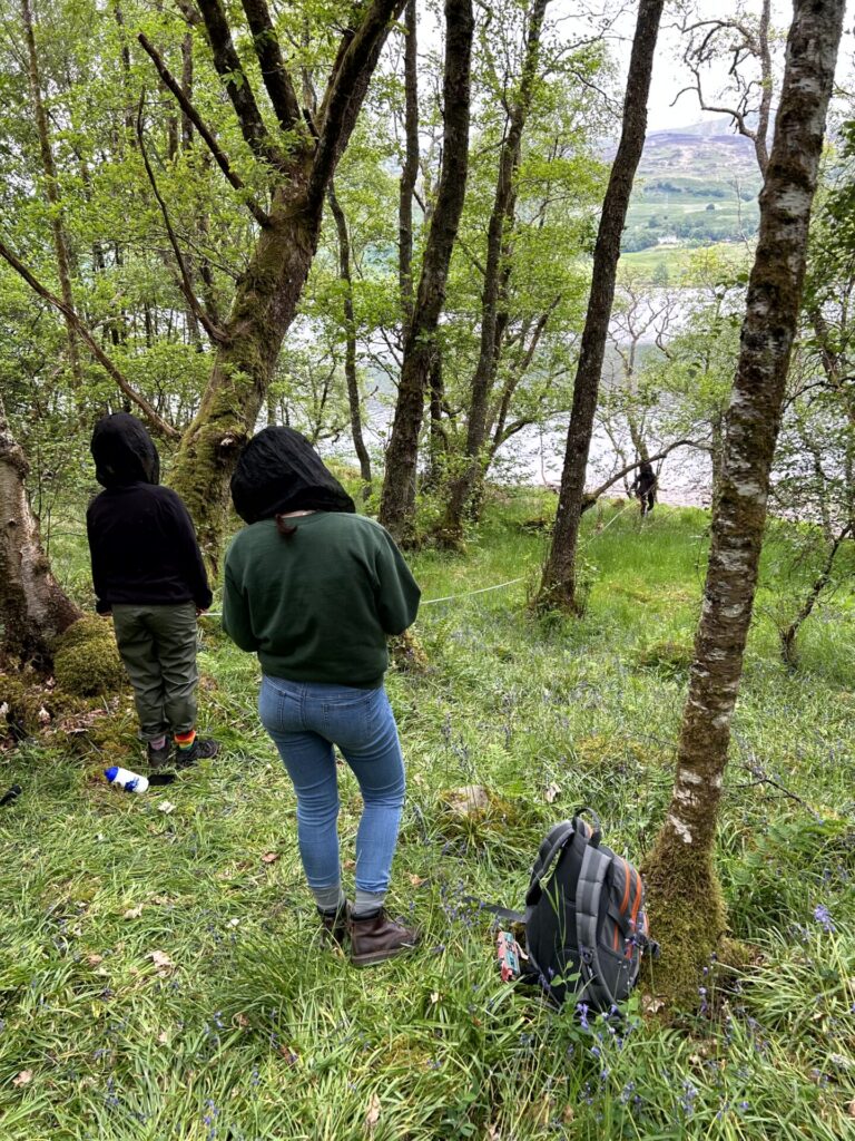
Our final activity was delivered by Harry Carstairs who has recently completed his PhD with the Mitchard group. Equipment for this was much more low tech in that included a tape measure and clinometer for measuring the height of trees. The challenge was to take a 20m radius section and measure the forest biomass. Harry is more used to the exotic location of the forest of Gabon for this type of field work but being a good field scientist had remembered an essential bit of kit for the students – midgie nets! The groups were given a few hours to do this and a few instructions so it was really interesting to see the different methods used and results they came up with. A great team building exercise as well as learning.

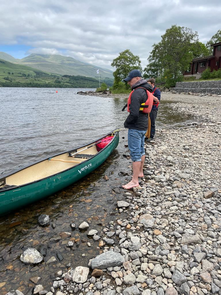
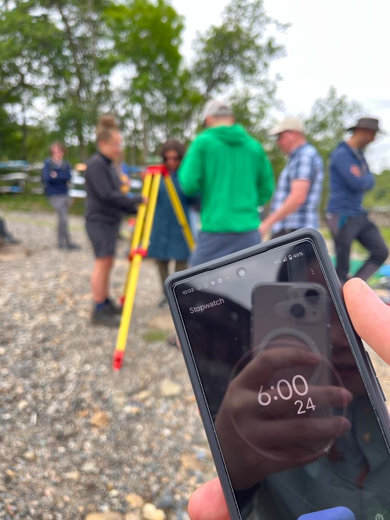
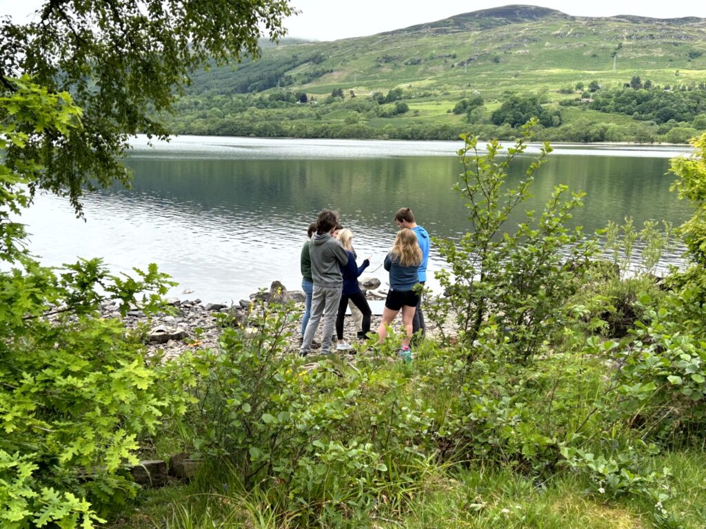
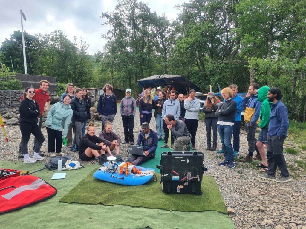
Day 4 of the training saw a change of team as we were joined by Mikael Attal and Alan Hobbs from the school of geosciences who was demonstrating the Acoustic Dopper Current Profiler (ADCP) and Global Navigation Satellite System (GNSS). The ADCP is used extensively by the Land Surface Dynamics group to investigate river velocity, turbulence, and erosional and sediment transport potential. It sits on a small craft which is towed behind a canoe and was taken in transects across the loch to give some information about what is happening under the surface. Mikael also gave a talk in his research which is part of the Land Surface Dynamics group and the students were particularly interested in his work on landslips.

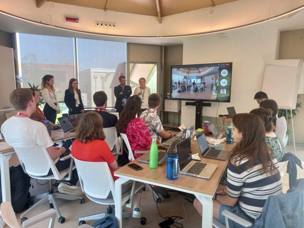
The group was also joined during the week by team ice Anna Crawford, Bea Ricinos Rivas and Dan Goldberg from the glaciology research group who gave talks about their research. As a interdisciplinary centre SENSE covers a wide variety of topic areas we like to give our students opportunities to find out about areas of interest out with their normal research areas.

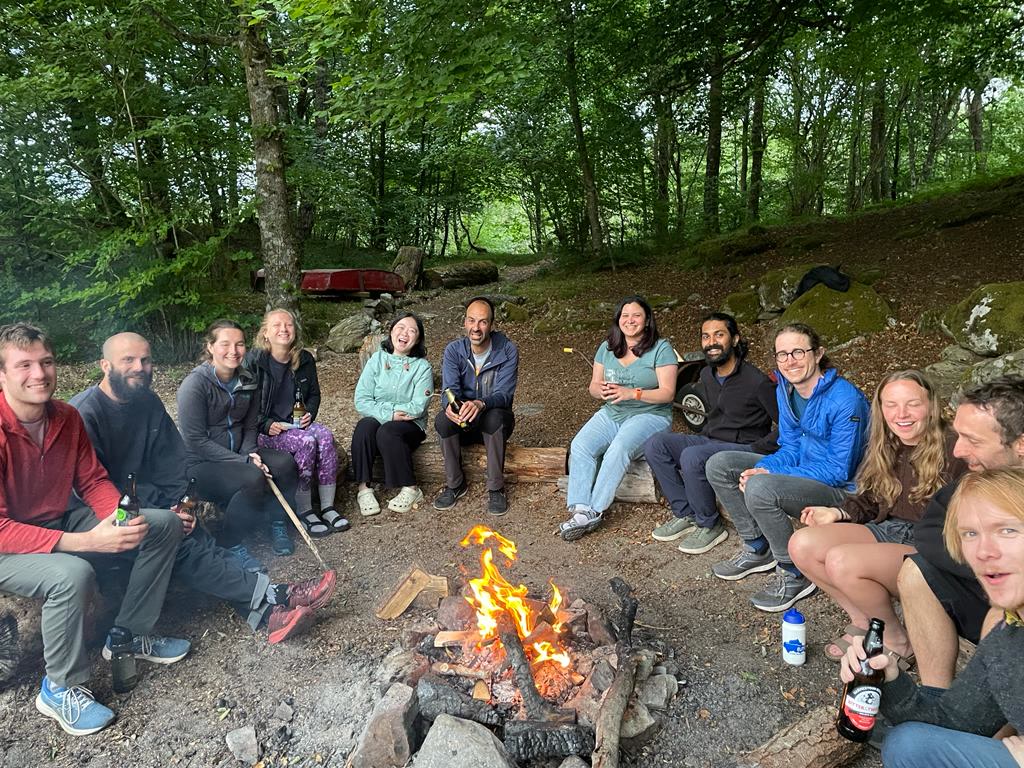
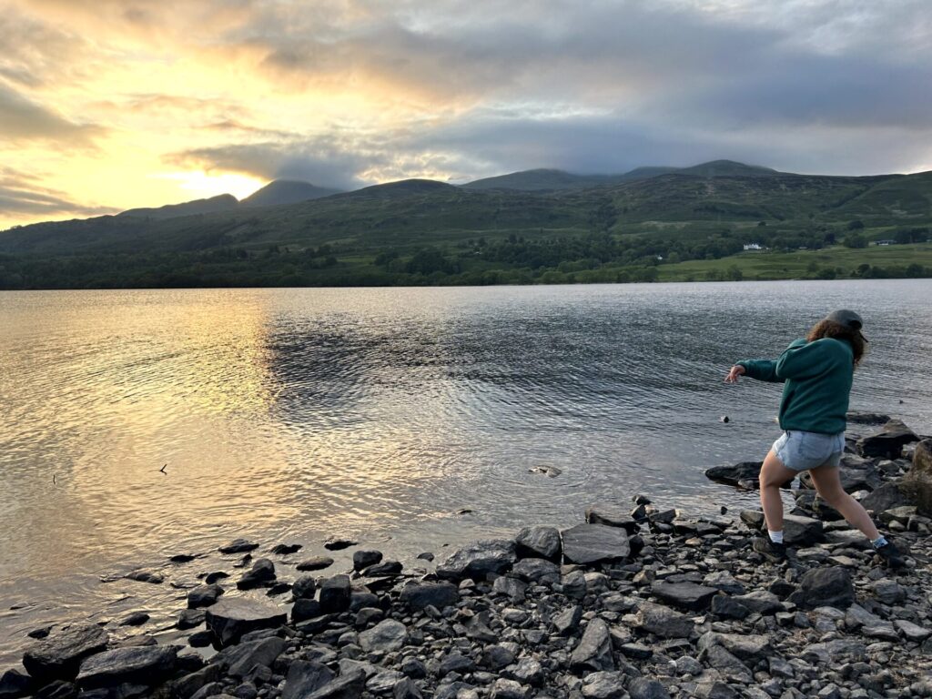
The week’s training ended with some more outdoor activities, another swim in the loch, a games night and then after another hearty breakfast the group headed back to Edinburgh on Friday morning a bit tired but happy with lots of new ideas and some new connections. It had been a great week in a fantastic location and a chance for the SENSE students to spend some time together and get to know their fellow students and staff a little bit better. Thank you so much to Tom, Liz, Charlotte, Calum, Harry, Alex, Craig, Alan, Mikael, Anna, Bea, Kathy and all the Firbush staff for an amazing trip and a really big shout out to Eleanor and Dan who worked so hard to put the week together. 

Oh and also to mention a very exciting spot of a beaver near the centre – it seems word of the training got out!

SENSE go to the European Space Agency

On 22nd May a group of 12 Cohort 1 & 2 SENSE students headed to the European Space Agency ESRIN facility in Frascati which is just outside Rome to attend an Earth System Science Workshop. The workshop aimed to train participants in working with ESA’s Deep Earth System Data Lab (DeepESDL), exploring the scientific potential of its multivariate datasets and analytics capabilities for Earth System research. 

You can read more about the workshop here

The centre is very grateful to all of those at ESA and their associates who made this trip possible and those who took time out of their busy working day to spend time with the students.

Invitation to join Field Skills Training June 2024

Firbush Field Training Centre – Loch Tay

The SENSE CDT will be running a field skills course from 3rd – 7th June 2024 at the University of Edinburgh outdoor centre at Firbush on Loch Tay. We have a small number of places available on this course for which UK based UKRI PhD students may apply to attend.

The Learning Objectives include:

  • To learn how to collect remote sensing data from drone platforms safely and effectively
  • To learn how to collect calibration data for Earth Observation satellites using
    • Field Spectroscopy equipment
    • The measurement of trees through forest inventory plots
  • To learn general fieldwork and teamwork skills, including how to work safely and collect reliable and useful data outside controlled settings

Training will be delivered by staff from the University of Edinburgh School of Geosciences and the NERC Field Spectroscopy Facility

There will also be opportunities to take part in outdoor activities and participate in research talks and informal networking with other PhD students.

Coach travel will be available from Edinburgh departing at 9am on Monday 3rd June and returning Friday 7th June around lunchtime. Travel, accommodation and meals during the trip are included. Please note that arranging travel to Edinburgh and will be the responsibility of the student. For students based outwith Edinburgh the centre may be able to arrange accommodation on Sunday 2nd June.

It is recommended that those attending have warm and water proof clothing and walking boots as the training takes place outside; midge repellent and a midge net is also recommended.

Should you wish to be considered for this training please complete the following form: https://forms.gle/5MzbK2i9nWfPUhDD6

The application deadline is Tuesday 23rd April and successful applicants will be informed shortly afterwards.

For informal enquiries, please contact [email protected]

Please see the SENSE website for a flavour of previous trips:

Two Chickpeas in a Podcast, Live at the Natural History Museum

2nd Year SENSE student Ashar attended an event at the Natural History Museum in January, featuring on a podcast panel discussion on the intersection between racial and environmental justice.

On 26th January, I was invited to be a guest speaker on the podcast, “Two Chickpeas in a Podcast”, who were running a session and live episode recording at an event run by the Natural History Museum’s Explorers Programme. The podcast focused on the intersection between racial and environmental justice, and the disproportionate impact of climate change on people of colour (PoC). 

The Explorers Programme supports and encourages those from racially marginalised backgrounds into careers related to Earth, environmental and ecological sciences, highlighting that everyone deserves the right to access. The programme’s events include an annual careers conference for professionals, early career researchers and undergraduate students, a Build a Museum event for sixth form students, and family festivals revolving around the natural environment. 

The event, Explorers Night: Mind, Body, Space, ran from 6-10pm. The public were allowed to roam parts of the Natural History Museum freely to immerse themselves in experiences brought by scientists, creatives and activists exploring our relationship with nature. These address various obstacles to us enjoying nature which stem from societal perspectives and treatment of race, and other aspects of our identity. Several activities were run, including a sensory space related to the marine realm, special tours of collections, nature-related poetry, workshops and quiz games, a Talkaoke (live drop-in talk show) and a patchwork quilt collaborative art project. 

From left to right, Josh Virasami, Nikkita Beghi (podcast host), Ashar, and Natasha Beghi (podcast host), smiling while stood around a board which says ‘Two Chickpeas in a Podcast: An Explorers Night Event, #ExplorersNight’. They are stood at the base of a staircase near to the Attenborough Studio and Spirit Collection at the Natural History Museum, London.

“Two Chickpeas in a Podcast” is hosted by sisters Natasha and Nikkita Beghi from West London. The podcast explores what it means to be a British Asian in the modern day, in terms of identity and heritage. I joined Josh Virasami, an activist, artist and author involved in political and climate justice movements, on the podcast panel for the live episode. We discussed various topics including: 

  • What are the perceptions of climate migrants in the media? 
  • What would happen if UK residents had to seek refuge in other countries due to climate change? 
  • Who does the work to look at the climate crisis and how it affects PoC? 
  • How do we work through the crisis when there is an inherent hierarchy in who can publish, progress in their careers, access climate education and display information? 
  • How should activists go about looking at climate change – should we describe it as a crisis/emergency or in another manner? 
  • What can we do about climate change and can we reverse it? 

You can find links for listening to the podcast, as well as others in their series, here

SENSE Spotlight – Ross Slater

Name: Ross Slater

Institution: University of Leeds

PhD Project Title: Ice sheet-ocean interactions: using satellite data to understand ice dynamic change

A headshot of Ross stood on a small cliff, with the sea behind him and waves breaking on rocks. He has dark brown hair and a short ginger beard, and is wearing light brown glasses, a blue hat, a green jacket, and a red jumper.

What is your background?

I am a 2nd year glaciology PhD student with the SENSE CDT, based at the University of Leeds. I studied for an MPhys integrated masters degree in physics at the University of Edinburgh from 2015-2020 and while doing so I became very interested in programming. This was really unexpected as I has no prior experience, but I loved the endless possibilities and creativity which it allowed. I realised how vital software is to solving problems in every scientific field and after I graduated I worked as a data scientist for an Edinburgh based Earth observation start up. I continued this until I started my PhD in October 2021 and I’ve brought my love of coding with me into my PhD, where I am analysing very large satellite imagery datasets using High-performance computing.

Tell us about your project and the area of environmental science you are most excited about

My project looks at the interaction between the Antarctic Ice Sheet and the Southern Ocean. I’m using satellite imagery to measure the speed of the glaciers flowing into the ocean, which we do by tracking the movement of features on the surface of the ice such as crevasses. The satellites I use are part of the Sentinel-1 constellation, which is able to take images over almost the entire Antarctic coast as frequently as every 6 days. This has given us unprecedented amounts of data compared to previous missions (which could only provide this speed measurements around once per month) and helps us monitor shorter term variations in the speed of the ice. Changes in the temperature of the ocean at the edge of the ice sheet can affect the flow of the ice, causing changes in the amount of ice flowing into the ocean and contributing to sea level rise. I’m aiming to compare ocean temperature observations to my measurements of ice speed to examine how ocean temperature is causing ice acceleration. Understanding how our planet’s ice sheets interact with the climate is vital to predicting future rates of sea level rise and I’m very excited to be able to do research which contributes in part to this goal.

Map of ice velocity ranging from 0 to 4000 metres per year over Pine Island Glacier in the Amundsen Sea Embayment, West Antarctica. The data was processed from two sequential images from the Sentinel-1 satellites in October 2021.

Was using satellite data at the core of your PhD project important to you?

Using satellite data was a deal breaker for me when it came to selecting a PhD. I wanted to be able to combine climate and space science, and satellite data was the perfect means for me to do this. I also knew I wanted to work with satellite imagery as I enjoy the visual aspect of the data. Satellite data is vital to studying the whole extent of the Antarctic Ice Sheet and without it we would struggle to cover the vast extent of the continent. Conveniently it also means that you can do this kind of glaciology research from anywhere in the world as long as you have a computer, as access to the satellite data I use has been made free and open by the European Commission’s Copernicus Program. I really enjoy the challenge that the volume of satellite data poses and the new tools and infrastructure which the scientific community are developing to perform environmental science at this scale.

Why did you decide to enter the space sector?

I always had an interest in the space sector while I was an undergraduate and knew I would definitely like to work in it in some capacity, but it was only when I discovered Earth observation that I realised I could combine my interest in the physics and engineering side of space with climate science. Space also led me to polar science in a roundabout way: I learnt that certain Antarctic research stations were sometimes used as analogues for deep space exploration, which I thought was really interesting, and from this I quickly became interested in exploring and studying the polar regions and eventually focused on glaciology.

Ross standing in front of his poster at the European Space Agency Living Planet Symposium in Bonn, Germany in May 2022. The poster is titled “Steady ice flow on to Sulzberger Ice Shelf in 2017-2021 from feature tracking of Sentinel-1 imagery“.

What does equity, diversity and inclusion mean to you?

I think it is important that everyone feels welcomed and supported at work and is able to be themselves. Academia can be a particularly confusing system to navigate for people without any prior experience and so I think it is vital that everyone is given the opportunity and support to thrive in their research discipline.

What are your hopes for future PhD students?

SENSE is doing a great job at making sure we are supported through wellbeing and EDI work and this has definitely made the transition to studying for a PhD a much easier process. It would be great to see more this kind of support become the norm for PhD students, regardless of whether they are part of a larger cohort such as a CDT/DTP.  There is a growing push to see PhD students treated as employees of the university (as in many other countries) and I think this would be a great benefit to all PGRs, giving us the rights and benefits which come from proper employment.

Ross standing beside a tall blue sign showing the logo of the British Antarctic Survey outside their headquarters in Cambridge.

Any tips for those interested in applying for PhDs?

Find a topic/project which you’re really curious about and can see yourself studying in detail for the next 3-4 years. Talk to potential supervisors but also reach out and talk to the PhD students in research groups you might like to join – it’s a great way to get a better understanding of what it’s like to work in that environment. If you’re currently working, don’t forget to explain the experience and skills you’ve gained since graduating in your application. Even if the work is not directly related to the project, what you’ve learnt will almost certainly be of use at some point in your research!

Read more about Ross here.

Follow Ross on Twitter @rossawslater and Linkedin.

SENSE Spotlight – Rebecca Wilks

Name: Rebecca Wilks

Institution: The University of Edinburgh

PhD Project Title: Counting Elephants from Space: Applying Statistical Ecology and Satellite Data to Elephant Conservation

Image of Rebecca smiling while stood in front of trees and a flowing stream.

What is your background?

I’m currently a first year PhD researcher at the University of Edinburgh with the SENSE CDT program, and my project combines statistical ecology and machine learning to study elephants from space. My journey here was a slightly winding trail. Before coming to SENSE, I did a Mathematics BSc at The University of Leeds which I really enjoyed, before specializing with an MSc in Statistics at Imperial College London. I liked exploring the vast array of statistical methods out there, but wanted a break from ‘pure’ maths by that point. Still interested in more commercially focused problem-solving, I spent 1 year trying out various business strategy roles.

In my spare time, I’d been reading around the latest applications of ML / AI over traditional analytical methods, and decided to join an analytics consultancy to pursue this, where the focus was on building custom data-driven products. Over 4 years, I developed from a Data Analyst to an Analytics Engineer and built my coding skills up from basic R simulations, to pythonising code for production systems. Reading around initiatives to counter the environment crisis, I saw how state-of-the-art analytics will play a significant role, and wanted to apply my skills in the same way. I was drawn to my project, as it had a strongly statistical focus and would enable me to work within conservation research. The gaps in my skillset were that I didn’t have any background in Earth observation, or even applied science – I stopped physics/chemistry/biology/geography after GCSE, but I think a willingness to learn is what can get you by.

Tell us about your project and the area of environmental science you are most excited about

The aim of my project is to develop statistical methods which will make live satellite monitoring of African elephants more feasible. It has been shown (Duporge et al., 2021) that AI can detect elephants in images, but there’s a number of steps from this in order to take sample counts from AI and scale them up reliably for conservation efforts.

Elephants roam huge distances across protected and non-protected areas in Africa, and therefore monitoring exact population sizes with aerial surveys has being hugely time and effort intensive. With satellites able to cover much larger extents with ease, the hope is to be able to integrate satellite monitoring into current conservation efforts.

Integrating satellite data into conservation is just one example of the ‘AI for Conservation’ research area, which I’m hugely excited about for its potential to contribute to protecting many endangered species. There’s so many interesting applications where AI has made a difference, for example enabling unique identification of individuals and wildlife censuses, animal recognition in camera trap data, acoustic detection of animals, live poaching warning systems,… the list goes on!

In addition to the algorithmic developments, the creation of robust, open-source hardware (drones, camera traps, GPS trackers etc) are also vital to this area, and there are many pioneers creating innovative solutions to challenging problems.

For anyone interested in knowing more, nature communications recently released a great review paper – D Tuia et al., 2022.

Very high resolution drone imagery of several elephants within forest/jungle

Was using satellite data at the core of your PhD project important to you?

Yes and no (if that counts as an answer). Before coming across the SENSE CDT I wasn’t really aware of the analytical power of satellite data, in particular how crucial it will be to monitoring and countering large scale environmental changes. So in that sense, I wasn’t initially set on a project with this focus.

However, after seeing my project advertised and reading around what can be achieved via remote sensing, it was a skillset that I knew I wanted to learn. The fact that SENSE provides in-depth training across a range of environmental applications of satellite data was very important me, as I wanted to develop a solid foundational understanding given that I’d be new to the field.

Why did you decide to enter the space sector?

Pursuing a PhD was mainly a career decision, but it was a happy accident that such a cool project also unlocked pathways into the space sector! I’ve always found the space sector interesting, but felt that I didn’t have the scientific grounding to pursue a career there, so it wasn’t on my radar.  

The satellite-space sector is a hugely exciting place to be right now, with new launch ports opening in UK, continuing democratization of higher resolution data and a highly active research community.

What does equity, diversity and inclusion mean to you?

It’s a really important issue – everyone should feel able to be true to themselves where they work, regardless of their personal beliefs, background or circumstances.

I believe that each person plays a part in creating a culture of openness, acceptance and encouragement where others can thrive. Culture is vital, but some barriers can only be overcome with proper institutional support. In SENSE’s case, we have a dedicated D&I officer and policies to ensure equal opportunities for all. There’s a nice camaraderie across the cohorts too, which is lovely!

Any tips for those interested in applying for PhDs?   

  • It’s good to think about if the change from a lesson based style if you’re coming from undergraduate, or structured teamwork if coming from industry, to a personal research project is something you’re sure you would enjoy. 
  • Don’t shy away from being bold in explaining that you have the skills and enthusiasm to do your chosen project. This is something that I’ve found hard in the past and it can feel unnatural, but it helps so much during the interview process.
  • Trying out coding tutorials can be helpful to understand the type of data you may work with, and what your bread-and-butter of satellite based analysis will consist of.

Good luck with your application! 🙂

You can find Rebecca on Twitter @Beckycwilks and on Linkedin.

SENSE Spotlight – Ashar Aslam

Name: Ashar Aslam

Institution: Institute of Climate and Atmospheric Science, University of Leeds

PhD Project Title: Severe Weather over Southeast Asia

Ashar stood in front of trees and hills within the Yorkshire Dales. He is of Pakistani descent with dark hair, eyes, and a beard, and is wearing clear, circular glasses and an orange raincoat. He is smiling.

What is your background?

I’m a second year PhD student within the Atmospheric and Cloud Dynamics Group at the University of Leeds. My research focuses on improving the understanding of the processes influencing extreme rainfall patterns over the Maritime Continent, another name for the thousands of islands and many shallow seas in Southeast Asia. Prior to starting my PhD, I did an integrated Master’s in Earth Sciences at the University of Oxford. I identify as queer, neurodivergent, BAME (Pakistani heritage) and as someone from a lower socioeconomic background (in no particular order).

From January to March 2023, I have seconded from my PhD to work as one of SENSE’s EDI champions. I have been engaged with EDI and outreach work since I was an undergraduate. This includes development of educational resources for KS3 school pupils, supporting programmes aiming to better understand the barriers of underrepresented groups to geoscience at an undergraduate level, and being a guest speaker at conferences and podcasts related to topics associated with being LGBTQ+, a person of colour, integration within the STEM community, and disproportionate impacts faced by marginalised groups.

Ashar showing several undergraduate student helpers how to run an outreach activity related to measuring precipitation at the GAIA (Geoscience Access, Inclusion and Attainment) Spring School in 2022. They are all wearing lab coats and safety goggles. There are plastic cups, tape, post-it notes and bags of Skittles on the lab bench, all used in the activity.

Tell us about your project and the area of environmental science you are most excited about

My research background is primarily in geology – during the latter stages of my undergraduate degree however, I specialised in more of the climate, ocean and atmospheric science portions of the course. I’ve always been interested in understanding extreme weather, particularly in the tropics. I stay away from declaring ‘fascination’ in topics such as natural hazards, given the detrimental impacts that communities face as a result. A major pet peeve when it comes to people documenting such events! I am primarily interested in understanding impacts for particularly more socioeconomically deprived regions, where the impacts are likely to be more felt, with climate change, for example, having a disproportionate (and often undeserved impact) on such groups.

I used to work on African climate model data for understanding reasons for biases in the representation of the regional meteorology, such as where you get anomalous rainfall. I now study the many processes influencing rainfall patterns over the islands of Southeast Asia. Such processes include the large-scale environmental field, the diurnal cycle of solar heating (unique to each island) and more transient/synoptic-scale phenomena such as tropical cyclones. As these processes all interact with one another, understanding the complex meteorology is very difficult. Limitations in our understanding mean that there are biases in current climate models because of this. They also mean these biases cannot be addressed without understanding the weather in its fullest form first – talk about a feedback loop! Given 400 million people live in Southeast Asia, understanding the meteorology is beyond important, as they are compounded with impacts such as flooding and landslides, leading todisplacement, loss, poor sanitation, epidemiological crises and death. This is just one of many sets of hazards affecting the region – it is also tectonically active, with earthquakes and volcanic eruptions occurring as well.

(a) Map showing the topography/elevation of the Maritime Continent, with some of its constituent islands and seas labelled. Panels (b) and (c) show the climatological means of GPM precipitation rates for (b) December-February and (c) June-August, from 2000/01 to 2019/20. Black arrows represent 850hPa (low-level) wind.

Was using satellite data at the core of your PhD project important to you?

Satellite data provides the foundations for my work – given it’s one of the most accessible, and high quality, sources of data, it is of great utility. It also supplements limited observational data, which is a big issue in Southeast Asia, in terms of the spatial distribution and density of meteorological stations, where, for example, radiosondes are deployed for determining atmospheric profiles, and where radars are for determining nearby rainfall distribution. In addition, it can be used in conjunction with models to confirm the presence of certain processes, or if biases exist in our models relative to that of observations, either obtained from the ground or from satellites. Luckily for me, a lot of the data has been pre-processed, so it saves me a lot of time!

Why did you decide to enter the space sector?

I don’t think entering the space sector was at all voluntary – I more or less stumbled upon it and thought, ‘hey great, this is cool’. But it is cool. I covered several space sector/satellite data topics in undergraduate, such as understanding active tectonics – though I didn’t realise how broad it truly was. You have geologists. Meteorologists. Ecologists. Glaciologists. Data scientists. All in one place. The space sector also has such a big tie with industry. Supporting efforts with Space Hub Yorkshire during the summer prior to starting my PhD really opened my eyes to how big the sector is, and what can be gained from it. Business jargon? Sure, there’s that, and sometimes I get confused, but you can get your head round it. It’s a very inter-disciplinary sector and it’s good to get experience in each area.

What does equity, diversity and inclusion mean to you, and what will you be doing as EDI champion?

Equity, diversity and inclusion is a celebration – but it’s also a battle. A celebration in that people from all walks of life can come together, showcase who they truly are and flourish in whatever environment they’re placed in. On the contrary, it’s a battle as EDI is very much becoming a buzzword acronym, chucked around without an in-depth evaluation of what it means, and what you should do to ensure the workplace is as inclusive as possible. Oftentimes, implementation of such best practices is restricted by limited commitments to the cause we fight for. EDI is a removal of barriers – barriers is another word I dislike as it implies almost permanent hindrances to your progress. Replace the word with obstacles, and you have difficulties that you can navigate around, provided the support is there.

In the role of EDI champion, I am supporting initiatives run by SENSE in tackling EDI issues. This includes analysing and assessing current EDI practices, designing new initiatives and evaluating their efficacy for implementation in both the PhD application process and postgraduate student support services. It also involves the production of showcases, toolkits, webinars, running of well-being activities and mentoring, and dissemination of results through open-source presentations and resources. Through this work, SENSE hope to highlight the necessary best practices for recruitment and supporting researchers throughout their PhD, linking with NERC’s ongoing efforts to improve the ways in which EDI is approached. We will be showcasing what the CDT has done and what it has to offer, and how we are doing our best, and constantly bettering our efforts, in making the environment more accessible and equitable.

Participants of the Equator Research School (April 2022) stood amongst the hills near Edale, Peak District. They are smiling next to several sheep near a path and small barn.

What are your hopes for future PhD students?

This is beyond cliché but for future PhD students to pursue their dreams, either within or outside academia. They should be allowed to engage in research without being pressured to do too much and being forced down a niche they don’t necessarily enjoy. Funneling a student’s mind is detrimental, and limits their freedom to think. The process should be as comforting and inclusive as possible, and I hope that support networks will be provided without the need for discussion around the topic.

Any tips for those interested in applying for PhDs?

PhDs are hard work, but they can provide high rewards. Ensure you find a supervisor team that aligns with your interests, both academic and personal, as you’ll be working with them for around 4 years! Also remember that you can shape the path of your research – if you’re not enjoying it, you can vocalise it and the team will listen to you. Though there are alternative career routes after graduating from your undergraduate, it can be nice to engage with work that you can, in areas, lead yourself, even if you feel at the base of the academic pyramid.

Any tips for those interested in engaging more with EDI?

With EDI, it’s a matter of testing things out and seeing what works for you. For example, you may be of a particular underrepresented group, but that doesn’t mean you have to do the brunt of the work simply because of lived experiences. Similarly, you don’t have to belong to a particular underrepresented group, but you should do your best to be aware of issues faced by those groups, and how to exercise allyship in the best way possible. Simply put, understand your boundaries while also understanding the boundaries of others. EDI isn’t a competition – we’re all working together.

Read more about Ashar here.

Follow Ashar on Twitter @Ashar_A_Aslam

SENSE Spotlight – Jess Payne

Name: Jess Payne

Institution: University of Leeds

PhD Project title: Falling Basins: revealing hidden faults from patterns of land subsidence from water extraction using Earth Observation data

Photo of Jess Payne smiling with the SENSE EDI logo at the bottom.

What is your background?

I am a second year SENSE CDT PhD student at the University of Leeds. Prior to my PhD, I studied an undergraduate degree in Natural Sciences. This was a great way to keep learning about all corners of science and not commit to a subject which might be very different at university compared to A Levels! I particularly enjoyed Plant Sciences and Earth Sciences, the latter of which I focused on in my third year. I then stayed at the same institute for my MSci in Earth Sciences. Here I chose to learn about Natural Hazards including earthquakes and volcanoes.

After finishing my MSci, I worked for a year researching the global tin market for the international tin board. This was a great opportunity to explore how resources are used and governed, but I missed researching Earth Sciences. I particularly missed learning about all the techniques and approaches used to remotely monitor volcanoes, earthquakes, and other phenomena on our planet. I was introduced to many of these as part of my MSci project on earthquakes in China but really wanted to learn about Interferometric Synthetic Aperture Radar (InSAR). This is a really cool satellite technique that measures how the surface of the Earth is deforming! With the support of SENSE, I ended up studying a PhD that uses InSAR to measure land subsidence in Iran.

Tell us about your project and the area of environmental science are you most excited about?

My project focuses on using satellite data to measure the rates and extents of land surface subsidence in Iran. Subsidence is where the land surface moves down over time. Iran experiences some of the fastest subsidence rates in the world at up to 150 mm/yr. But how does this subsidence happen? Iran is an arid country with little rainfall and as a result has few lakes and reservoirs. This means freshwater is often instead extracted from aquifers underground. When this water is removed, gaps or empty pore spaces remain where the water once was. As there is a lot of sand, sediment and even buildings weighing down on these pore spaces, this weight forces the gaps to close or collapse. Sometimes grains around these spaces even deform. These processes result in land surface subsidence. We can use InSAR to measure where this subsidence is happening.

Jess Payne stood at a podium with her slides behins her the American Geophysical Union (AGU) conference.

Sentinel-1 is a satellite constellation launched by the European Space Agency in 2014. The data Sentinel-1 collects is used to calculate velocity fields of the land surface. These velocity fields tell you at what rate the land is moving up or down. If we construct such a field over Iran, the regions of subsidence clearly stand out. In fact, we documented 99 of these regions across Iran and constructed the open-access COMET Subsidence Portal, a helpful tool for those interested or affected by land subsidence in the country.

Land subsidence might not appear the most exciting solid earth hazard out there, but it is often directly linked to human development, activity, and economic growth as well as climate change. Indeed, working out where subsidence is happening can tell us how groundwater resources are being managed and how changes in precipitation rates are impacted our land. Moreover, subsidence presents a threat to buildings, bridges, and people. For example, subsidence has been linked to metro line collapse in Mexico City, while communities are being forced to move out of villages in Iran to avoid buildings collapsing due to subsidence. Managing groundwater resources and resulting subsidence rates is therefore essential in our changing world.

Map of Iran with surface velocities calculated using Sentinel-1 data plotted. Areas in deep blue are subsiding or moving down, red areas are moving up. Calculated using tools developed by Watson et al., 2022.

Was using satellite data at the core of your PhD project important to you?

Absolutely! Having done a lot of geology during my undergraduate degree and not knowing the potential of satellite data, I was blown away when I first heard that InSAR could be used to automatically monitor volcanoes thousands of kilometers away. I was used to travelling to a geologically interesting place at one or a handful of times, recording a few pieces of data by hand in spot locations and using these data to come to conclusions about how the area has or is currently deforming. The enormously increased data coverage and frequency of satellite measurements has and still is revolutionizing how Earth Sciences is studied; satellite data is an incredibly useful tool to complement geological studies.

Also, studying regions which are difficult to access for political or social reasons is made a lot easier with satellite data!

Jess Payne stood infront of her poster at the European Space Agency Living Planet Symposium 2022.

Why did you decide to enter the space sector?

Entering the space sector sort of happened by accident- my interest in Earth Sciences and Geology drew me to satellite based tools. However, I love using satellite data and would consider a related career in future.

Jess Payne, Emily Dowd and Megan Udy Presenting Earth from space at Tech Week.

What are your hopes for future PhD students?  

I hope that people from any background will feel that they are able to apply and have success in applying for a PhD programme. SENSE is a really exciting programme to be part of because of the diverse backgrounds and cultures that SENSE students come from- my time so far wouldn’t be the same without the diversity among my cohort. In future, I hope more PhD programmes and institutes make prospective students at any stage of live and from any culture feel welcome.

Jess Payne stood infront of slides hosting a Pint of Science which aims to communicate academic research in an accessible way.

Any tips for those interested in applying for PhDs?

Ask lots of questions and show lots of interest! Applying for a PhD can seem like a mysterious, black-box process so asking anyone you can think of how to apply is a great start. Maybe some of your peers have applied for a PhD, sometimes sending an email to a potential supervisor asking for some advice might be useful. Most people want to help and are excited about their research, so would love to chat.

Read more about Jess here.

Follow Jess on Twitter @Jess_ca_98

SENSE Spotlight – Emily Dowd

Name: Emily Dowd

Institution: University of Leeds

PhD Project title: Detection and quantification of local methane sources using novel high-resolution satellite data

Emily Dowd stood with rolling hills behind her and the SENSE EDI logo.

What is your background?

I am a 3rd year PhD student at the University of Leeds on the SENSE CDT. My PhD focuses on atmospheric methane which is the second most important anthropogenic greenhouse gas in our atmosphere after carbon dioxide. Before starting my PhD, I completed an MPhys Physics with Meteorology degree at the University of Edinburgh and worked as an Offshore Meteorologist in Aberdeen. It was my lifelong goal to be a meteorologist after I graduated, and I was thrilled to get the position in Aberdeen. After working there for a while, I decided I wanted to do a more project-based job and started looking for opportunities. Then I came across this project on the SENSE CDT, which felt like it was written for me. When I was at university, I thought that getting a PhD position was out of my reach because I struggled with taking exams, but I worked hard and got my degree. To be honest, the best bit about my undergraduate degree was doing the research project. The research project was on atmospheric methane and is probably the reason why I’m here doing this project.

I am also one of the co-founders of SatSchool which is an Earth Observation outreach programme aimed at 11-15 year olds. The aim of SatSchool is to introduce key earth observation concepts to students across the UK and as well as highlighting STEM career pathways into the Earth Observation field. The project has already reached 200+ students across the UK and we are aiming to reach many more in the future, particularly those lower income schools to broaden their horizons. I believe that being a visible role model in this field is valuable in order to show students that they too can work in the space sector.

Tell us about your project and the area of environmental science are you most excited about?

My PhD project focuses on investigating local and global atmospheric methane using satellite data and a chemical transport model. Atmospheric methane is the second most important greenhouse gas in our atmosphere after carbon dioxide. Global concentrations of methane have been rising since the 1980s, with a stagnation in growth between 1999 and 2006.  Also, in 2020 and 2021 we saw the largest global annual increases in methane concentrations on record. However, our understanding of what is driving the global trends of methane remains incomplete. This is partly due to the lack of long-term observational coverage in regions of large and variable methane emissions making it difficult to fully understand what is driving these changes.

This global map shows the annual increase of methane emissions relative to the global mean annual increase and has been created using data from the Copernicus Sentinel-5P satellite (ESA, 2020)

In 2017, Sentinel 5P was launched with the Tropospheric Monitoring Instrument (TROPOMI) on board. TROPOMI provides near global coverage of methane concentrations daily and had a ground pixel of 3.5km x 7km which is a big improvement on the previous satellites, such as GOSAT. GOSAT provides global coverage of methane concentrations every 3 days and has a ground pixel 10km x 10km. TROPOMI allows us to view methane in a way that has not been done before.

I have been using TROPOMI observations to investigate the large rise in global methane during 2020 and my work on this so far can be found on the ESA Webportal.

Methane is an incredibly interesting field to be working in just now with the methane pledge at COP26 and the advancement of satellite technology allowing us to monitor changes in methane. In addition to TROPOMI, GHGSat can monitor anthropogenic methane emissions at 25m resolution allowing scientists to pinpoint large emissions at the source. I think the combination of TROPOMI and GHGSat is the key to help reduce anthropogenic methane emissions, which is super exciting.

Was using satellite data at the core of your PhD project important to you?

I did not know much about Earth Observation until towards the end of my undergraduate degree. Even then, the importance of Earth Observation wasn’t entirely clear to me until I started my PhD. Satellite data is incredibly useful as it allows us to observe the earth daily and investigate changes in regions which are difficult to access and measure. For example, the largest and most variable source of methane are wetlands, and these are often in places which are difficult to access so satellites help us to observe changes over these regions.

Why did you decide to enter the space sector?

I don’t think I made a conscious decision to join the space sector, it wasn’t a career pathway I had considered. My PhD project has completely changed this and after my PhD I would consider staying in research, using Earth Observation data, or working in the space sector.

Emily Dowd stood infront of a scale model of Sentinel-5P as the European Space Agency Living Planet Symposium 2022.

What does equity, diversity and inclusion mean to you?

It is very important for everyone to bring their whole selves to work as it builds the foundation of an inclusive environment for people to work in. It also can make way for new perspectives, research ideas and collaborations, which are crucial for making advances in science.

What are your hopes for future PhD students?  

I hope that there will be better diversity in mentors and supervisors for future PhD students. I also hope that PhD students will be treated like employees at the university to remove the blurred lines between being treated as a student and researcher. Finally, I hope that future PhD students will be given the same opportunities I have been given during my PhD so far as the SENSE CDT has allow me to network with both academia and industry in a way that other students might not have the opportunity to.

Any tips for those interested in applying for PhDs?   

My advice for those applying for a PhD is to make sure you are interested in the topic and are able to show in interviews why you find the topic interesting. I would also suggest meeting with supervisors on the project to get to know who you are going to be working with and gain a better understanding of the project you are applying for.

Find out more about some of Emily’s work here.

Find out more about SatSchool here.

Charlotte’s Antarctic Adventure

SENSE Student Charlotte Walshaw is currently on a very exciting trip to Antarctica to complete field work as part of her PhD on Remote Sensing of Antarctic Vegetation. Here she tells us a bit about her intinerary:

‘We’ll be flying down to the Falklands from RAF Brize Norton on an MOD flight and then travelling down to Rothera via the Sir David Attenborough across the Drake Passage. Then we will be in Rothera for about a week before departing on the SDA to our main field research location (Robert Island, South Shetland Islands) for New Years day. We’ll stay there until the end of March.

Whilst there I’ll be carrying out multispectral and hyperspectral drone flights over the terrestrial vegetation, ground-truthing Sentinel-2 satellite imagery, taking gas exchange measurements of the vegetation and helping with the data collection for the EcoSnow Antarctica project (NERC snow algae grant), which is aims to understand the past, present and future of Antarctic snow algae, with my supervisor (Andrew Gray), Matt Davey and Alex Thomson (both from Scottish Association for Marine Science SAMS).’

See below for a few pictures so far – we hope you are having a great time Charlotte and we are looking forward to hearing more about your trip on your return.

Charlotte is a student in the School of Geosciences at the University of Edinburgh here primary supervisor is Dr Claudia Colesie.